Io
by Chris Wayan, 2007-2015
For the builders of the Io Mountain Database:
Paul Schenk, Henrik Hargitai, Rhonda Wilson, Alfred McEwen, Peter Thomas
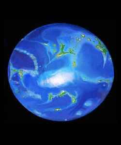
Why Io? Well... I'd just painted, sculpted and wrote a novel-length web guide to Lyr, a model of a livable super-earth. A wet world; islands in a world-sea. Lyr was huge: huge world, and huge project! It took a year or so. I got really, really, really sick of blue. I wanted something hot. Hot colors.
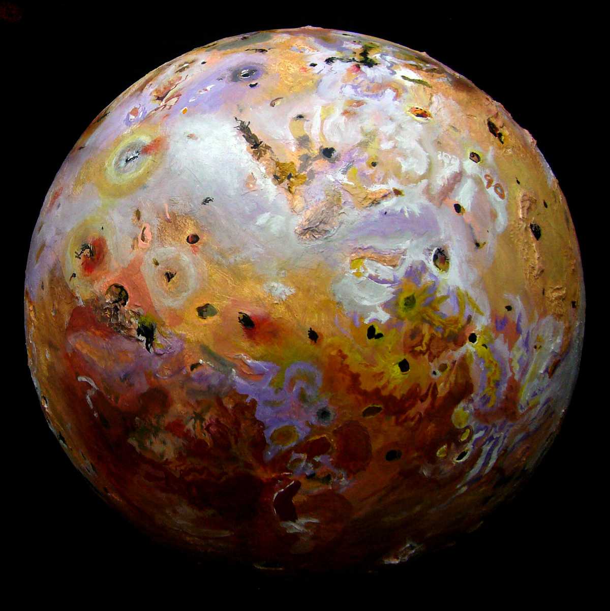
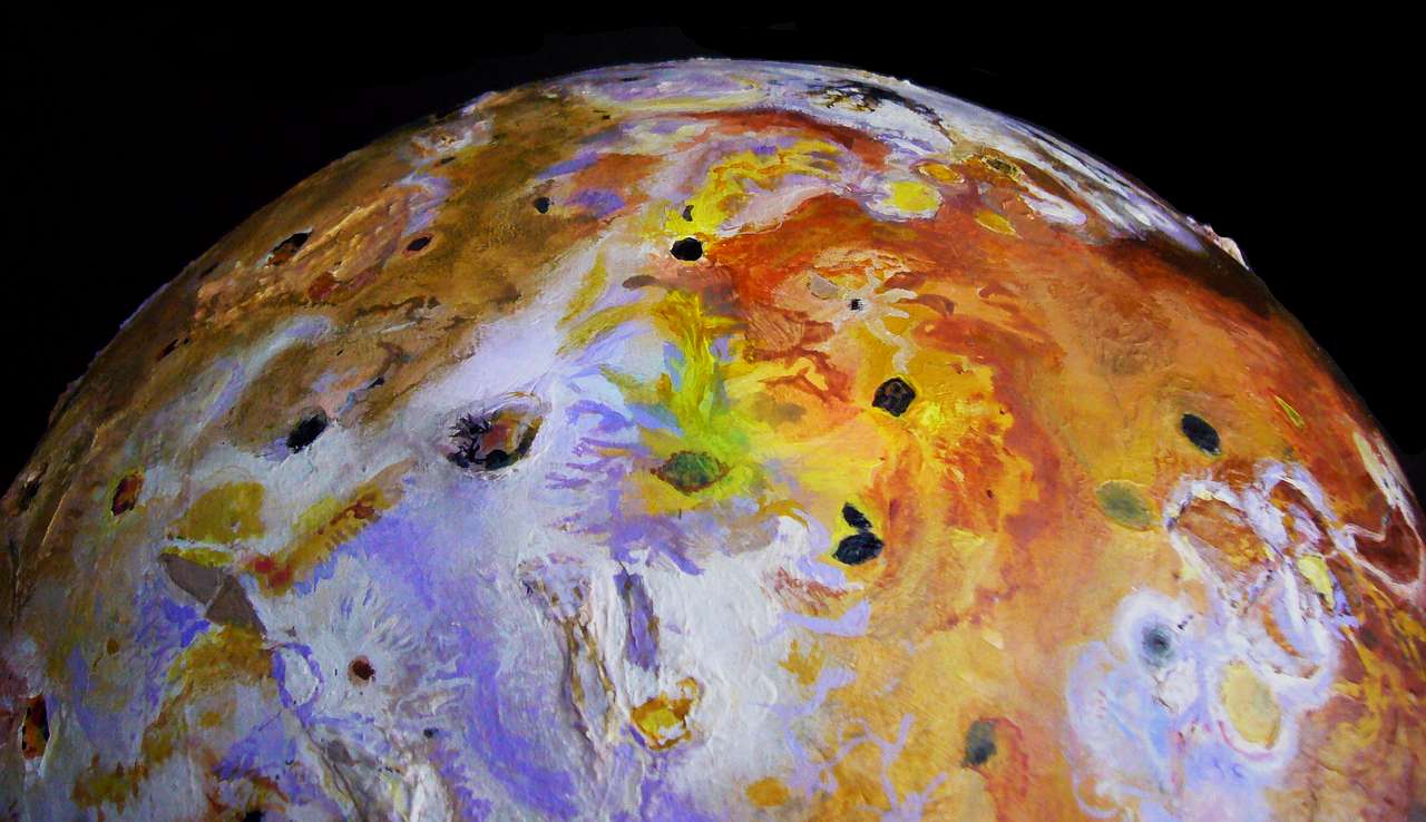
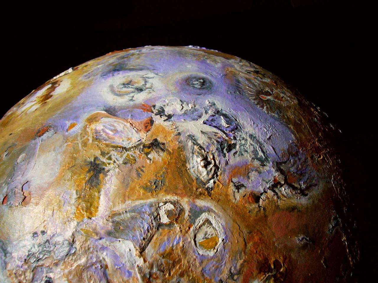
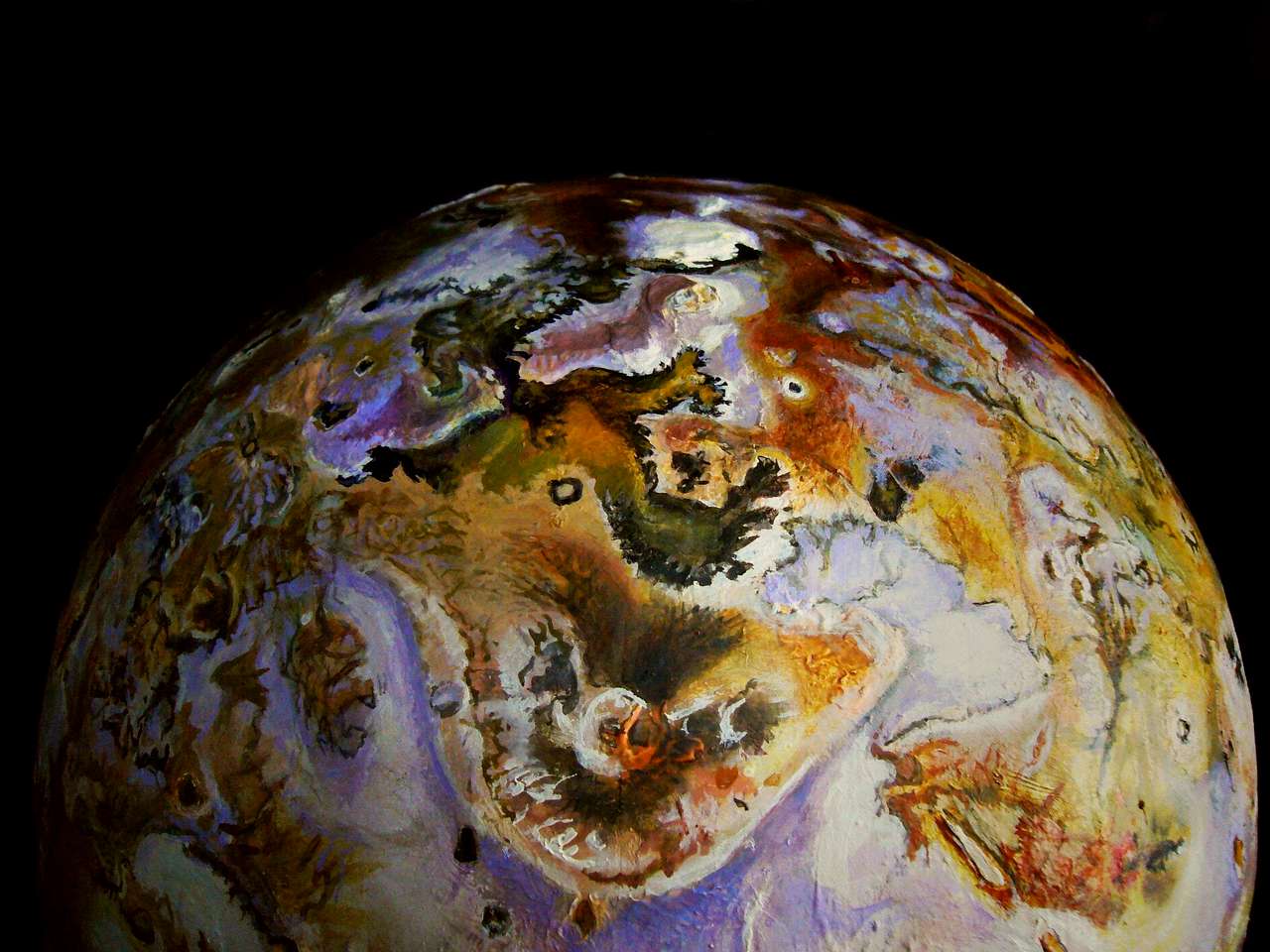
So I started a realistic globe of Io for fun. It may orbit Jupiter, but the big guy hasn't pushed his hippie sensibility on his feisty little kid. No paisley swirls here, no cloudiness. Astronomers can call Io a pizza, but I call it a bratty little Abstract Expressionist slingin' and splattin' that paint around. Mustard, black, brick red, olive green, lilac (no joke! pale lavender), rich sepias, siennas and ochres, and white, with accents of blood-red and lemon-yellow (sulfur is weird chameleon stuff).
Io has to be a New York abstract expressionist. Just look at all those cigarette burns! And ash all over...
The sculpting was fun too--mountains eleven miles high! Second only to Mars, and way steeper. Spectacular, if you could stay alive long enough to see it. Full of gas under pressure, the rocks here are often explosive if exposed to the surface vacuum. So cliffs abound--mountainslopes get sapped and gnawed and blasted into bizarre shapes.
There's some interpretive guesswork, but Io's basically scientific portraiture--the first straight realism I've done. With a place this insane you don't need speculation.
This article's chronological, so the early part is on making the art; the newer, edgier scientific speculation is in the 2015 section.
2007/7/7--I've been studying Io, not for any particular project--it's just beautiful. Should check online, see it there's an altitude map yet; if so, do a relief globe of it just for fun.
7/18--I got a beat-up old globe. Gesso it white. No, that won't do for Pizza Planet. Get out some sienna and paint the whole thing ochre.
Too bad I couldn't find a smooth globe, they just don't make 'em any more. This one had Earth's relief on it. Or rather, horribly distorted, drunken parodies of Earth's relief. This is what we teach kids? Worse than flat. Anyway, I have to smooth Earth off this damn thing before I can build another world on top. So I pry my fetal Io off its stand and spackle it, covering up human stupidity. Leave Io on our back deck to dry. Hope it doesn't rain.
7/22--The spackle left plenty of bumps and hollows. I do another smoothing layer, this one with acrylic sculpting gel and a blade. Messy, tedious, but better. I have a usable globe at last. Jeez, if it'd been a smooth globe all this would have been unnecessary. In future, I'm gonna buy round light fixtures, or beachballs, anything but this. I don't mind prep work, but I resent cleaning up incompetent cartography...
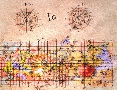
Seek maps of Io online again, and find an enlargeable Mercator that's fairly detailed, with names. Also a crude but very useful database called the Io Mountain Finder. Blurry photos, estimated altitudes and locations--but it gives me different angles. Enough to sculpt from.
7/23--The globe cured on the deck OK. It's as smooth as I'll get it. Paint it white again, and mark a few meridians so I can fix positions.
Draw a big map of Io in pencil, sketching in all the major features--peaks and their altitudes, paterae and their depths and shapes, the twists of lava flows, notes on terrain colors.
Now I'm toggling between a NASA map onscreen and the Io Mountain Finder database--just convert their blurry photos, altitude-estimates and meridians to real shapes... piece of cake. No, I don't mean it's easy, I mean the first mountain's shaped like a slice of cake. They're all weird scabby things, nothing like Earth mountains. And huge. Miles high.
My first mountains didn't fall off. OK, we're in the god business! I can sculpt Io. But this method means I really will have to sit before a screen and work from images and databases on the Web, not paper. Can't print out a couple hundred screens!
So here I sit--Io cradled in my lap like a toddler I have to cuddle while I work. Except the way I placate the baby is to spackle and carve him. Don't try this at home with your baby. Even this one rolls away... fat kid. Volcanic butterball.
7/24-25--Start at longitude 0 and sweep west, building mountains steadily around Io. NASA maps show color, shapes and names, but not profiles or heights; the database shows profiles (low orbital shots; most mountains get spotted as they broke the smooth arc of Io's horizon, or by their long shadows near dawn or dusk) but not color or much context. Hard to reconcile them.
7/26--Work for hours, scarcely realizing it, on Io's topography. A third of the way round, now. Of course 0-75° west went very fast because few mountains were detected--few close-up photos. But 80-100° west has a chain of huge peaks.
7/27--Scattered Andean and Himalayan peaks on through the mid-100s. But no huge chains like the 90s.
7/28--Take a break from spackling, and I draw all the paterae in pencil on the globe, for reference points. Like eyes on a bad potato. Now, back to adding mountains and relief; from 180 to the 230s.
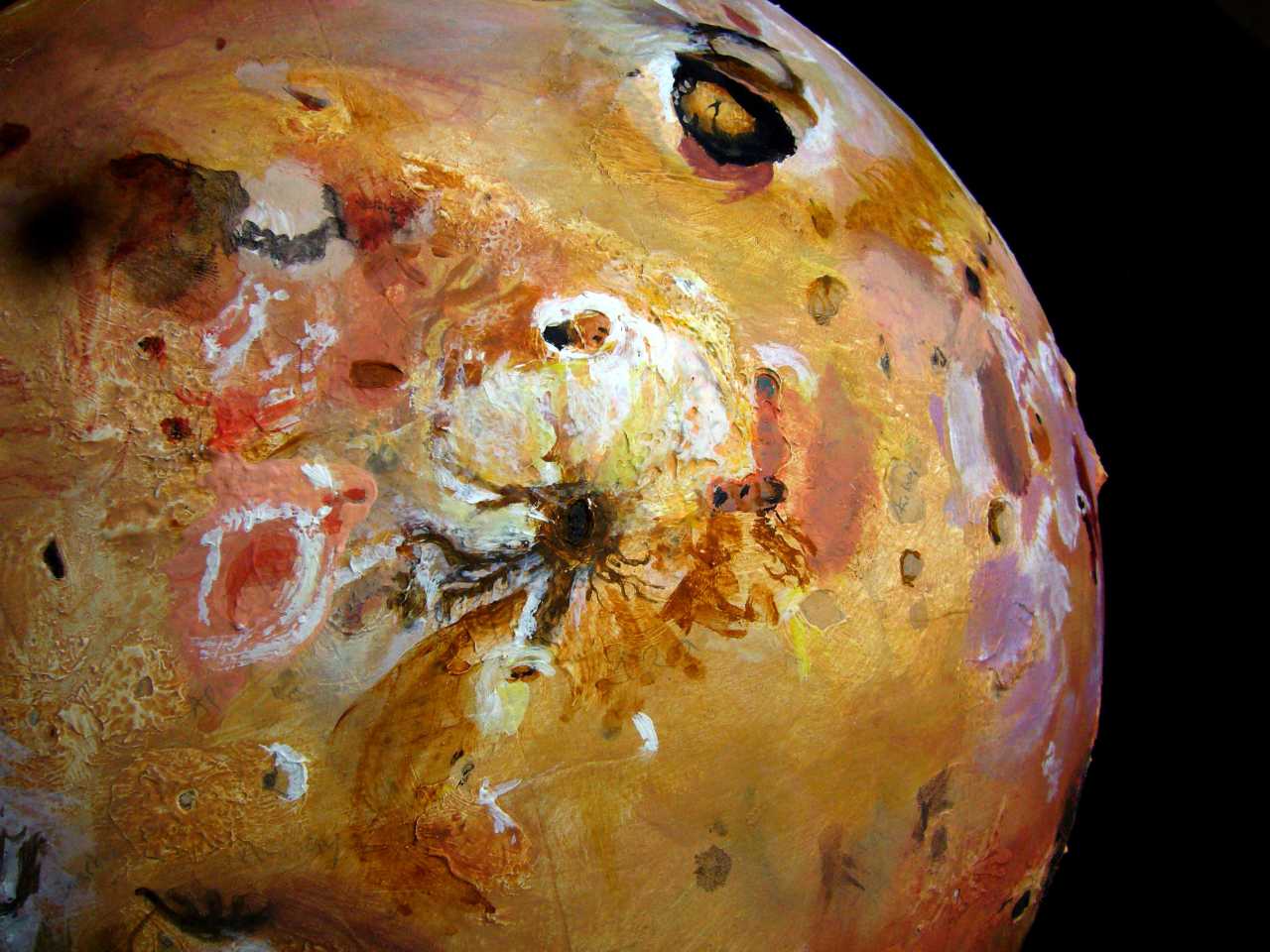
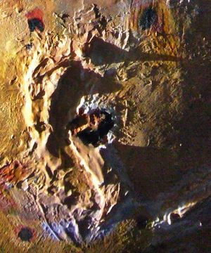
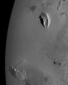
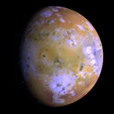
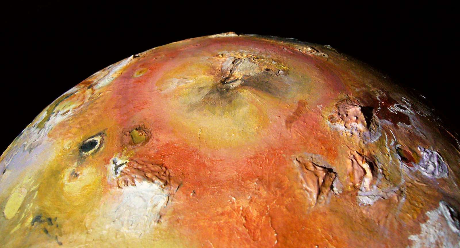
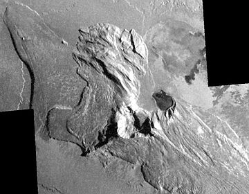
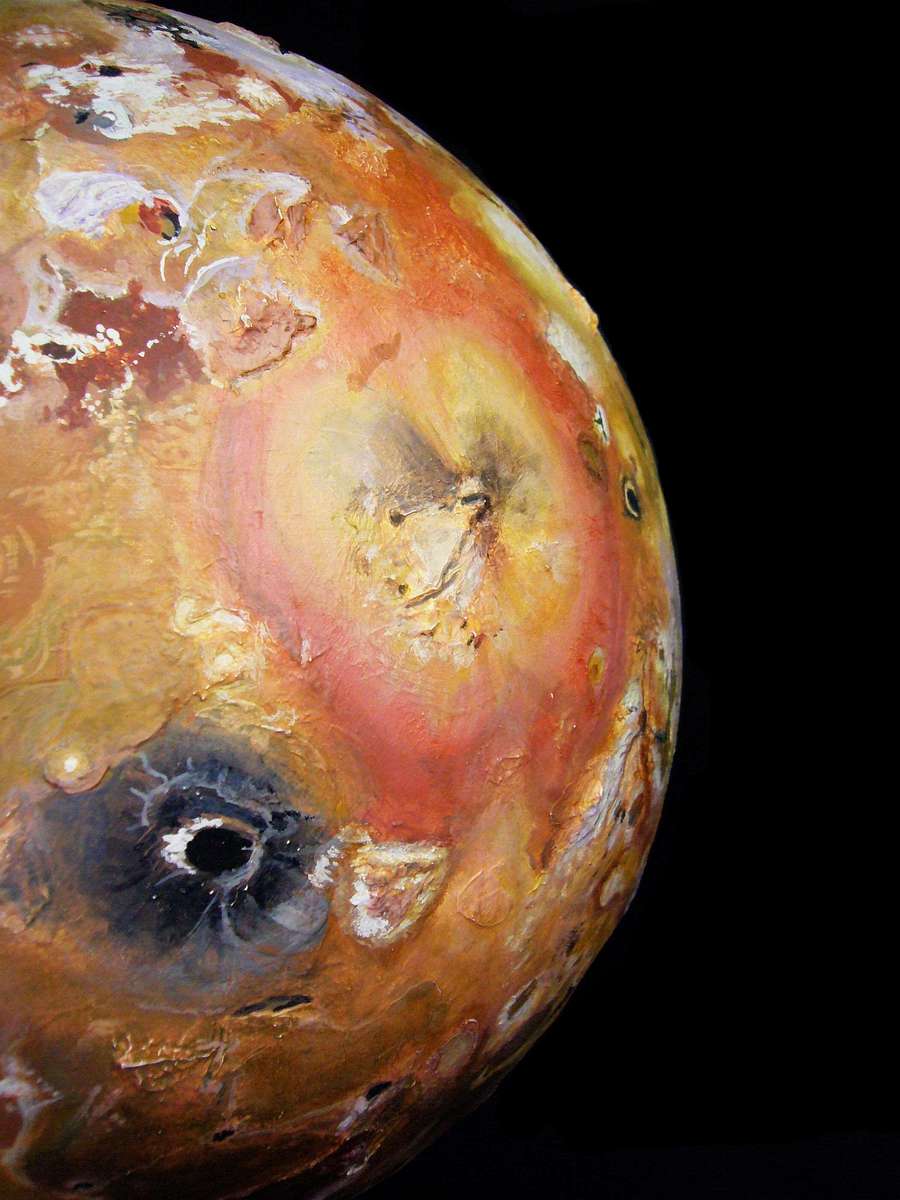
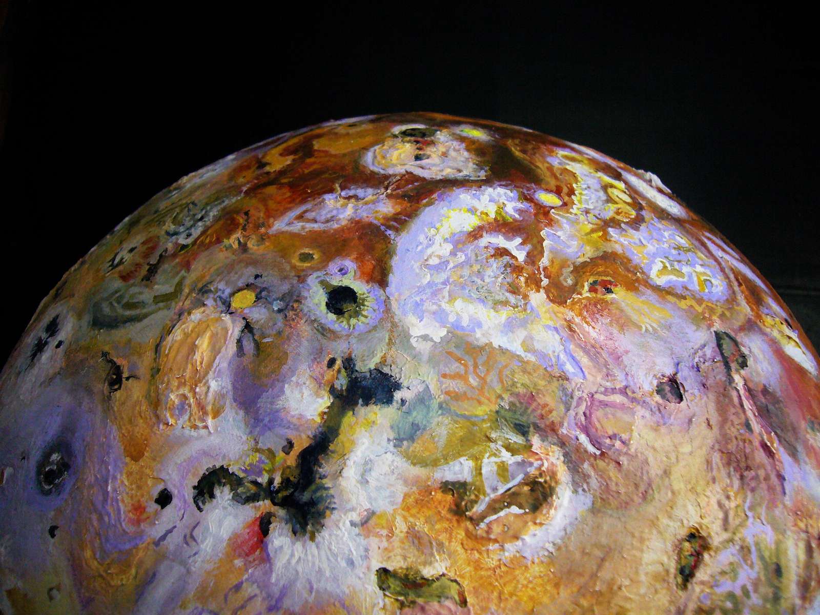
Io. Center: Horus/Ra vents. Upper right: Loki. Horizon: the Boösaule Mts, 18 km high (11 mi) |
7/29--Work all morning, add mountains from 236-280 degrees east, and go back over the old ones; rebuild a couple placed wrong. Slip back into obsession; shivering and exhausted and hungry when I quit after noon. Never did eat.
7/30--Work many hours, adding the last mountains. Data gets sparser as the longitudes creep past 330° west, back toward zero.
8/6--Work obsessively again; hours of three-way switching--mountain site, general map, and globe. Still some big discrepancies and missing mountains.
8/7--Corrections. Move some mountains, add a lot of hills, fine-tune the altitudes.
8/8--Decide that several mesas I did early on are really pateras (huge calderas)... and vice versa. Feel confident about the rest though--my model's about as good as can be, from ambiguous photos. Almost time to paint...
8/10--NASA's main site for Io is broken, but I find another site with 250 photos. Page through them all, reworking bits in light of new data.
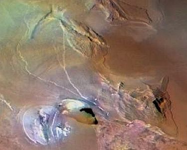
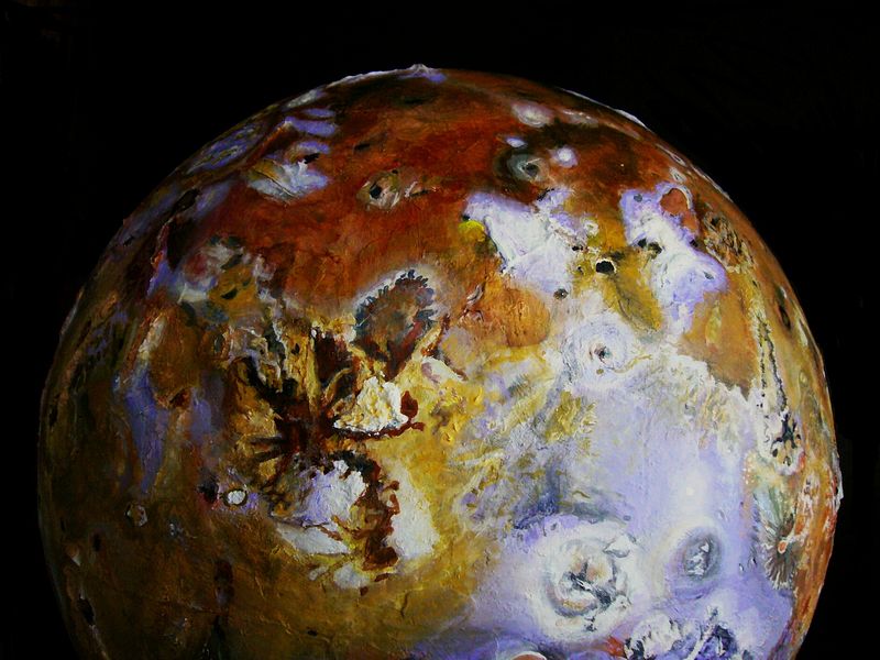
Greens and browns near Mt Euboeia, 13 km tall (43,000'),
|
8/11-23--Slowly paint Io, over two weeks.
2007/11/6--Retouching details. It isn't truly finished--one hemisphere's way more vivid and detailed. But the close-up photos fade out halfway round, so some guesswork's unavoidable. Until more data comes in and gets posted, this is about as accurate as I can get.
2009: ORPHAN ART?
I finally uploaded the above blog and images to the World Dream Bank, over two years late! Even then, I just posted it as an oddity, an orphaned piece of nondream art.
I felt I couldn't add "Io" to the Planetocopia project, because it's not truly Planetocopian--that series is speculative, and Io was not. No "what if" premise, no intelligent life, indeed no biosphere at all.
Unless maybe the silicon fish swimming in that underground sea of molten sulfur are cunning as well as incandescent. And how you gonna IQ-test them before you melt?
But it was too wild a globe to hide on my shelf forever.
Ooh, pwitty colors. Blues, begone!
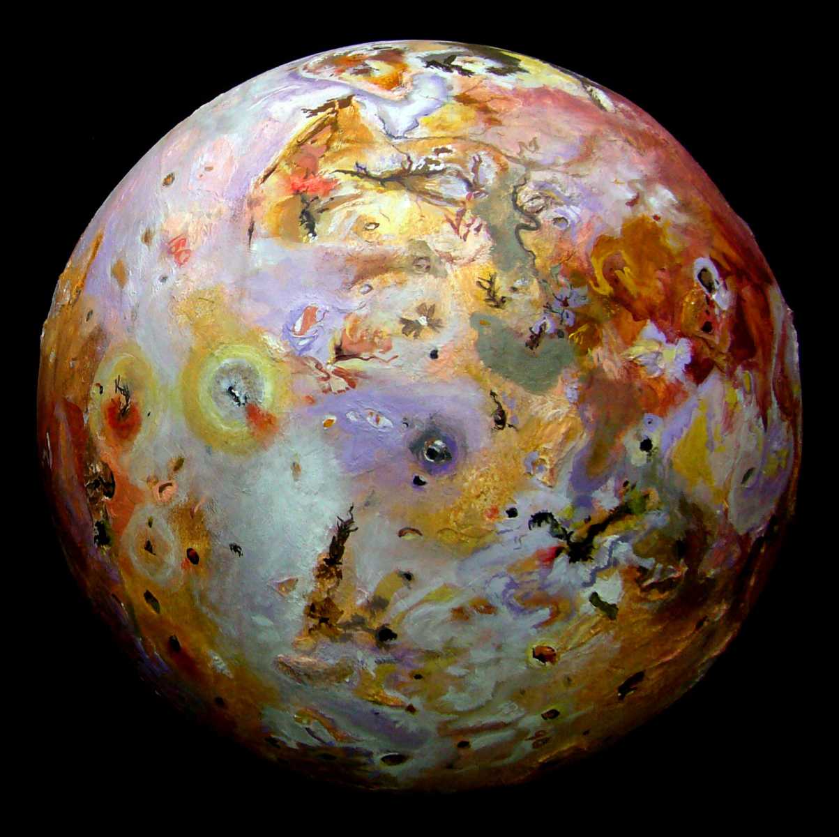
Six years later, I suddenly came back to Io with a senseless desire for closure. I re-searched the web, revisited the Io Mountain Database--which has expanded since I first built my model--added and corrected topography, then repainted in much greater detail than was practical in 2007.
This time around, though, I studied at such length and in such detail that I could make some speculations. Not Planetocopian speculations on life, on what makes a biosphere, but scientific ones. Yet from an artists's perspective! Close yet naïve observation by an Aspie attuned to patterns. With a loathing for jargon...
COLOR
Eight years ago, I had doubts I'd caught the "real" color of Io; I assumed my eye and brush were just sloppy. This time around, I'm noticing how much my reference photos clash. Several reasons for it:
In most regions contrast and saturation are probably exaggerated; if several shots conflicted (and they did constantly) I favored shots showing fresh volcanic and tectonic activity. Hotspots are often lurid (sulfurous yellows, reds, olive greens) and contrasty (white sulfur dioxide snow next to black lava). Quieter regions are duller--the bright compounds decayed and the contrasts smoothed by hazy ash layers from distant vents.
But Io's inner hemisphere, the one always facing Jupiter, is artificially dulled--the probes never swung by that side, so all shots are either distant and fuzzy or close but very low-angle; details must be retrieved by triangulating glimpses on the horizon. This is often possible, though; for once it's a virtue Io's airless!
TEXTURE
Io's fractal textures are too wild for me to capture fully. I can only paint details down to 10-20 km (6-12 mi)--my hand, brush and eye just can't do better. This is all the data we have for some parts of the inner hemisphere (facing Jupiter), but it barely hints at the crazy fractal patterns in close-ups from the outer hemisphere. My model, looked at closely, is actually rather restrained-looking next to the feverish reality. Jackson Pollock's dream.
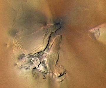
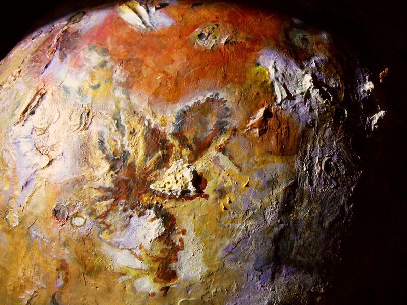
Scalloped cliffs of Tvashtar (top) and Savitr, on Io, sculpted by Chris Wayan |
The wild colors and patterns both draw the eye, making Io the iconic Jovian moon; but they have a hidden drawback. They reveal active regions pretty well, but because those colors are often sprayed-on (from eruptions near or far) they can camouflage local terrain--not just disguise the colors of local rock, but even hide relief.
Under the camouflage, Io has a lot of relief to hide! You'll notice I use some grayscale NASA photos below, shot in wavelengths that ignore the spray-on paintjob.
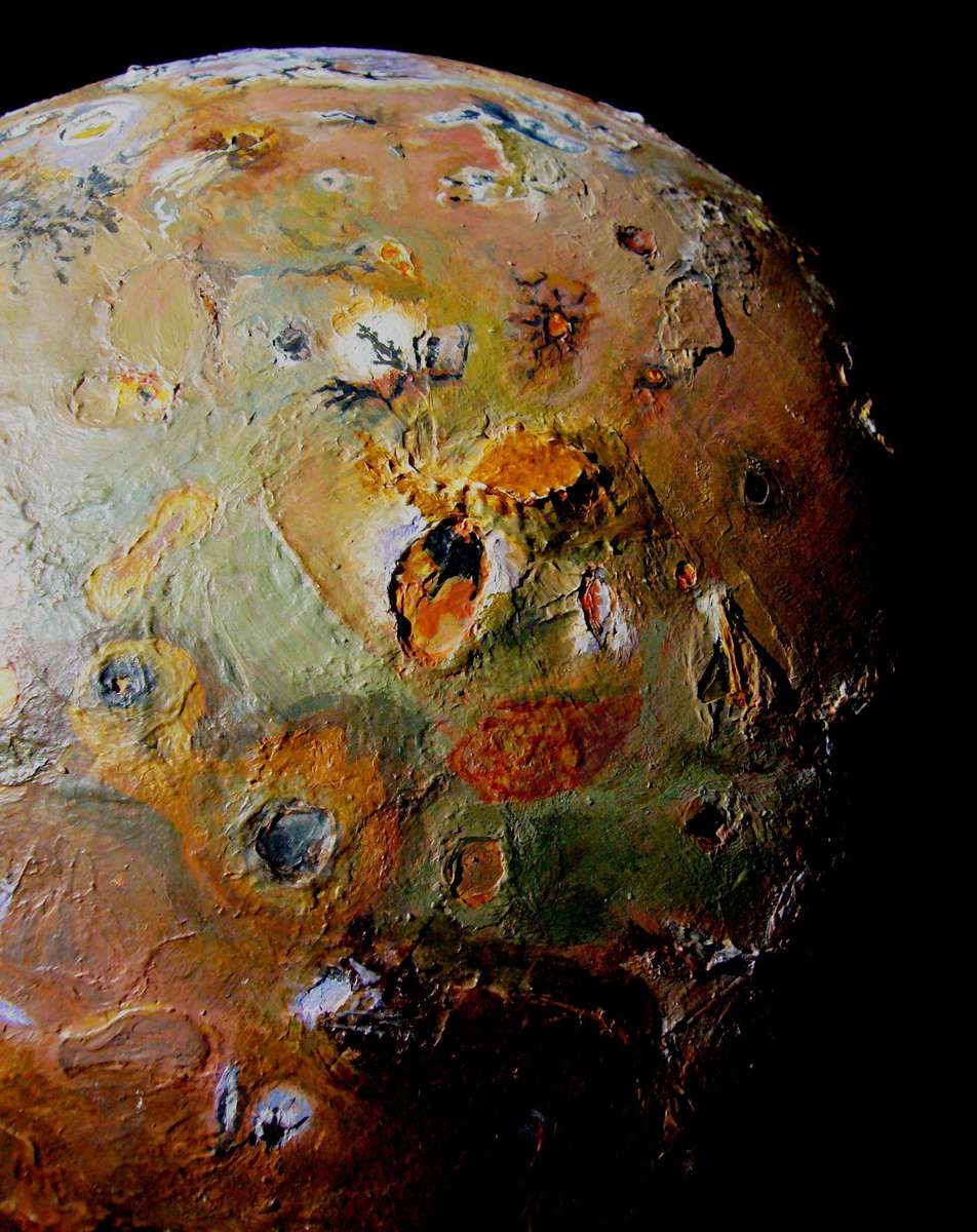
Io's one of the ruggedest worlds in the Solar System. The Io Mountain Database contains only 120-odd "mountains"--but that's way more than you think. On Io, a typical "mountain" is the size of an American state or European country. Those hundred-odd mountains alone cover 3-4% of Io's surface.
They're not just extensive; most are dramatic crags or mesas rising from a lava plain with few or no foothills, as distinct and separate as an island in a sea--Uluru rising from the Outback, not Everest or Fuji. But Uluru's a pebble next to these monster rocks: Io's mountains are typically 1-9 km high (3-30,000'), ranging up to 18 or so (eleven miles high!)--visible for 1-200 kilometers, even with Io's sharp curvature.
Io is cliffy too. Ionian rocks, suffused with gas, are stable under pressure but prone to explosive sapping when they're exposed to vacuum. There isn't much rubble--it's blasted away and buried under subsequent lava flows, I guess. So mountains tend to have sharp edges--the cliffs are gnawed inwards even as the mountain rock thrusts upwards. Such sapping can lead to strange swiss-cheese shapes like the mesas east of Tvashtar.
On Earth similar shapes arise from different sources--a cap of hard rock over soft can lead to mesas and labyrinths due to rain, or the sea may gnaw at coasts, creating cliffs, stacks, and terraces. But Io's peaks don't face external weathering--it's autodemolition!
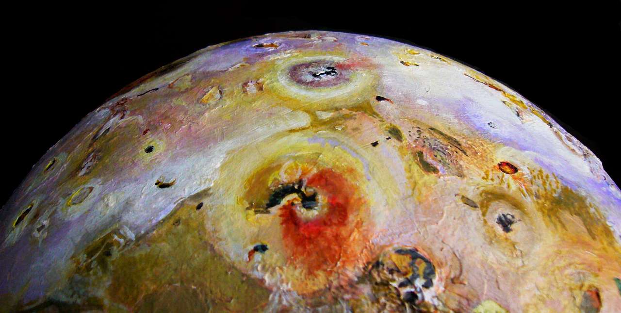
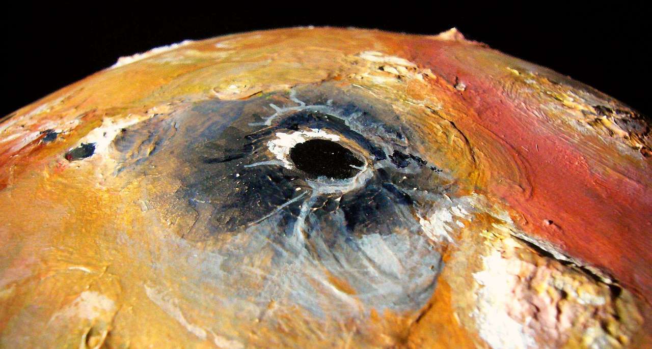
There are no great basins as on Earth, Mars or Venus. But hundreds of smaller pateras (cliffwalled volcanic craters 10-100 km wide) yawn as much as 3 km deep (10,000'). 18 above the plains, 3 below; so Io's total relief is about 21 km.
Mars has a greater total relief--some 34 km, from Hellas Basin (8 km deep) to Mt Olympus (26 km). And there are huge cliffs, up to 6 km. But unlike Earth or Mars, whose tallest peaks, measured base to top, are shield volcanoes with gentle slopes, Io's tallest mountains are dramatic, with huge basal cliffs.
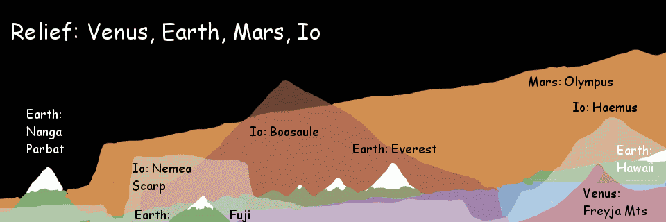
Tallest visible/fully exposed mountain, base to top:
Sheer cliffs? 1-2 km. Yosemite's Half Dome and El Capitan, some of the Norwegian and New Zealand fjords, Pakistan's Trango Tower, Patagonia's Torre Egger.
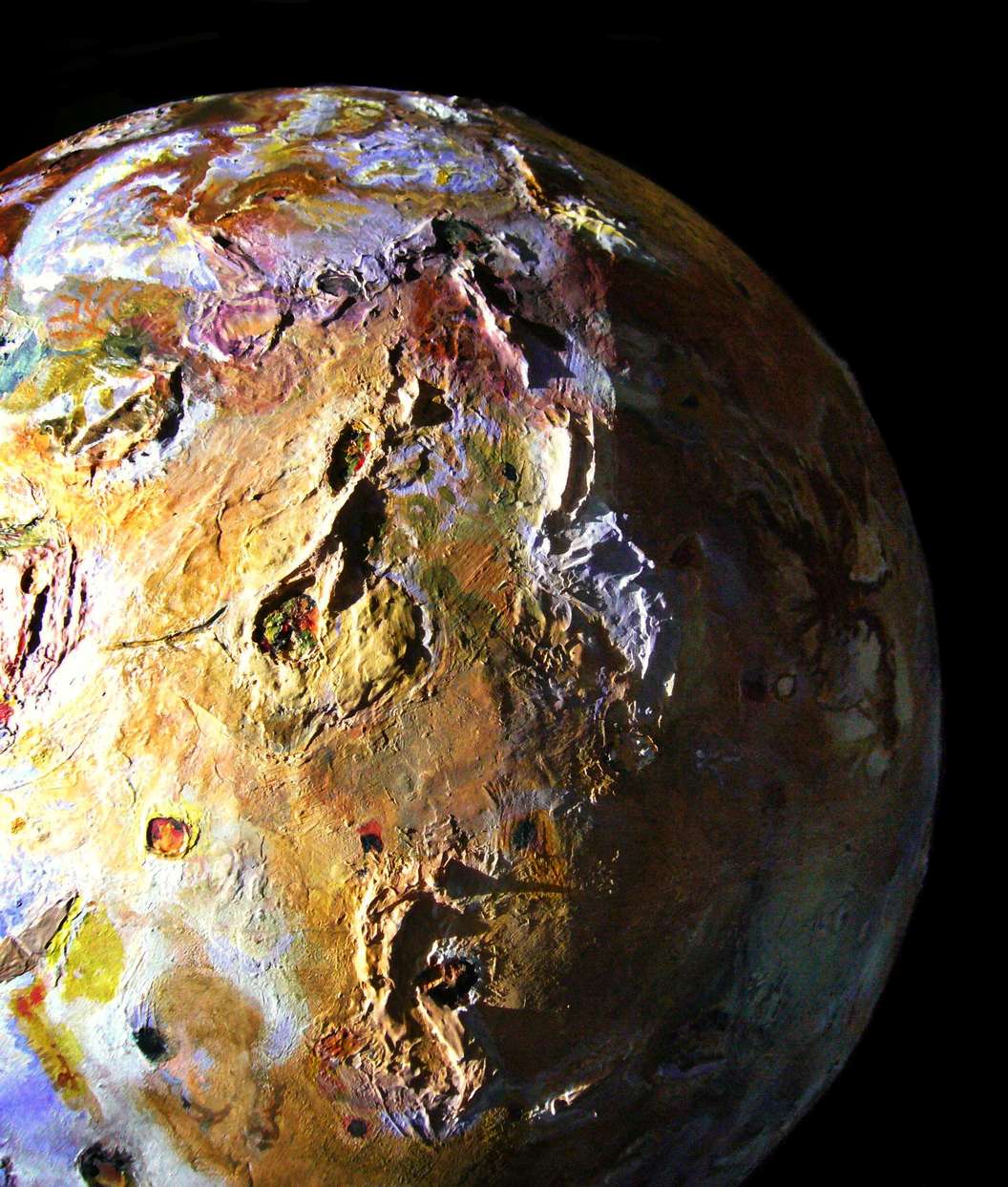
Cliffs of Nemea Planum, 6-7 km high (20-23,000') |
Sheer cliffs? More and higher than Earth's. Lakshmi Planum (a plateau 3-4 km high, the heart of the Ishtar highlands) has calderas like Colette with cliffwalls a good 2 km high; nearby Sacajawea and the Valkyrie chain may together have 1000 km of cliffs over a kilometer high. Venus favors cliffs: explosive sapping like Io's to carve cliffs, slightly lighter gravity (less strain on rocks), and not much erosion. Here's a tour of Lakshmi's mountains and cliffs on a terraformed future Venus.
The highest true vertical cliffs: calderas such as the throat of Pavonis, as much as 6 km or 20,000' deep. Certainly Io's great rival for Barbaric Splendor. Here's a tour of a terraformed future Mars.
Long shadow of rock spires, Hi'iaka Mts, 11 km high (36,000') |
Highest cliffs? Well, Hi'iaka's northernmost peak (80°W, 2°N) appears to be a near-vertical crag some 11 km (36,000') high. Very steep at least.
The deepest "canyon", in northern Lei-Kung Fluctus, drops in scarps or cliffs from a (nameless) white northern mountain 11 km high into a narrow black crack--maybe Lei-Kung's lava well--penned by a south wall rising to 9200 m, higher than Everest--and that's the low side! The photos of that region are poor; those may just be rugged slopes.
The same is true of the Haemus Mountains in the far south; 11 km high, and they drop on the west into a chasm maybe 2-3 km deep--but it's all shadowy. Out of that 13-14-km drop, I suspect cliffs 5-6 km high, but can't be sure.
The highest sheer drop I'm sure of is Nemea Planum's east end; this sinuous plateau rises to about 4-5 km high and then drops into a chain of cliffwalled pateras perhaps 2 km deep; long, apparently vertical cliffs here drop 6-7 km! They may even overhang in spots where lava in the patera has lapped at them like the sea eroding coastal cliffs into stacks and arches. Anyway, tough rock! I think these Nemea cliffs are the tallest in the Solar System (at least on a world big enough so gravity makes you feel down as down).

MOUNTAIN TYPES
When a local plume of lighter or hotter rock wants to rise, blocks may tilt or just pop up. Sometimes they come up as a unit, bursting from plains--a whaleback looking like Australia's Uluru. Often they sport plumes of white, purple or yellow around the base of their cliffs, where vents blast sideways onto the plain. Here's a rock nearly 100 km long and 4 km high (13,000'), looking, with its plumes, like a manylegged bug.
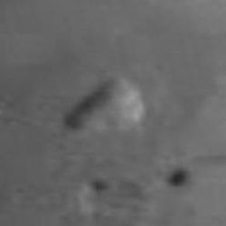
Distant shot in low-angled sun, blurry but showing relief |
A sharper but shadowless shot reveals plumes at the rock's foot |
Approximate color, from two blurry distant shots |
My rendering: a giant Uluru with vents scalloping its base |
Of course this is the sort of interpretive struggle I underwent all over Io. Easy in some places, hard in others--including here.
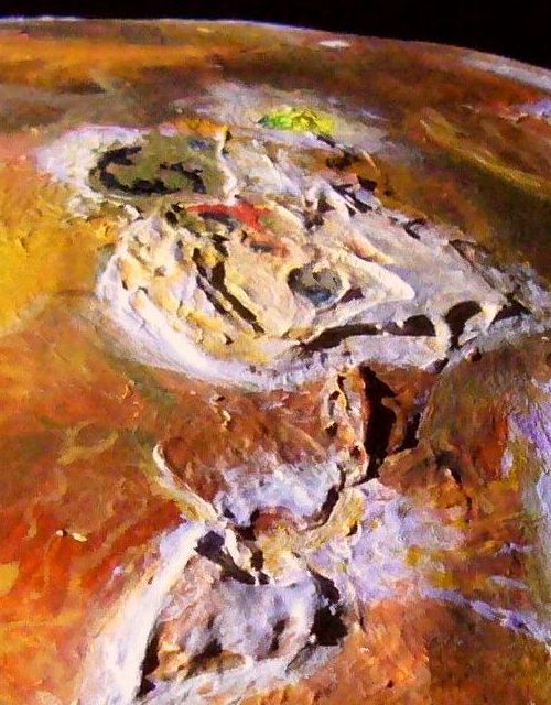
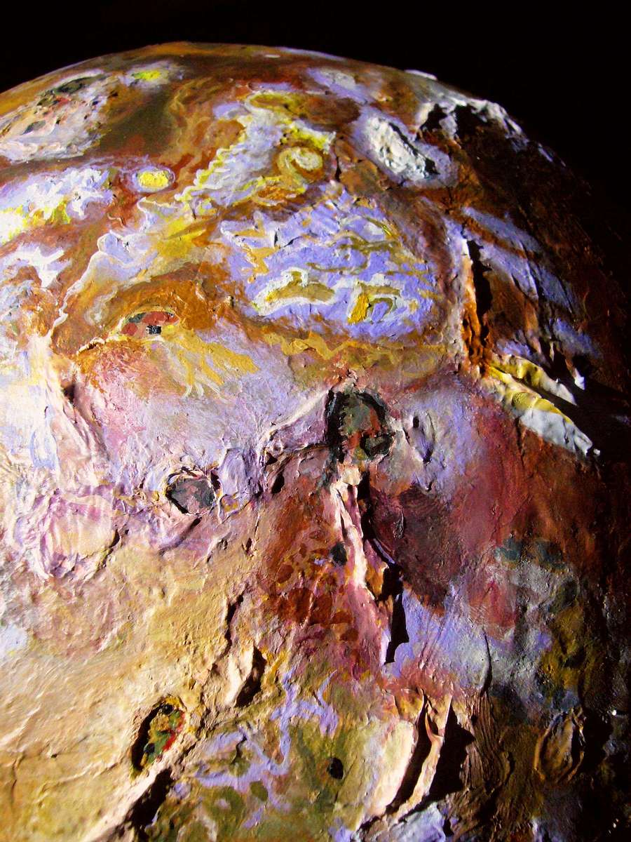
The striated/terraced Caucasus Mts (10.6 km or 35,000' high) near Pele |
TERRACING
Some of these rocks-the-size-of-countries look like layer cakes, with roughly level lines of cliffs, like a crude topographical mockup built of layered cardboard. Each stage is likely a relic of the days when that level was the whole visible mountain. The cliffs are relics of the explosive sapping that afflicts many Ionian rocks when they're first exposed to vacuum, rising from the plains.
Shown to right: the Caucasus Mts (southeast of Pele). Grian Mons (15°W, 15°S) is another good example and Euxine Mons (125°W, 25°N, near Amirani) when seen in low sun looks likely.
Such peaks may be like marine terracing on Earth--where slowly rising coasts may not display smooth slopes but terraces--ancient beaches and cliffs. The source of the erosion's different here, but the effect's similar.
PENTHOUSING
A weird, fascinating variant: the two-stage plateaus breaking up the Lei-Kung Fluctus, north of the white sea of Colchis.
Lei-Kung is a bizarre wriggle of black tormented fractal dragons worthy of Mordor.
But the twin Mt Dooms looming 9200 meters above it aren't volcanic, but (I think) a mass that upthrust, paused long enough to sap into two huge mesas tall as the Alps, then resumed the long upthrust, to Himalayan height this time--and sapped again into twin mesas ATOP a huge lower mesa.
The two-stage Lei-Kung Montes: mesas atop mesas |
They're like two penthouses atop a gigantic sinuous hotel, with both white jets of sulfur dioxide "snow" and the black lava flows of Lei-Kung around it, bringing out the lower story's twisted shape.
I know the model is a bit confusing to eyes used to Earth topography; the NASA photos are even harder to interpret. But this is my best guess for this fascinating formation. It's either that or a team of Godzillas on bulldozers stripmined these highlands and those are the access roads. And I don't see any tractor treads in the dust, do you?
UNNOTICED MOUNTAIN CHAINS
I believe these peculiar mountains link via lower ridges to the Nile Mts far to the west, forming a crescent-shaped range spanning 90 degrees and higher than the Himalaya. This is speculative; the sinuous purple ridge linking the two firmly established ranges is not in the Io Mountain Database. But I do, in some photos, see shadows suggesting considerable relief; just not on the spectacular scale of its neighbors. And the lava flows diverted around its base do reveal that the connecting hills exist; the only question is how high.
Here's a shot of the proposed complex, in my model. Top is north. Note that the scene's lit unnaturally (with the sun shining at a low angle from the North Pole); this brings out the relief better than any realistic east/west lighting. (My funding, like NASA's, is insufficient to tilt the actual moon, you see. "Make it do, or do without.")
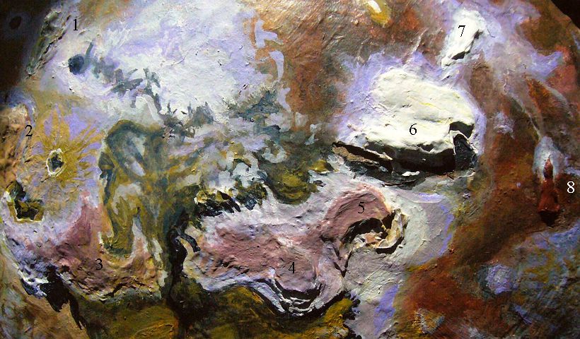
Proposed Nile-Lei-Kung Range: 1: North Mt. Nile, 6.5 km (21,000'); 2, South Mt Nile, 9 km (29,600'); 3, winding ridge 3-4 km (10-13,000');
|
I don't insist on this exact configuration. Omit #8, the orange flatiron on the right, and the remaining seven form a neat curve with quite narrow gaps. I included #8 as an outlier because no others are near it and its height and type are like its neighbors. Judgment call.
This won't be the last mountain range I'll propose for Io that I haven't even seen mentioned or mapped! The point to take away is that chains do exist; few mountains here rise in isolation, any more than on Earth. It's just that on Io, lava flows and explosive sapping eat away the foothills, making connections harder to see.
Ionian Mts, twin ridge (top) & Mt Pillan, cracked scallop |

Ionian Mts, twin ridge (top) & Mt Pillan, cracked scallop |
TILTED SLABS
The rising crust doesn't always form level mesas; it may also tilt the way a treeroot can lift a sidewalk pavement-square; low or no cliffs at one end, scarps 5-10 km high at the other, like Shakuru (north of Pele, east of Loki; 265-270°W, 25°N) or Egypt Planum (just south of Pele) and Mt Pillan (just north of Pele), notable for lateral vents at the foot of its cliffs, spewing white plumes hundreds of km (inactive and essentially invisible in NASA grayscale shot to left, which however nicely reveals the structure of the rising mass; vents recently active and prominent in other photos and my model, right).
Such wedges seem commoner in regions near huge vents, where paterae and mountains themselves are fewer but larger; is the crust thicker and/or tougher here?
DOUBLE DOORS
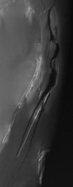
Rising blocks of crust may also crack into pieces that hinge up and apart, leaving canyon-like gaps between. Such cracks may be single or multiple:
A long bulge, linear or arcuate, may crack down the middle as when double doors are ajar, creating twin ridges like the Ionian Mts (12-13 km or 8 miles high; NE of Pele; shown above, at top). The Mongibello Mts (merely Himalayan; 70°W, 25°N) and the nameless range north of Mongibello (11 km tall?, around 45°N) are two more examples of such twin ridges.
CRACKED PYRAMIDS
Multiple cracks can create pyramidal shapes or domes split by with forking chasms. The two eastern Boösaule Mts (7-8 km high; top of photo, below left) are huge though poorly photographed. The Danube Planum (heart of Pele; 3500 m high, a mere 11,000'; below right) and the northwestern peak of the Boösaule Mts (cracked lavender-white bulge on left of photo below left; 4100 m or 13,400') are lower but more visible.
Cracked pyramids in Boösaule Mts, near Pele |
Danube Planum, cracked plateau around Pele's vent |

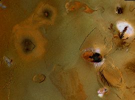
Cluster of quite Earthlike volcanic cones near Atar Patera northeast of Loki; click to enlarge.

S-curve near Galai Patera (brown gourd shape, lower
|
TERRAN CONES
Amid all these quite alien landforms I was surprised to find one patch of perfectly familiar ground--a family of volcanic cones 1-2 km high, northeast of Loki. True, near it is a caldera wider than any on Earth, but for a hundred miles or so it looks like the volcanoes of Kamchatka or Iceland. Even the scale, for once, is Terran.
NASA: white dotted S-curve
|
This may be Loki's influence; monster vents like this seem to suppress oversize Ionian mountains around them for hundreds of kilometers. My belief: Loki may be just the visible vent for a whole "iced-over" sea of molten sulfur, so bedrock in this region is kilometers down, and visible peaks like these are essentially islands in a sulfur sea with only their tips poking above the "ice".
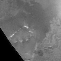
THE SWIRL
West of the Boösaule Mountains, around Galai Patera, is a region of lava flows and lakes with peculiar meandering dotted lines, alone or in pairs These seem to be vents spewing sulfur dioxide 'snow'; it isn't clear if the dots are flat patches or hills. Pingos of 'ice' bursting through heavier strata? Or could they be something like the flowstone castles that geysers can form?
What causes these winding lines? No idea. Presumably the lines are faults--but such sinuous twists are unlike any Terran faults I know of. What this S-curve on an undrinkable lake reminds ME of isn't a natural wonder but an artificial one, an art project: the Spiral Jetty in the Great Salt Lake.
Not quite Spiral, but at least a Swirl.
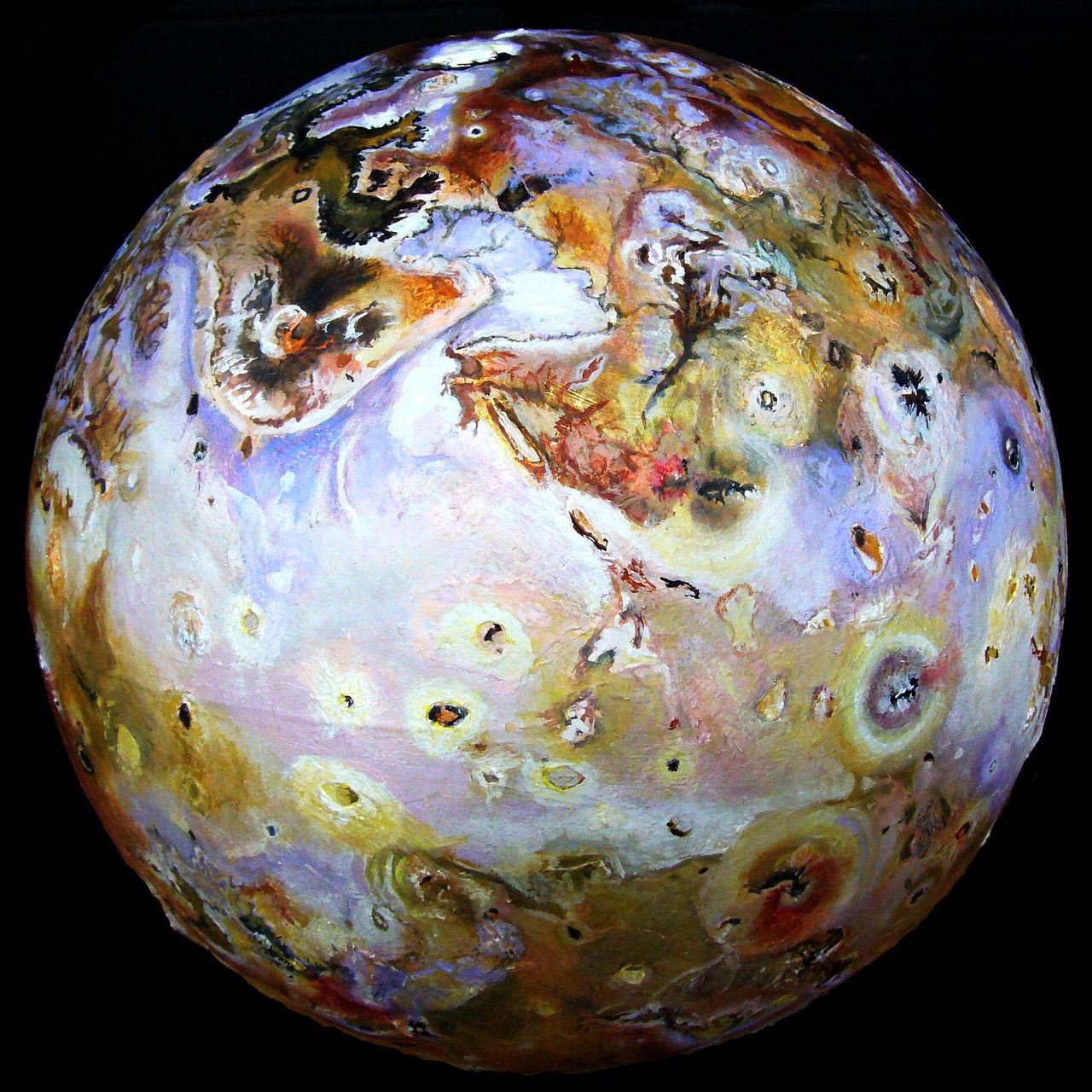
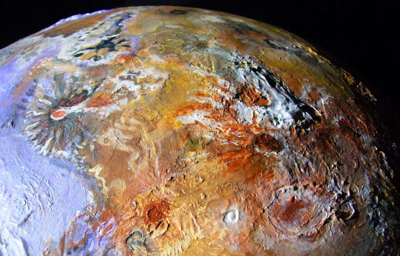
Online text about Io speaks of its little-known, poorly photographed 'inner hemisphere' (no, Io's not contemplating its navel; the hemisphere always facing Jupiter). This is a slight exaggeration. Pretty good photos cover half this hemisphere, especially at the edges. True, many are at low angles. And the north pole and northern latitudes from around 15 east to 75 west are truly fuzzy, no close-ups available. South of the equator, the bad slice is narrower: only about 30 to 75 west, and the south pole's okay.
Here's a pair of shots showing the problem: a shot of the inner hemisphere, then a panorama of the sharp side centered roughly on Prometheus (this one's enlargeable. And gorgeous--one of the most beautiful sights in the Solar System.)
Io's inner hemisphere |

Io's outer hemisphere: click to enlarge |
Although the following shots of my interpretation of the Inner Hemisphere aren't standouts scenically, I'm including two here because this area's so poorly covered on Io sites and maps.
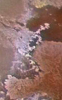
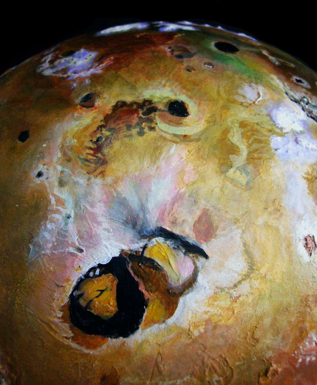
Colors of Io's poorly mapped inner hemisphere. Lei-Zi Fluctus (brown/white), left center. Ukko Patera (black crater on
yellow flanked by lavender patches) upper right. 'Snow' patch around Karei Patera (purple/gray/white) lower right.
My model is more detailed, brighter-colored and shows more relief in this area than published Io maps; but I spent serious time collating marginal shots, and I stand by the rich yellows browns and blacks of Lei-Zi Fluctus (butterfly-like lava flow in photo above) and in the areas around Ukko Patera (black spot on yellow, between lavender patches of sulfur dioxide snow, upper right).
One thing I'm sure is wrong: the lack of colorful detail inside pateras, which are often multicolored--red yellow green black. The heart of the bad patch just blurs such details together, to mud. But I'm sure they're there--sharper shots of Io all have them.
Relief: the photo below, shot in low-angle light emphasizing shadows, reveals a diagonal mountain chain slashing across the north. The well-lit peaks in the center to center-right are from 3.9 to 6.1 km high (13-20,000') and one of the peaks floating in shadow on the terminator (far right) reaches 8.2 km (26,500').
Low-angle sun shows diagonal mountain chain we'll dub the Ukko Montes on Io's ill-mapped inner hemisphere.
If you go back to the softer shot you can spot more mountains stretching northeast, even without shadows to help. Two orange mesas, 4.2 and 4.8 km high (13,700' & 16,000') have white plumes of sulfur dioxide snow outlining them, much like the Telegonus Mensae in Io's far south. Taken as a whole this mountain range is a good 1000 km long and Himalayan in height; yet it's unnamed and apparently unnoticed AS a chain on the Io maps I've seen. Let's dub them the Ukko Montes (since that's the only named patera associated with them).
Northwest of Ukko is a dark, mostly featureless plain, with only one known height, a lonely white peak near that dark little patera; it's a mere 3500 m tall (11,400'). Not even Fuji!
But a few hundred km past Not Even Fuji is a HUGE range, taller than anything on Earth. But still unnamed! I'll treat it below; it's an extension of the well-known chain starting with the Hi'iaka, Gish-Bar and Mongibello Mts, running northeast all the way to the pole.
My first impression of Io's distribution of features was: "Mysterious!" It looked random, like a starfield. But is it? Features are roundish and evenly distributed--every hundred km or two, another damn feature, sprinkled on the multicolored lava plains. A rock. A hole. A vent. No wonder it seems like a pizza--not just the colors! Salami slices and olives get placed--evenly, not randomly. Chaos is NOT even. Io suspiciously is.
But then what we see is selective--your eye goes not to Io's most massive features, but to its brightest colors--the red, yellow, black and white spots of active paterae. Random or not, they're ubiquitous. This alone is suggestive. Earth's inner heat gets vented mostly at plate boundaries. Not on Io! All over. Plates are either absent or they're small, just a few hundred km each. The spacing isn't too different, I'd like to point out, from the spacing of volcanoes at the edges of Earth plates--1-200 km apart is common in the Cascade Range I know best. If pressure builds up between them, it's just easier for it to escape laterally through an existing vent than to punch through the crust and create a new one. This Earthlike spacing suggests a crust solid enough to form plates, at least in many places. No crust? We'd see random. I don't. I see even.
The Io Mountain Database tentatively points out two subtle worldwide clusterings:
Mts c.80° W. South to north: Hi'iaka (11 km tall, 36,000'), Gish-Bar (yellow, in sun, 8 km), Mongibello (twin ridges, terminator, 8), Zal (diag. ridge, 4.5), unnamed mts (polar, 8-11) |
Around Pele: Boösaule Mts (top right) 18 km high (57,000'), Pillan (lower right) 5.5 km, Caucasus (lower left) 10.6, and Egypt (left edge) 10 |
The poles are generally rougher, with more dark reddish rocks and more mountains and mesas; an equatorial belt has more smooth, pale "seas" where low broad calderas abound, like Colchis, Bosphorus and the unnamed patch from 0° west to 30. It's not as consistent as, say, Titan's equatorial dark belt of dried-up seas as well as polar lakes--more like Earth's patchy distribution of forest--on land only, mostly in the tropics, some patches at higher latitudes, but none at the poles.
At first glance it's hard to avoid seeing these white regions seas as iced-over seas with volcanic islands, especially Colchis, with its distinct coast and flat expanses. Is it possible these really are sulfur dioxide sea-ice covering liquid sulfur oceans? The stuff melts at mere hundreds of degrees, not thousands. If so, it's a hot, stinking, sterile parody of Europa's ice-covered oceans (and potential for life).
Or is that our bias? Life in Terran hotsprings and undersea vents flourish in heat nearly comparable to such sulfur seas. Who knows where life can evolve?
Io may have more sulfur seas than these white/lavender/yellow zones reveal. It's possible that the smooth plains surrounding huge vents like Pele and Loki are also seas of sulfur melted by the hot spot creating the vent--just camouflaged by layers of ejecta in other colors. Loki is especially suggestive--over a million square km around it with hardly a hill. Though cliffwalled pateras like the black pit of Dazhbog (top of photo below) or Pele's mountainous Danube Planum imply solid rock. But if Earth were iced over today, as it was 600 million years ago, Ionian astronomers could use this argument to say Hawaii proves the Pacific is a solid basalt plain... Looking at Europa, or northern Mars, we're quick to suspect iced-over seas; why not Io? Anti-sulfur bias?
Gish-Bar Mts (8 km /26,300') with
|
This equatorial belt of paler flats could be due to the heat of the sun. Yes, it's weak by Terran standards--equatorial soil should be just 10-20° Celsius warmer than polar rock, unlike our 50-degree difference. Still, even Titan (nearly twice as far out, with 30% as much sun) seems to have seasons precipitated by sunlight; Saturn's atmosphere does too. Maybe the slightly warmer temperatures of the equatorial belt favor whitish snows and break down brick-red sulfur compounds faster than at the poles.
Or, more likely, the full-on solar radiation of the tropics (not necessarily visible light; ultraviolet?) cracks such compounds faster.
But I can't see how a slightly less chilly surface could encourage more plains and low shield volcanoes, or discourage rugged mountains. That's topography. We want deep forces for that.
There's a plausible candidate: tidal warming. This effect is stronger in the tropics because these forces pull laterally, not north-south; the tropics offer more moon to massage. And of course, unlike sunlight, tidal stress runs deep indeed.
So I do believe in sulfur seas, showing up mostly in lower latitudes. At least spotty ones. Perhaps as spotty as our continents in their world-sea? But no less real for that.
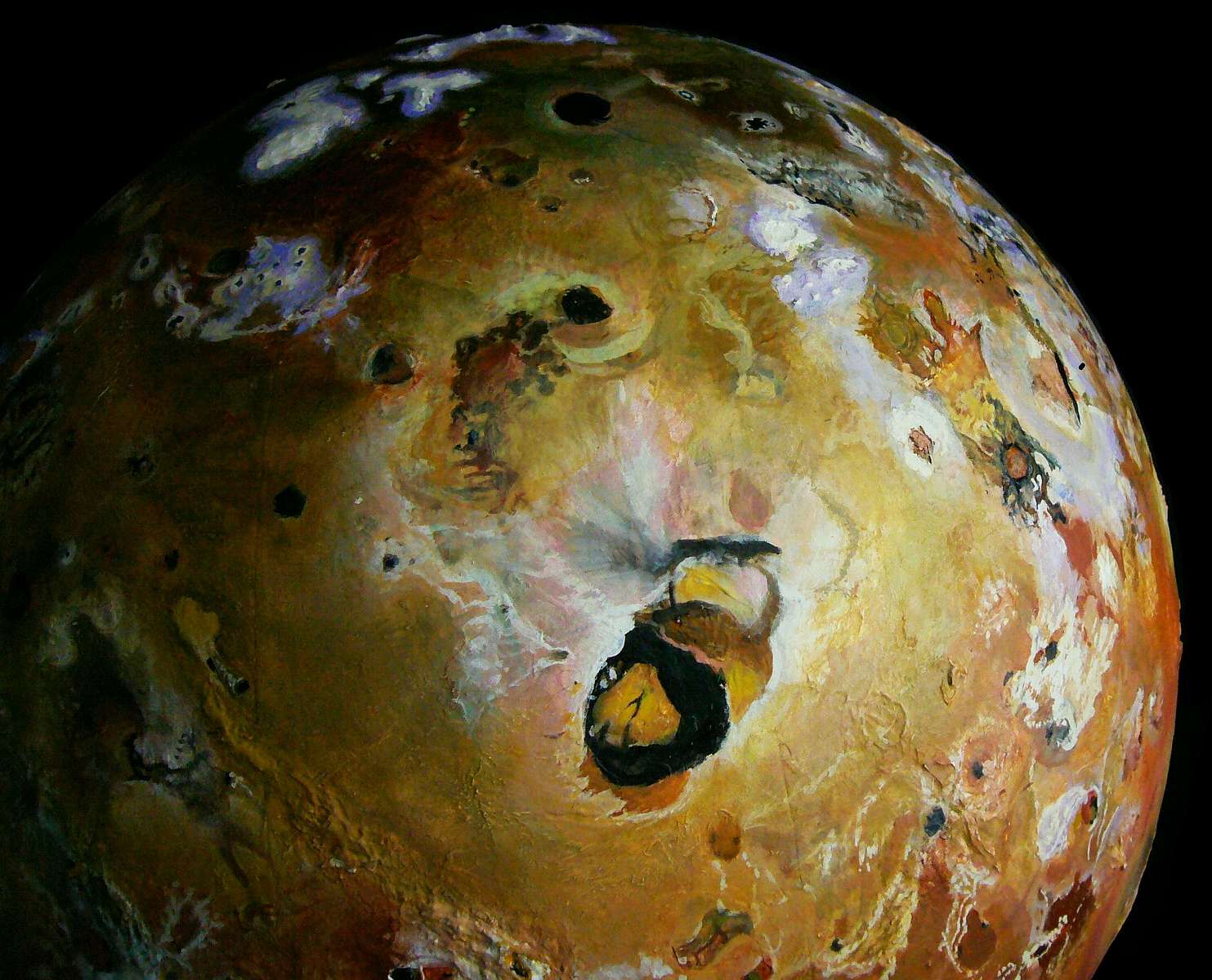
Pateras gape at the feet of Io's mountains more often than chance. A long plateau often has calderas at the ends, like sockets or knobs at the end of bones. Hi'iaka (11 km tall, on equator at 70°W) and the Gish-Bar Mts (8 km tall) north of Hi'iaka have paterae at both ends (see left). On Pan Mensa (30-40°W, 50°S) the end paterae are highly visible, being snowcapped shield volcanoes. Single end-sockets are even more common--see Tvashtar (120°W, 60°N), nearby Savitr (7200 m tall, 125°W, 45°N) and Euxine Mons (125°W, 25°N). Not coincidentally, these three form a chain.
Mt Tohil, 9400 m (30,800') high, & patera
|
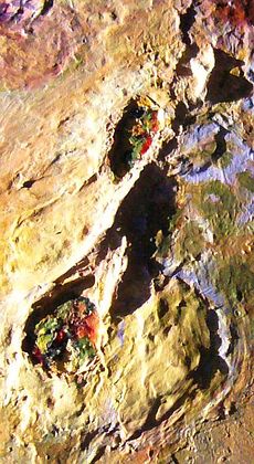
Next most common place for a patera: hugging the flank, often gnawing into it, excavating monster amphitheaters--Mt Tohil (160°W, 20°S), shown to right, the Carancho Mts (315°W, equatorial), and the Nyambe Mts (345°W, equatorial; amphiteaters on both east and west flanks), shown below left.

Nyambe Mts, 6.9 km tall (22,700'), gnawed by THREE pateras |
The bone-end ones are especially intriguing. If you see these paterae as part of the uplifting ridge, just a part that's nicely disguising this by exporting the stuff in lava flows... then you suddenly see chains of these enlarged mountains all over Io, not just around Tvashtar.
Mountains and pateras alternate in many places. And close-up photos, where available, often reveal actual bright lines--sometimes low scarps, often just cracks venting white sulfur "snow"--crossing lowlands, connecting the dots--like Tvashtar to Savitr to Euxine. These mountains ARE chains! Not always but often. The average one isn't alone, any more than the average star is.
How big are such ranges? One arc of peaks runs from the North Pole to 20° south, around 80° west; it then veers east, running to about 30° west and south, and then runs southeast to huge Mt Euboeia, second tallest on Io. From it the Iopolis-Charango branch runs 2000 km north to near Loki; a shorter eastern branch runs through Argo Mensa to link with the rings of mountains around Babbar and Pele. This range may not circle Io quite as clearly and extensively as, say, our Pacific Ring of Fire, but proportionately they're at least as long as the Andes or the Mid-Atlantic Ridge or the East African Rift and associated peaks; and just as high, too.

Io, south: the Telegonus Mensae, Illyricon, Mycenae, Bactria |

TIMB; a possible plate? |
Such lines of mensae, peaks, paterae and venting cracks can surround large areas much like a Terran plate boundary. Example: the Telegonus Mensae, Illyricon, Mycenae and Bactria seem to form a plate--call it TIMB.
Proposed boundary: start at Mt Tohil, below and to the left of Culann Patera, that big red and yellow ring near the top; from Tohil (rough dark area) go east through Bactria along a chain of mesas 1-4 km high (well camouflaged under lilac, yellow and pink ash), to the Telegonus Mensae (white/lavender mostly; fresh vents), then south along unnamed mensae (brown mesas 3-4 km high with white vents along their feet) and actively venting cracks (thin white line on brown, at bottom) near the South Pole, then up again (unnamed sinuous mensae, streaks, cracks and peaks up to 7 km high!) to the Dorian Mountains (off photo to left) and east along a tan, almost invisible mesa chain (still 1-4 km high, visible in low light) to Tohil again.
Is TIMB truly a tectonic plate in the Terran sense? I don't know. But consider how long it took--centuries--to recognize plate boundaries on Earth!
So I'll stick my neck out and propose it.
If Io does have small plates, is there lateral motion, do they drift? I'm doubtful. Io's mantle may not need to move laterally as on Earth; it looks rather easy to punch through that thin crust and vent any pressure on the spot. Even if there is lateral motion, the crust may be too fractured (or elastic) to move over long stretches (of space OR time!) the way you can with Terran plates--ours record history going back hundreds of millions of years.
Io's just too busy for tracks to last long even if they DID exist.
On the other hand, Io has a rather unEarthly force that puts even motionless plates under lateral pressure, pushing them to overlap at boundaries. Here's how it works:
Io's volcanoes belch out enough rock to resurface the whole moon in not-so-deep time. We tend to think volcanoes are wells with an infinite supply, and on Earth and Venus for all practical purposes they are. Not on Io. So much volume's ejected so quickly that in deep time the mantle steadily shrinks; lava flows covering Io's surface a kilometer deep (as may well happen every million years or so) mean the old crust (as it sinks under the new layers) will have to become a shell 6.28 km less in circumference, and enough magma's been ejected to do just that. Crunch!
Even without lateral motion driven by convection in the mantle, platelets squeeze and want to overlap, enouraging faults and extruding mountains. It's slower than Terran drift--for a plate like the one I propose in Telegonis-Illyricon-Mycenae-Bactria, this relentless IRS (Ionian Recycling Squeeze) would be millimeters a year at most, not centimeters as in some fast faults on Earth--but Io has time. And the Slow Squeeze is constant, relentless, and worldwide, always adding to local pressures and local movements (if any).
I'm not a geologist; just an artist who's looked closely at Io for eight years; so I may misinterpret the cause and meaning of the patterns I see. But I'm pretty sure the patterns are there to see. Scientific training can hone your eye, sensitize you to patterns worth seeing; but life-drawing classes promote a sort of active naïveté--to see what's in front of you, eject all certainty about what they are. While sculpting, and again while writing up these speculations, I deliberately avoided reading too much about these structures from nice, human, Earth-trained geologists, and just looked and looked and looked. I wanted to keep my eye naïve enough so I can see. Theory often blinds.
So discount my sculptural crudities, beware my geological inadequacies... but at least consider my case for faults, meandering dotted ventlines, mountain chains, rings of fire, sulfur seas, crustal crunch and miniplates.
Or... just kick back and enjoy the color. All those moons in their sober business suits... then this.
Mt Grian (B&W lens, center) & unnamed snow-sea 0-40° W |

Dazhbog Patera & my guess at (blurry photos) of arctic Vivasvant Range, up to 5400 m (17,800') |
Labyrinthine flows round Isum 'Peninsula' in the Colchis 'Sea' |
Babbar Patera, a sooty shield volcano as big as Hawaii
| 
Pele (red) & Babbar (black)
| 
Lurid lavaflows, Tvashtar (top left) to Zal Dorsa (red, center)
| 
Right: curving Nyambe Mts, 6.9 km (22,700') high, with three pateras gnawing into their flanks
| 
Loki (bottom), Amaterasu (center) and Dazhbog (black/green, top) |
Done! Free! FREE! Here endeth my foray into realism. Such as it was. Dream well, little rabbits.
------Chris Wayan, April 2015
Amirani Fluctus (black backwards L) and the psychedelic stained plains around Tvashtar, by Chris Wayan.
World Dream Bank homepage - Art gallery - New stuff - Introductory sampler, best dreams, best art - On dreamwork - Books
Indexes: Subject - Author - Date - Names - Places - Art media/styles
Titles: A - B - C - D - E - F - G - H - IJ - KL - M - NO - PQ - R - Sa-Sk - Sl-Sz - T - UV - WXYZ
Email: wdreamb@yahoo.com - Catalog of art, books, CDs - Behind the Curtain: FAQs, bio, site map - Kindred sites
-SHARP.JPG)