
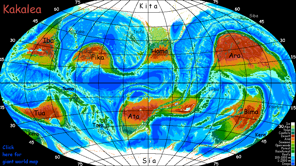
Kakalea:
EAST ATA
by Chris Wayan, 2012-2015
for the Atacamans, all twelve of you
Kakalea basics--map--geology--
creatures--
Building Kakalea
More worlds? Planetocopia!
Kakalea:
EAST ATA
by Chris Wayan, 2012-2015
for the Atacamans, all twelve of you
Kakalea basics--map--geology--
creatures--
Building Kakalea
More worlds? Planetocopia!
INTRODUCTION
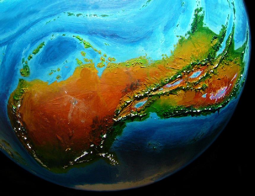
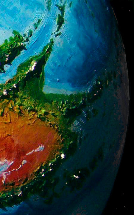
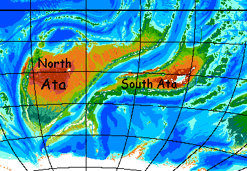
Ata is big. At 35 million square kilometers (14M sq mi), it's almost as big as our Asia. It's the biggest continent on Kakalea--probably. Kita-Homa, the north polar continent with a huge unfrozen lobe, may be as big as Ata--certainly it comes close--but it's hard to tell under all that ice.
Ata's two-lobed, East and West; because each is continental in scale I'll treat them separately here.
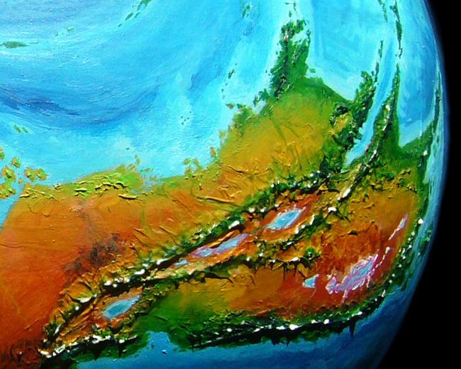
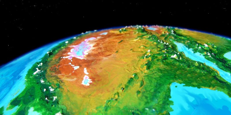
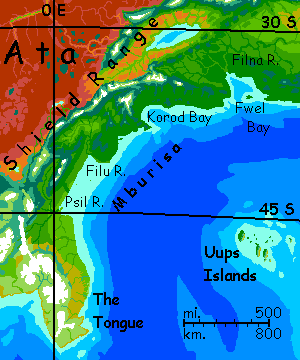
East Ata is mostly fertile, though it has one of the nastiest deserts in the world, a salt- and alkali-poisoned basin with bacteria-stained lakes below sea level. But the most prominent feature in the East is a huge rift zone that comes ashore much like our East African rift. And like it, the East Atan Rift raises wide highlands around it, breaking up what otherwise would be another dry Kakalean interior. So the proportion of nondesert is quite high for a Kakalean continent.
West Ata is bigger but less fertile overall; unusually for Kakalean continents, most of its biomass is in the temperate zone, some of it subpolar--quite Nordic. Almost an antipodean Europe! But the bulk of West Ata is desert. No surprise there; it's true of every large continent but Bima. But West Ata, if it were a separate continent, would be the driest of all.
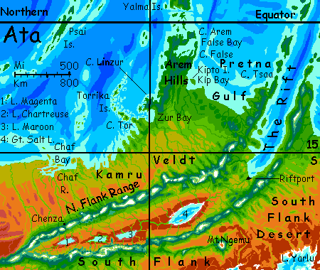
THE NORTH: A RIDE THROUGH THE RIFT
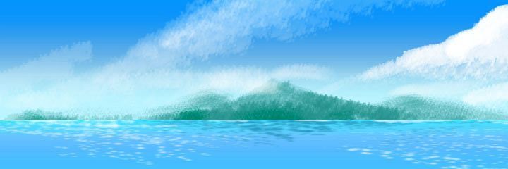
You start at the tip of Cape Tsaa, one of the flanking ranges of the rift zone; they march out to sea, creating twin peninsulas; Tsaa, the western one, is 500 km long (300 mi). Mountainous and green: just ten degrees from the equator. It's winter: cooler and sunnier in this monsoon zone. Offshore are the endless, verdant Artaho Islands; thousands of kilometers. But that's another tour! This is a coastal vessel just ten meters long. Still, this little catamaran is capable of 15 knots (25-30 kph) and can circumnavigate this continent in a few months.
You sail west along a low green coast. Note how small the rivermouths are: just 160-320 km inland (1-200 mi), the forest thins and breaks up. It's just a fringe. For 2000 km southwest runs Kamru Veldt, one of the world's largest, some 2M sq km (800,000 sq mi) of grassland. We'll eventually cross it so you get a ground-level look, but out at the dry west end, after you've acclimatized; and to get there we must round Cape Arem.
After three days' steady sail west, we reach green Kipto Island. It shelters Kip Bay; the end of the plains. Hills rise ahead; the shore turns abruptly north. For two days your ship reaches across shoreward winds, running north to the tip of Cape Arem. The inland hills are cloud-capped and the forest verdant; we're almost on the equator now.
At noon on the second day, your crew will try to fool you! The apparent tip of Cape Arem isn't; that's False Bay opening to the southwest, big enough to look like open sea; the arms of this bay wind 300 km inland, and you could waste days exploring its mangrove-like swampy forest shores. Head northwest another few hours. Those 'islands' aren't; that's the true Cape Arem. Almost on the equator now, though you haven't quite crossed the Line. If you did, following the Yalma Chain, you'd end up, weeks later, on the northern continent of Homa.
On day four you pass Cape Linzur and Rian Island, sheltering Zur Bay. Late that day, the coast curves toward the setting sun; you anchor for the night, as your captain won't risk running through the Torrikas in the dark.
The skies have been clearing ever since Cape Tsaa; dawn is clear, save a few cloud-towers over the hills of Cape Tor to the south. You climb the mast to see the long curve of hilly green islands peering over the horizon to the west and northwest out of sight.
Cape Tor is only 200 km long, but the Torrikas run north a good 750 km (450 mi)--small but pleasant wooded islands ringed in coral reefs. Hence the captain's reluctance to try Tor Passage last evening, straight into the setting sun's glare.
The strait's 25 km wide (15 mi) but most of it's a hull-ripper. The navigator unrolls a chart and studies it all through breakfast. Ears back, tail twitching uneasily, she climbs the mast herself, a rarity, and orders light sail--only a few knots--to thread the channel.
At last the corals open up to deep azure, and your ship puts on full sail again. South away! A long hilly coast sweeps by steadily. Dark groves of trees still, but the great forest's broken up; clearly drier country. Red and ochre crags loom on the heights.
Promontories and bays, for three days. Gradually the captain veers true west, further out; too many sea-stacks. The heads you round are grassy and stony, with trees only in clefts and along creekbeds now. Inland, golden hills and ridges. The dry season.
And getting drier. Three days west-southwest, then south into winding Chaf Bay. Red dust and dry grass onshore, rising to rocky hills. This is the narrowest point of Ata, the waist; by some reckonings you're not even in East Ata now.
In any case, it's time to disembark; your ship will head west along the dry of West Atan coast, then trade in the Sun Islands and green Liarote Archipelago. But those are other tours.
At Chaf Port, you sign up with a caravan heading up the Chaf River to the highlands of the Rift. Since I write these geographical outlines well before the biological or cultural layer, you don't yet know what sort of mount you'll be riding--how awkward to be riding a blur!--but whether it's squat and scaly, hairy and lanky, or beaked bipedal and feathered, it will spit. And reek. They always reek. One of the cosmological constants.
Caravan up the Chaf River! Little more than a creek, really, though a loud one--stony and swift, in a broad canyon--bluffs a mile off, on both sides, constrain the view. No meanders on the Chaf! This plain is subtly tilted; you're climbing steadily. Well under a degree, but relentless--it adds up, day after day. The steady tilt has helped such a modest stream to carve such a canyon.
A week in, you're nearly a kilometer up. On Earth that wouldn't matter, but on Kakalea it does, for Terran tourists: at sea level the air is half Earth's pressure, and the higher gravity makes that drop off faster as you climb, too; it's now like Earth at 5200 meters (17,000'). Now you see why I wanted you to acclimatize for weeks at sea level (equivalent to 4 km or 13,100') before risking a trek inland.
Even as it is, riding not hiking, you sleep badly, dreaming you're in orbit. Without a suit. And then as you try to breathe vacuum, you wake from your nightmare to find it's mostly true.
But you are adjusting. Blood reddening, heart enlarging.
You'll need to. For the caravan climbs on...
Away from the river, it's treeless. At evening camp, you climb the western bluff (huff, puff, no air in that stuff!) to see the plains. Nice sunsets, but dull land: just dry-grass plains to the horizons. Except ahead, now: that dark smudge to the south is a thin haze of feathery, drought-adapted trees. And over it, a gleam of white.
The next it's unmistakable; you're entering the highlands. Trees, hills, then snowcapped peaks ahead.
Not even the Mongolians loved their horses that much.
Details, details! Close your eyes and it sounds and smells like Samarkand. Haggling in a bazaar is another cosmological constant.
So is overpaying.
The local currency is a colorful spiral shell. There are many local "currencies"--shells, carved stones, small coins--but they're not quite Earth cash. Mere markers, memory aids for accounts kept orally or in ledgers. All these markers ride on a worldwide standard, their equivalent of gold: a pound of kushka nuts. These small subtropical nuts--tasting like a hybrid between sunflower seeds and peanuts, are high in protein, oil and B vitamins. A Kakalean staple.
But, and this is crucial, the oils that make them healthy make them spoilable. You can't hoard them more than a season or two. Circulation is constant and you plant or eat them as often as you trade them. Hoarding just won't work; building up capital for large projects requires amassing credibility and plausibility for your proposals, pledges of kushka-equivalents in materials or days of labor, more than actual capital in our sense. This shouldn't surprise; grain credits were common in medieval Europe until rulers outlawed them, imposing metal coinage as a monopoly, precisely because gold could be hoarded. We still face the problems of that legacy.
Kakaleans were, still are, herd creatures who live in a network of trust (and annoyance and skepticism and gossip); they're predisposed to cooperate on projects. Our lone-wolf capitalism would baffle them. Pretending each person works only for their own benefit? What a primitive superstition! Not just false; harmful. Fosters greed and deceit.
Kakaleans are happy to work for peanuts. And beautiful coral, and featherwork, and shells, and tickets to that interesting musical...
You may overpay in the bazaar, but the musical in the cafe that evening is worth every shell you toss in their basket. Quilts for sets, ecstatic praise-songs, flirtatious zebras dancing, that comical mixture of nerd and star that so many Kakaleans reveal onstage... and off.
Here's Suplica singing a praise-song for the Flank Range that gives these uplands life.
From here, most merchants and all the players (bands, dance troupes, theatres) will head northeast along the outer flank of the northern Rift Range, which is much greener (and more densely populated) than the inner flank along the rift itself; with twin mountain ranges blocking rain, the Rift is mostly high desert. Still, it's not that high; denser air than Chenza and its sister towns along the caravan route.
A tired, headachy few days follow as the caravan sells its goods in town and splits up; a much smaller group prepares for Chenza Pass. You're 1500 meters up now (5000'), with oxygen like Earth at about 5800 m (19,000'). But cheer up! It could be worse. As you'll soon see.
As you thread through Chenza Pass, at nearly 1900 m (6200')--it's all you can do to cling to the saddle, cheek to the mane or scales or feathers of your sturdy, blurry mount. But it isn't just your mount that's blurry now. Everything is. Oxygen equivalent at the pass: 6300 meters (20,700'). Above the summits of Denali and Kilimanjaro--the only comparable heights on Earth are Andean and Himalayan.
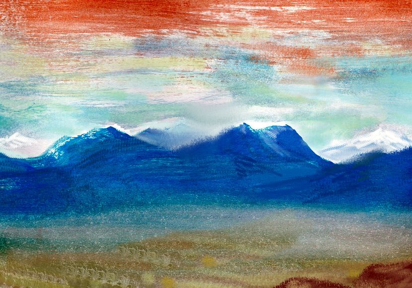
But then a surreal vista opens--a huge drop-off into a red bare valley. More great peaks on the horizon--the South Flank. Below, a swirl of... lake? But a virulent veined pink, scabbed with white near the shores.
Down switchbacks into the Rift. By nightfall, when the caravan sets up camp by a tiny creek, you're a mere 1200 meters up; your head is clear again. Air so dense it feels like breathing soup.
You weren't hallucinating the color of that lake. This isn't the one we collect salt from; it's alkaline and bitter and rather toxic from halobacteria. But oh, those psychedelic colors!
Birds adapted to tolerate the sting of those waters fish for bitter shrimp. Their tastebuds must be adapted too, you think, as you sip your coffee. Or dark chocolate. Or tea. Have I made the point yet? It's not genetic; just as you have, those birds have acquired an appreciation for certain bitter tonics. The trouble is, salt customers haven't. Salable salt tastes salty, no matter how salutatious a little bitter can be. Your caravan guides have three lakes to pass to earn their salary (and yes, "salary" did derive from "salt").
In this open country and mild temperatures--nights still brisk, spring days not that warm, but pleasanter than Chenza--the caravan makes excellent time. In just a week or two you leave Lake Magenta far behind, and pass Lake Chartreuse and Lake Maroon (I was tempted to make that one a lighter red and call it Lake Lake, but only pigment historians--all two of them--would get THAT pun).
Three days of steady descent. You can breathe! Not too far above sea level now. For a change, it's water not air you thirst for. True desert--low red hills. White teeth still float on the horizons, on both sides, but dim and far; a wide spot in the Rift. But their climatic effects are still all around you--blocking the rain.
Ahead lies... the Great Salt Lake! Not my fault; that's what they call it. And given that it's 500 km long and 160 wide (300 by 100 mi), it deserves the "Great" much better than that puddle in Utah.
A week skirting the salt flats on the shore, to the north end of the lake. Here the caravan loads up with salt slabs. These are cream to white, not psychedelic. Just plain salt.
The last leg of the caravan route is hard on your laden, blurry beast, but not too hard on you. A hot slow climb back to 600 m or so (2000'), then the track levels. You're leaving the internal drainage; from here on, streams run to the sea. And there are streams now--the mountains right and left have closed in some. Not all their creeks dry up before they reach you--not this early, anyway. Maybe not even in late summer--some of it's snowmelt. By the next day, the track runs along a modest winding river, shaded by the first woods you've seen in weeks. Just a strip... but a promise.
Follow that stream down for a week, into lower, hotter, but subtly greening country. Semiarid; brush, grass, even a few spindly trees stepping away from the river. The influence of Rift Sound ahead! There's a weak, fickle monsoon that sweeps up the sound in summer; this long slope gets thundershowers at least.
The last couple of days, you can see blue and silver ahead to the northeast--the head of the Sound. Brush thickens, trees spread.
Farms, tilled fields. Music-inns. A harbor swarming with catamarans--Riftport!
You get a berth on a coaster heading up the Sound, and a week later (1400 km, 800 mi) you're off the tip of Cape Tsaa, where we began. Though I think we'll head east next! And this time, stay on the damn boat.
THE GREEN EAST
You're on the deck of a floating theater--a common sort of boat on Kakalea, where most life (and paying audiences) are coastal. Only the most desperate or adventurous troupes tour on land. So your vessel, the Bethura, is crewed by actors, dancers and singers. Not a bad way to travel, if a slow one.
You sail northeast from Riftport along the east flank of the Rift--the Telne Peninsula. Each creekmouth, a small town. Fertile country, warm and mostly wooded. But though the Bethura halts nightly, and sometimes holds over for a second show, you can't explore far inland. Not that the locals wouldn't welcome you, if only to get a good look at a funny-looking alien; but the air's too thin for you inland. The land rises dramatically out of the Gulf; most of this thousand-kilometer cape is a long cool highland 1500-2500 meters up (5-8000'). Oxygen levels are like Earth at 5800-7000 m (19-23,000'). Not that it's a snowy waste as Earth is at this altitude: Kakalea's a little oxygen-poor so the total air pressure is merely Tibetan, and richer in CO2--plus, we're near the equator. These are just cool, pleasant Ethiopian highlands--to the natives. True, they're punctuated by volcanoes rising another 1-2 km--notably Mt Kubrebe, a hundred-km wall of fused, ice-mantled cindercones. A Kakalean Ruwenzori!
But all that's a distant vista--white teeth peeking though clouds, no realer than the Bethura's theatrical backdrops. You're still finding sea-level air thin; you tire easily and sleep poorly. It's one reason I booked you an easy sea-journey at first.
After a week, you reach the tip of Cape Telne. This is the jumping-off point for the long island chains of the Artaho Sea--big enough to merit their own page. 200 km north is Furuna, the nearest and largest, bigger than Java. Many boats travel north up one half of the archipelago and back along the other; it's neatly split in two by the Rift that created it. Earth's equivalent structures are mostly underwater--Saint Helenas and Azores are rare--but such twin mid-ocean chains are common here, for the seas are shallow enough for the heights flanking every spreading zone to break the surface.
But the Bethura rounds the Cape and heads south along the east shore of Telne. Plays in towns under tropical shade... but less so as the days pass. The foot of the cape is still mostly wooded but the trees are sparser and wizened; winters here in the Tilim Bight are warm but dry, like Northern Australia's.
Five days and the coast abruptly turns east. Inland, to the south? Olive-green plains, then low cliffs broken into scabby hills on the horizon. You could explore up those canyons--flooded in the summer monsoons, but passable now. But I wouldn't. This green settled country ends just 2-300 km inland; the hills drop to a desert plain 1000 km across. My Australian analogy wasn't casual.
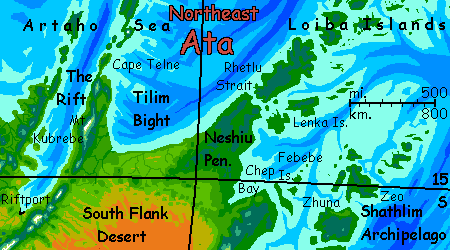
East along this monsoon-wood shore a day, then northeast, as you sail out of the Bight... and (almost) back into the rainy zone. The trees grow denser, taller, greener; the dust settles. Inland, dark-forested, cloud-snagging hills 1-2 km high--lower than the Telne Highlands, but even larger in area. By now you're breathing easy at sea level and could trek inland, but Cape Neshiu is a broad wedge; even though the Bethura's course is lazy, stopping at every fishing port, you can't cut her off; you'd take weeks to cross and she'd be long gone down the east coast. This is true for the locals too; inland transport is slow. It's another reason the coasts dominate--it's not just the rains! Kakalea, with thin air and rather high gravity, doesn't make flight easy. Until railroads are built, the sea is the fastest highway.
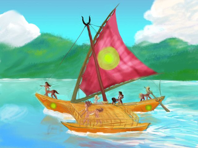
Nor is it that slow; Kakaleans build catamarans. I called the Bethura a slow vessel, but that's because she's a floating theater doing a mere 12 knots in a good wind, not the 15-16 of a fast trading vessel ("only" 20 kph, instead of 25-30!) It adds up, and it adds up all round the clock. Kakalean cats sail at night, even in coastal waters, unless it's truly a Dark and Stormy Night. Kakaleans, like most land animals here, have good night vision (how could they not? Their ancestral Eve is big-eyed Barbie! Clearly a nocturnal creature) and Kakalea's a big world with three moons and a faint ring; night skies are consistently brighter. So in an 18-hour day, the Bethura easily does over 350 km (220 mi). 6-10 times the pace of a caravan! No wonder trade here favors sail.
My sketch isn't terribly accurate--she's too stubby, with heavy masts and too-small sail. I omitted some ropes I didn't understand, and a removable shelter on the deck because it hid too much else. But the basics are right. Asymmetrical hulls, one big one small; lateen sail, wishbone boom, less rigging than on a European oceanic vessel from the Age of Sail.
A week east, a passage opens suddenly through the hills: Rhetlu Strait. Beyond, the Loiba Archipelago leads over 2500 km (1500 mi) northeast all the way to Ara. This island complex is nearly Indonesian in scale: one of the largest rainforests on Kakalea. Rising from a shallow sea, it might have been a continent-sized landbridge, an Amazonia, if its platform were just a few hundred meters higher.
Oh well... but maybe that Kakalean refrain I indulge in so often isn't appropriate here. Could Loiba be better off as an archipelago? Consider Indonesia versus the Congo--where would you rather live? This reef-dotted sea is not only fertile in its own right, it speeds communication and sustains a higher population than a single great forest would. Eco-axiom #37: interfaces beat lumps.
But Loiba's next year's theater season! This year, the Bethura's committed to touring East Ata. So are you. So into the Strait! Southeast for two days, slow and wary--coral reefs here, too. And the strait's south end is island-choked--the southernmost of the Loibas. The Bethura wastes fully a week looping around these islands, the Lenkas. Villages and towns, many on stilts. No more dry season! Here it rains year-round, though typhoons hit only in summer.
You start to realize why the Bethura detoured to play this circuit as you watch the supplies and tradables--cunning crafts, jewelry, musical instruments--pile up (well, get wrapped carefully and stowed in the lesser hull).
These islanders aren't just richer than the mainlanders (disdainfully referred to here as "the Bighters")--islanders are more sophisticated; the troupe can stage more ambitious work. We're right on a trade route and the Lenkans resupply cargo ships sailing between four continents. In contrast, the Bight, just by being a bight, discourages all but local traffic. Ships headed from Homa or north Ata to southern Loiba or Ara or Bima all cut across, skipping those towns. As one Lenkan drinking song puts it (in salty dialect hard to translate, but I'll try):
|
Guts o' continents' flinty ways
Nohow soothe yer raw abrades: Refugee,Alway broader be a border, Sence all frogress breeds in worter: Refugee, |
|
South along Chep Bay, a miniature echo of the Tilim Bight. But much greener; rains blow in from the east year-round, as on the Lenkas. That'll be true all along this east coast. So Cheppians, while less sophisticated, are comfortably well-off, and grateful for a little entertainment. Comedy and romance, though, not the new Ethical Quandaries the Bethura risked up north.
Well, they risk one piece with some subtlety: here's a scene from Mirrormate, or, Drowning in a Pool of Light...

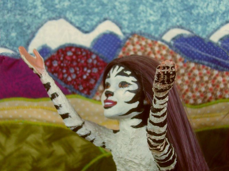
To Terran eyes it plays much like the Greek myth of Narcissus: Proni, the beautiful ingenue with the cloud-leopard coat, risks being pulled into complacency, self-reflection and even vanity by the steady attention her beauty draws--the social mirror of too many friends, too many lovers. But it's no simple morality play against vanity; Proni also gains from the feedback, and does acquire, among the sweet-talkers, real friends whose attention she, being rather shy, might not have snared without that striking pelt. In the Reef Aria she sings

|
How do I thread through
Razored reefs of praise To find the true Coral passage to Real love? But also blue Depth beyond this maze. O I'm in a daze... |
|
Lotora, her caustic Plain Sidekick is played here by quite a graceful actress with raccoon-coloration giving her violet eyes a masked or sunken look--is it natural and typecast, or carefully made-up for this show? You never know with Kakaleans. She's obviously in love with Proni--obvious to all but Proni, that is. Lotora's still two long acts away from winning her with truth, seeing no hope yet, when she sings, in her big aria, that Proni's better off "than an ugly girl like me," with no lovers, less sexual experience, little attention, no feedback--a mirror shortage. Mirrors can be as deadly as storms--but slow drought, though less dramatic, can stunt life too.
So it's not a... primitive show. But, please note, carefully universal--romantic comedy intelligible even to a Terran with quite different biology! Calculated to challenge no Cheppian social norms. Theater people learn from experience that geography creates gradients of cultural sophistication as recognizable (once you learn to read what's mirrored) as rainfall.
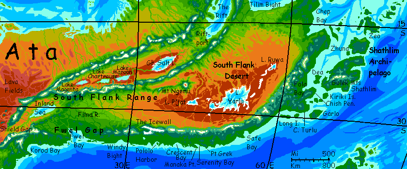
THE SOUTH FLANK DESERT
The hills at the head of Chep Bay are low enough for you to pass without anoxia--the easiest inland passage for Terran tourists. So let's take a hypothetical detour. No, don't take the trek in reality--stick to the Good Ship Bethura, it's far pleasanter, believe me. You can't even find a caravan to take you. No caravans. Why trade inland? No reason to, and excellent reason not to. Sand- and dust-storms aren't rare; and the dust is salty and alkaline, a lung irritant.
Why? This desert, the South Flank, has huge salt lakes--the world's largest. Shallow Lake Yarlu varies year to year-occasionally swelling to 100,000 sq km (40,000 sq mi, bigger than Lake Superior or Victoria) or as small as 15,000 sq km (6000 sq mi, more like Lake Chad or the Great Salt Lake in a wet year.)
Satellite lakes to the east and west never get larger than Chad or Australia's Lake Eyre, and sometimes dry up almost entirely. An uncertain country.
Well, the flies are certain.
The coastal peoples tell stories--half myth, half gross-out joke--about a God of Flies living in Lake Yarlu, indeed creating the lake out of the collective worship of its billions of followers. It may have a little basis in fact; the fly population, always bad, swells in wet years. Here's a scene from a Bethura production--I'm not going inland to one of the raspy, comic tribal plays on the same subject. More authentic but... too many bugs.
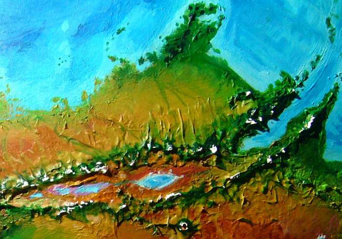
North of Lake P'jat, at the west end of this miserable sump, a Kilimanjaro rises from the baking plain. Well, not quite: no higher than Mt Ararat, 4800 m (15,800'). But even at this low latitude, that's high enough to be permanently icecapped; the summit's air is thinner than Everest's and nearly as cold. But unlike Kilimanjaro or Ararat, the summitzone is neither a wide plateau nor a sharp single cone; it's a ring. Mt Ngemu has a caldera 48 km wide (30 mi), the largest on this continent. A huge cliffwalled crater, its floor desert dotted with cones--volcanic little afterthoughts. A hot salt lake at the low point--unsafe to explore, as it burps carbon dioxide every generation or so, enough to stifle all animal life around it for a mile.
The outer slopes, though, have stony alpine meadows, snowfed, and a broader ring of sparse forest, and an even broader ring of warm but not scorching grove-and-meadow country, dry-Mediterranean in character and, compared to what's all round it, quite habitable. The villages of Ngemu mostly don't need to irrigate with snowmelt; rains and occasional snows are adequate and the volcanic soil is rich. Isolation is the only drawback to this rather pleasant ring-oasis.
All around? Oh, a few million square km of desert. Because Kakalea really needed one, right?
Oh, well.
A refrain that's becoming routine as I write these tours. So many might-have-beens!
So stick to the Bethura, and skip the detour.
Middle Cape... smaller than the others. But with an island chain at the tip, the Febebes, that the Bethura insists on visiting. You can't figure why; Febebe's lush, its people are well-off, but not as sophisticated as the Lenkans.
But then, for the first time, the Bethura heads straight out to sea. You may have mistaken this light catamaran with its dancers and players for a casual, coastal yacht, not a real ship and deepwater sailors. Wrong! Indigo water--deep channels, as much as a mile--that's deep on Kakalea, near-shore or not. The extent of the seas can fool you into forgetting how shallow they are.
Two days out of sight of land, due east. Why?
The rugged answer heaves over the horizon on the third dawn, black against the rising sun: the Shathlim Archipelago. Accept the detour; no way will Bethura Troupe skip this lucrative a circuit. And this isn't a few days like the Lenkas; Shathlim is as big as Japan, and all of it fertile, if rugged. Towns still cling to the coast; dense forests inland.
Days looping round Zeo, big as Belgium.
A full week around Zhuna, bigger yet.
Over two weeks round the big island, Shathlim proper, from Eastport along the south shore and up to Westport (it should be named Northwestport). Westport's particularly scenic; pseudomango groves under snowy Mt Rak, the westernmost of the Golek Mts, some 4 km high. Or maybe you're just seeing it in a kindly light because the troupe's ready to get back on track. You've gone four-fifths of the way round the Big Island and played all the major towns.
Back to the mainland at LAST...
Not that it's hard or far. You've been creeping back toward Ata all the way along the chain. Land's never out of sight now. The low, broad garden isle of Dea, then the dark green cone of Cape Chish, sheltering Fola Bay.
In Port Fola, you spot snowy peaks inland. Back to the Kakalean norm: a green strip, but the coast range cuts off rain on the far side. That's the Yarlu Basin I mentioned earlier, that dreary salt- and alkali-poisoned desert plain bigger than Western Australia.
Oh, well. Now where have we heard that song before?
Round Cape Chish, then threading a slow (but lucrative) course through the Kiriki Islands and round Cape Turlu to...
THE SOUTH COAST
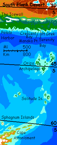
A green coast, though the strip is not wide; beyond the coastal range, South Flank Desert. We're further from the equator here, and the mountains are closer to the sea. Icy volcanoes above dark forested highlands wall in the horizon. Long Island, Safe Bay, and Point Grek. This last is the jumping-off point for the monthly ferry out to the lonely Oriza Archipelago 1000 km to the south. You'd have to charter someone to take you further, to the recently settled Solitudes 800 km beyond. And the mossy, treeless Sphagnum Isles 1000 km south of that, off antarctic Sia's shore. Brr. Definitely another tour.
The good ship Bethura creeps on, its crew playing every harbor--comedies, mostly. Serenity Bay, Manaka Point, Crescent Bay, Pololo Harbor under the Icewall--the crest of the Southern Range, an icefield capping a ridge 400 km long (250 mi) and never dropping below 4 km high (13,000').
This narrow strip is temperate--meaning Kakaleans find the winters harsh. You probably won't. Just cold rains on the coast most years, but snow in the hills. And hail is common and snow occasional even at sea level in bad years. We're only 35-40° south, but Sia, the Antarctic continent, lurks offshore.
A long reach west to Fwel Bay. The coastal mountains dwindle as if building the Icewall just exhausted the Kobolds. Or I guess I could translate it Tectonic Gremlins. Kakaleans all believe in these spiteful little (furry, centaurian) mining gnomes who build the mountains blocking rain over most of their world. Note how the gremlins' wickedly misplaced mountain-spines are echoed in their own design: a misplaced upper torso implying a bad spinal shape like an inverted T, just guaranteeing Annoying Backache in later life: punishment for their rain-theft.
People of whatever shape tend to personalize natural forces, especially when they gang up on you. And Kakalea does have the rotten luck its Greek name implies. Kakalean resentment is just misplaced: tectonic gnomes are not to blame. It was an Act of Plod, the Uninspired Designer. Better known as me.
And yet... Kakaleas happen without Jealous Plods to curse them... if you roll the dice long enough. Deep time means perfectly good worlds spend tens of millions of years in ecological eclipse now and then, and not just from catastrophes like impacts or solar fluctuations--remember Snowball Earth! Life did that to itself, sucking up all the CO2 and nearly sterilizing the planet. Climate-wrecking isn't a theory. It's been done, and on a far bigger scale than humans have managed.
Really, Kakalea's lucky; it's just having a nap. Eventually, continental drift will pull land away from the poles, so sea levels rise and deserts become fertile archipelagoes. Other deserts will slip into the tropics or the temperate zones. Others--Ata is a prime candidate--will split, and slabs of desert become coasts, and green. Other plate boundaries will slow, and mountains erode, letting rain inland...
But here and now we can offer a foretaste of those blessed days to come when Almighty Plod relents: Fwel Gap. Here the Tectonic Gnomes slip; Plod nods. For over 500 km, the coastal ranges fail! Storms roll inland here from Fwel Bay across the plains. Green woods, then groves and meadows, then open but fertile prairies... all the way to the South Flank Range. No desert! The Gap is the only place outside the tropics where life runs from sea to Rift. A wide fertile coastal plain? Positively European--or American. Makes one wonder if those continents' prosperities aren't technological or political but geographic. Nah, I'm sure it's the inhabitants' sterling virtues alone...
If you did ride inland on a caravan up the Filna River, you'd wind northeast along that Senegalese riverine oasis ("all set about with fever trees"--just don't pester the hexacrocs with your Insatiable Curiostity) through savanna plains for some 2000 km before the tributaries grow seasonal and then dry washes while the grass thins into red dust. Beyond are only the alkali flats around Lake P'jat in the South Flank Desert.
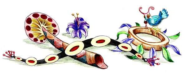
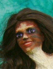
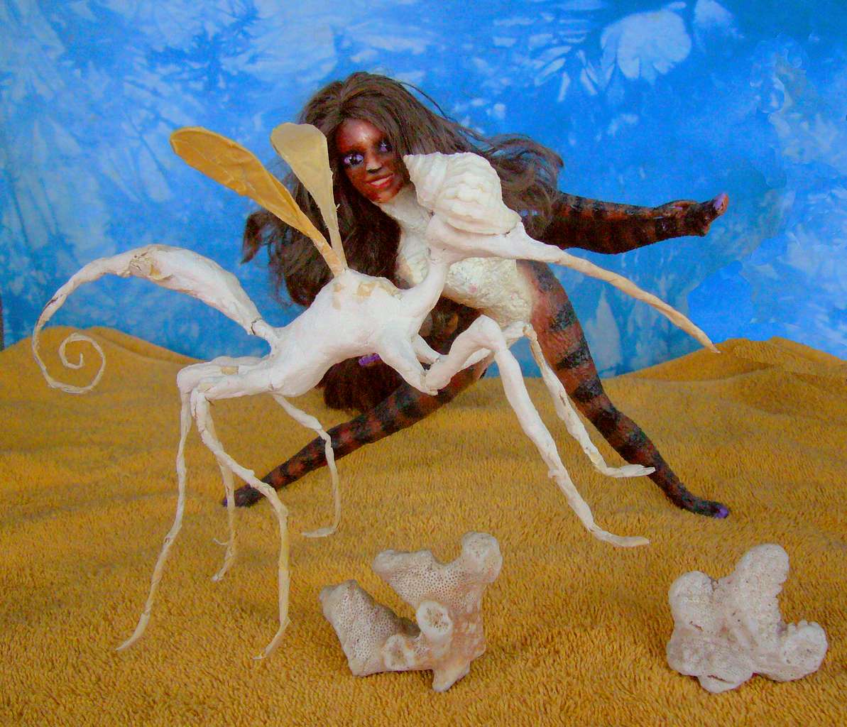
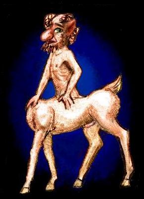
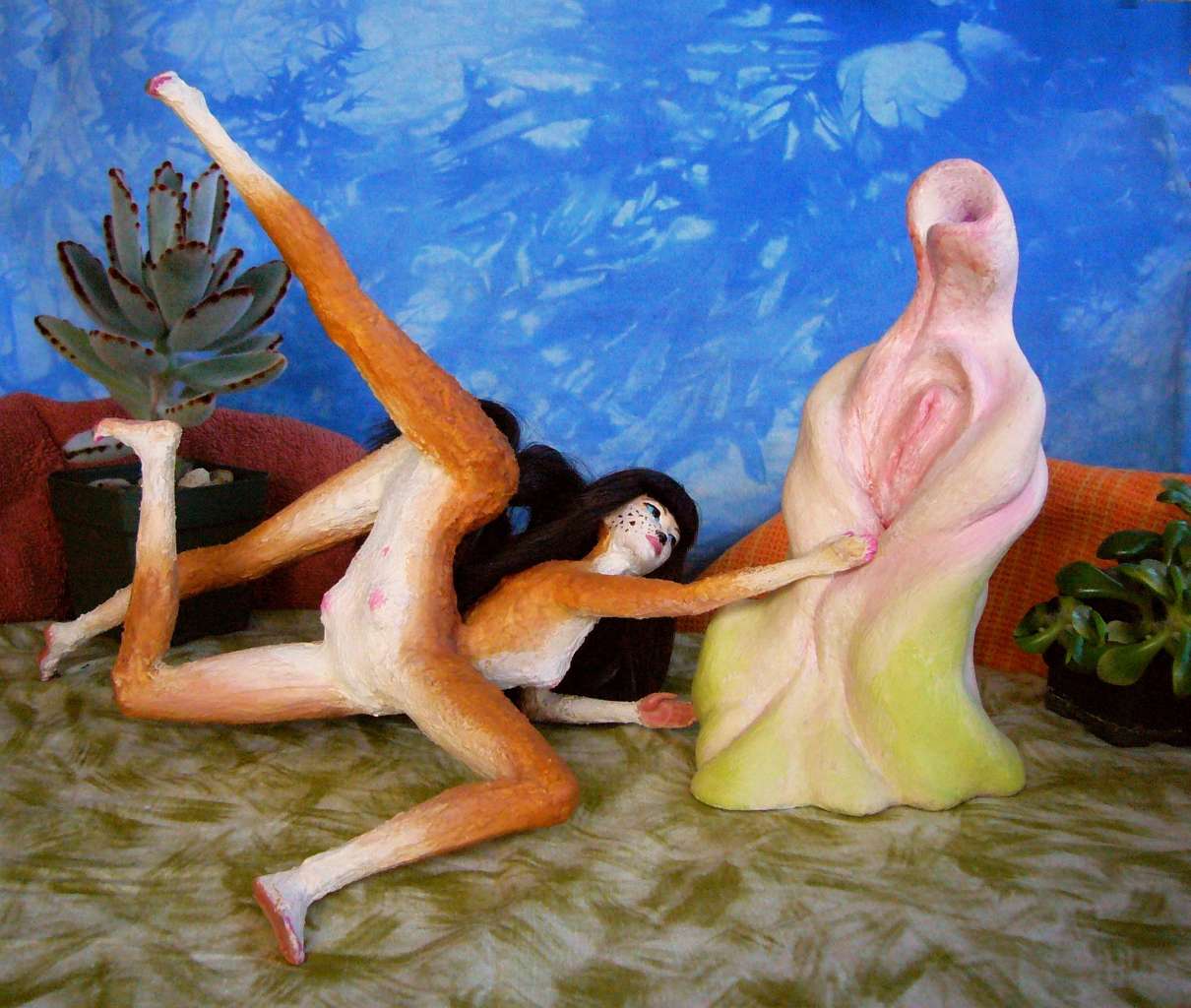
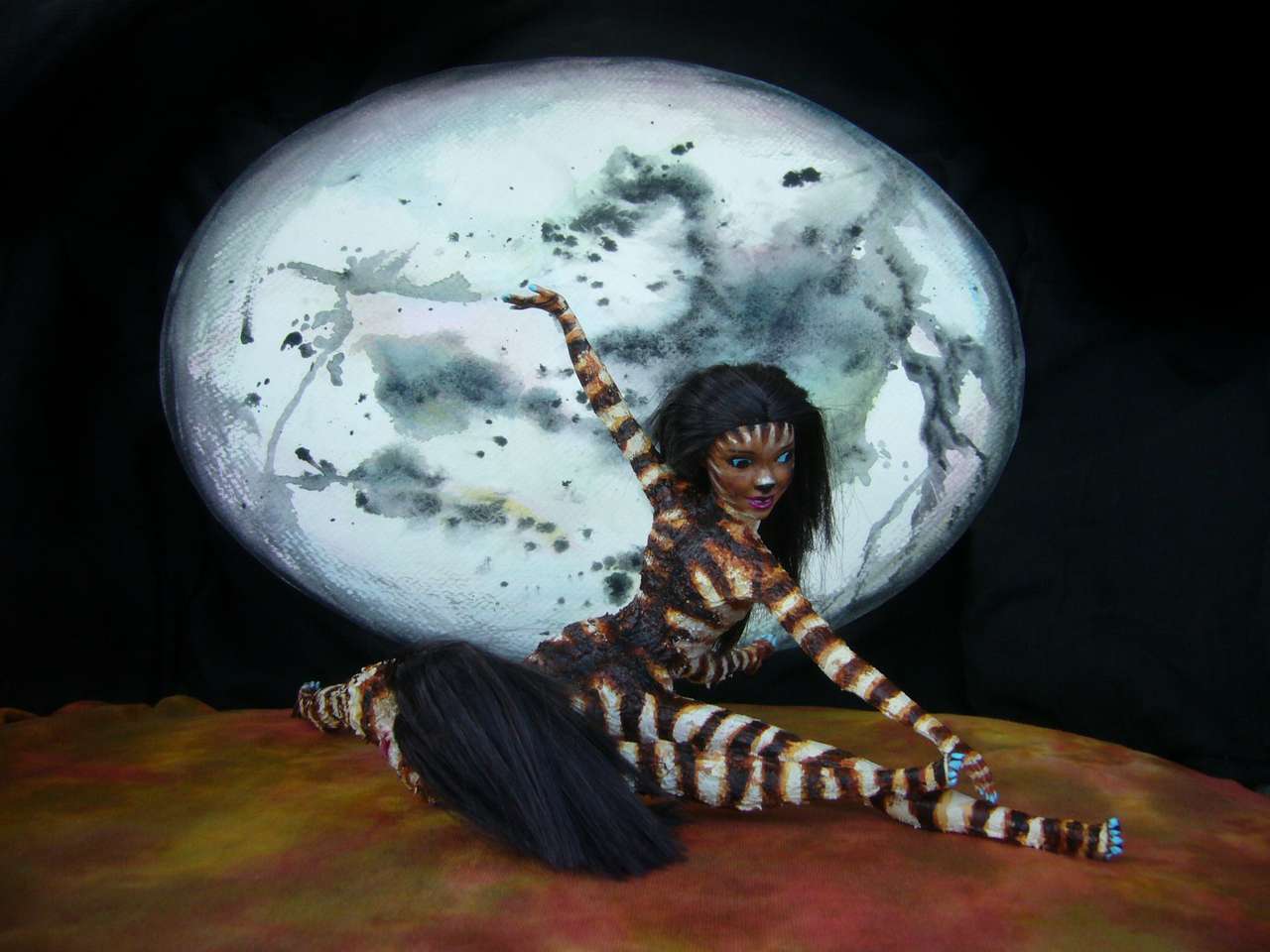
Well, you'd find one thing: the Filna Relic. Pilgrims actually do make this journey to touch this mysterious figure rising from the northern savanna, near the foothills of the South Flank Range. It's clearly some sort of personification of sex or love or fertility. But its culture is long gone--there's just this one statue. What you see below is a reproduction, of course, the stage-set for a romantic tragicomedy staged in Port Filna, but it's from field sketches--the artist actually visited the site. The gold standard on this cameraless world.
If you veered off the Filna Strip and rode due north, right over the South Flank Range (hazardous, but just possible; your blood's up to the job by now, as long as you ride, not trek) you'd find yourself in a familiar stretch of the Great Rift: Lake Magenta and the switchbacks up to Chenza Pass! Full circle from our northern tour.
But instead, I want you to sign on with that caravan heading northwest from Fwel Bay. Two weeks of green plains and farm villages, then low hills--even a Terran fresh off the boat could survive the crossing, and the New Acclimatized You doesn't even get short of breath--then semiarid slopes down to the Inland Sea.
This brackish lake is larger than our Aral Sea (oops, that's a dwindling benchmark, isn't it? And the Inland Sea is relatively stable. Rains here vary year to year, but they don't fail. Larger than Lake Victoria, is that better?) The Inland Sea's shore is 100 meters below sea level--the other sea level--but it's no Lake Yarlu or Great Salt Lake. Full of life! Its shores, unlike the desert lakes to the northwest, are tree-dotted savanna, not desert. Fwel Gap can be felt even here.
West of the Inland Sea, the Rift narrows gradually to Shield Gap, where your caravan will pass on into West Ata. Here the South and North Flank Ranges fuse into a single wall, the Shield Range, curving south to become a coastal wall blocking the cold desiccating winds off Sia, the polar icecap.
Too bad they also block all rain; these western plains and canyons are one of the driest corners of a dry world.
West of Fwel Bay, the coast turns south, and colder. A line of snowy sawtooth peaks on the horizon, but even down here on the coast you see blizzards most winters. This cool, isolated but still-fertile coast is called Mburisa. Busy little ports at each rivermouth, exporting lumber. And, most of the year, importing fruits and vegs. Spring comes late here--summer gets hot and muggy, but the growing season's short.
The wooded hills turn golden then red early in fall, then drop their leaves, unlike most of Kakalea's forests. No surprise why. Leaves staying on trees get trashed in blizzards. Bad climate creates color...
Just as on Earth, this autumn display's seen as mysterious, magical and a little spooky. Mburisans lack a close equivalent of our Día de lost Muertos or Halloween, but everyone does celebrate the Harvest Moon. A little anxiously. As dark closes in...
Mburisa's narrow--just 240-400 km (150-250 mi). The back side of the Shield Range drops to desert--a maze of black barren lava fields and alkali sinks. Summer temperatures can match Death Valley. The few people here live in old lava tubes and farm small gardens along the rare creeks. Spartan.
What you see is all you get! We're back to the Kakalean norm.
Oh, well.
Will Mburisa, the Shields, the South and East Coasts eventually splinter off from Ata, forming a new continent, South Ata? I think it's likely. Humans generally find divorce painful, but continental breakups are an unmixed good. Certainly for Ata, oversize as it is, it's a healthy move. Once the strait dividing the twin Atas starts to gape wide, the south coast of North Ata--today the western desert--may be opener to storm tracks roaring up that sea-level corridor. One of Kakalea's worst deserts may green at last.
But not tomorrow. Check back in thirty million years.
Besides, West Ata's another tour.
LISTS AND LINKS: More worlds? Planetocopia! - dreams of other worlds - ecology - climate change - evolution - natural disasters - terraforming - sculptures and 3D art -
World Dream Bank homepage - Art gallery - New stuff - Introductory sampler, best dreams, best art - On dreamwork - Books
Indexes: Subject - Author - Date - Names - Places - Art media/styles
Titles: A - B - C - D - E - F - G - H - IJ - KL - M - NO - PQ - R - Sa-Sk - Sl-Sz - T - UV - WXYZ
Email: wdreamb@yahoo.com - Catalog of art, books, CDs - Behind the Curtain: FAQs, bio, site map - Kindred sites