
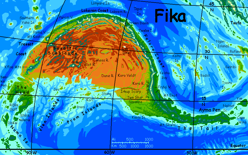
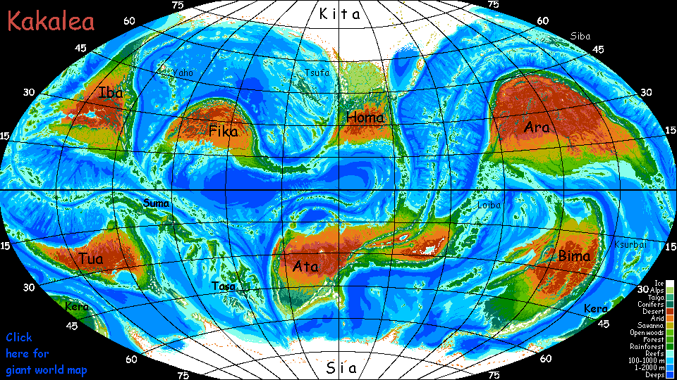
Kakalea:
FIKA
by Chris Wayan, 2012-2019
Kakalea basics--map--geology--
creatures--
Building Kakalea
More worlds? Planetocopia!
Kakalea:
FIKA
by Chris Wayan, 2012-2019
Kakalea basics--map--geology--
creatures--
Building Kakalea
More worlds? Planetocopia!
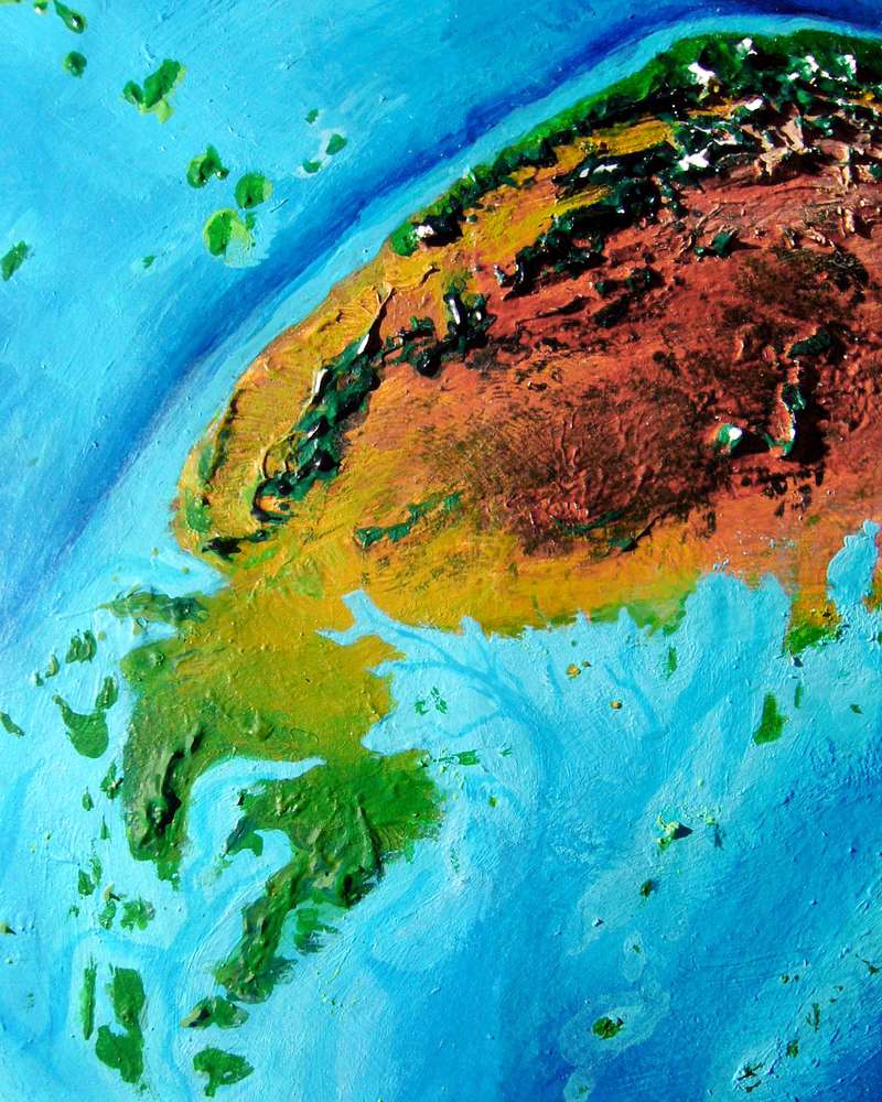
Just looking as Fika gives me déja vu. The huge continent of Ara looks like an obese manatee, and Fika looks like Ara's baby (well, a baby with insect mandibles). Similar shapes, orientation, latitudes and geological structures--except Fika's only one-third as big! Slightly smaller than South America, about 16 million km2 (6.4M sq mi).
There are differences:
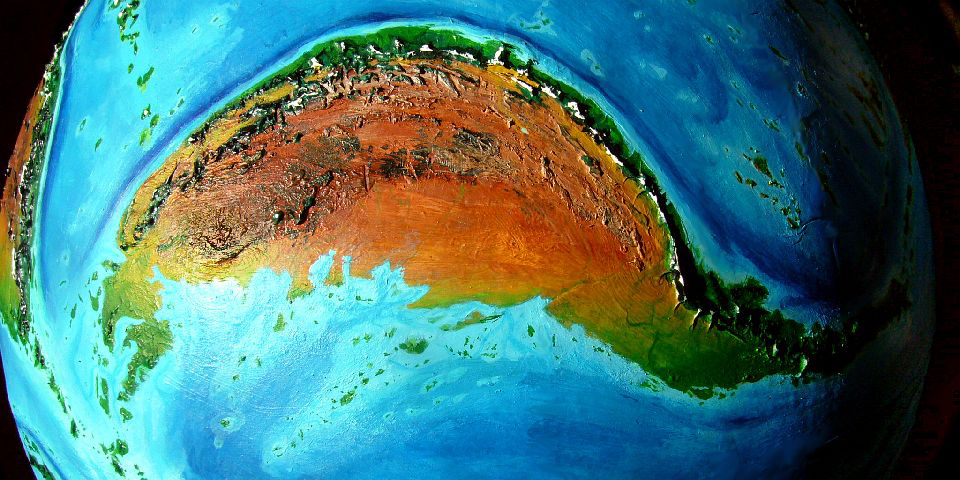
The Tail (the local name translates that way; Kakaleans are great sailors and cartographers; and on maps it does look like one) is the eastern third or so of Fika. It's some 5500 km (3300 mi) long. Biologically, the Tail wags the dog: under 30% of Fika's area, but over half its biomass! Mexico and Central America are similar in size, shape and climate, but are just a sixth or less of North America's area. Even so, note how Central American civilizations long dominated North America. So I anticipate the same on Fika--only more so.
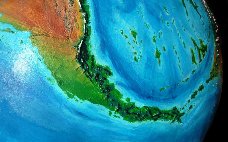
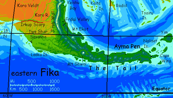
The Tail is green, green, green--from the temperate Felore Coast, through the subtropical Frdai Valley nestled between the Ekut volcanic chain and J'reb Wall, a massive alpine ridge over 1000 km long (625 mi), and down to the long jungly Ayma Peninsula, under the nappy green cindercones of the Yao Mai Range, verdant to their summits.
Here, and in the dense forests of the Frdai Valley plain, rivers are the only roads... but since streams are everywhere, that's no problem. Practically everyone lives on or near the coast, too, but since everywhere in the Tail is near the coast, that's no problem either.
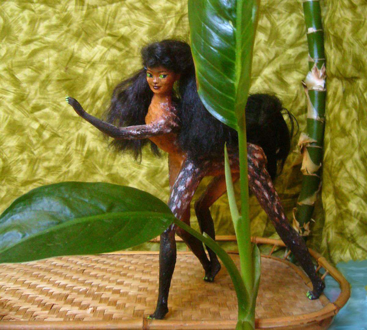
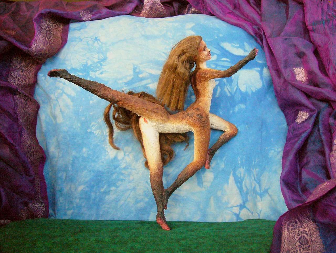
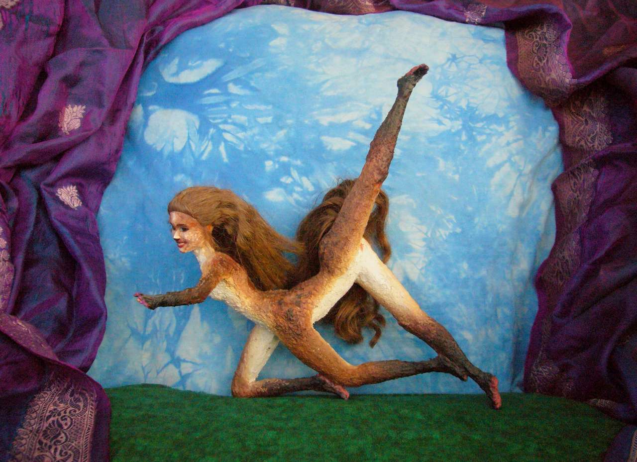
The scene below isn't on-the-spot, of course, but a performance by the well-known circumnavigist Frizia, dancing her sense of this steamy region.
Kakaleans see nothing odd about traveling song-and-dance shows about geography, of course. Kakaleans turn everything into musicals.
In the eastern Tail, both north AND south shores have a strong monsoon climate--mild sunny winters with occasional rains and muggy, torrential summers. We're only ten degrees from the equator in places. It's the second largest equatorial land on Kakalea--only the mini-continent of Suma is bigger.
The continent tapers so gradually it's hard to say where the Outback ends and the Tail begins, geographically--but ecologically the border is the Irkup Scarp, a line of 300-meter cliffs some 800 km long (1000' high, 500 mi). The Scarp rises on the south bank of the Koro River, which it likely created, roughly on the 18th parallel.
Here's Lina, a native to this savanna zone. But not to the Twe Shar--she comes from the far end of the continent, four thousand kilometers to the west. She walked here--for curiosity and fun. And Lina's not unusual; Kakaleans are great wanderers, and run for pleasure.

The coastal plains west of Koro Veldt are nearly as dry as the Veldt itself, though you might expect the sea to have a moderating influence. This coast is so arid partly due to latitude and rainshadowing--most of the year, winds blow south from the dry side of the J'reb Range, and the mountains have wrung all the rain from them--and it's partly due to proximity effects--winds from the west or northwest, off the great desert, are truly hot and dry; the lava fields in the west hold the planetary record, 60�C (140�F). The summer monsoon, short and savage, is all that keeps the scrub here alive. Drought, flood, drought again!
Perhaps you begin to see why the Kakaleans have evolved to be great wanderers. They had to be.
The Felore, Lokeran and Tressat Coasts are really one long, curved strip divided more by climate and culture than geography. The strip varies in width from 100-500 km, but is fully 7000 km long (60-300 mi wide, 4500 mi long). Think of it as a bent Chile. The strip always fronts the sea, and at its back are snowy mountains, usually not a single wall but broken, discrete ranges, rising 3100-4400 m (10,200-14,500'). Storms do slip in through the gaps; the back sides are drier, but often savanna not desert. The second range takes care of that, though. Or the third.
But these savanna basins add up--they double or triple the width of the living lands.
We'll sail west around this great arc--or rather, continue from the Frrdai country at the root of the Tail. First up: Felore.
Felore is a subtropical widening of the tropical Tail. Still quite hot and often muggy--the winds are off the sea and bring rain or damp heat all summer--when they're not bringing typhoons. But winters are lovely--still occasional rain, just enough to wash off and keep things verdant. Cities full of flowers.
Eventually I'll have a whole journey along this coast from...
Port Keishu at the north end of J'reb Wall, a rivermouth town on the best natural harbor in the region; sadly that's not saying much. Cut off from inland drainage by the Wall, the Keishu River is small, and Keishu Bay's widemouthed and vulnerable to storms from the northeast; they're common. So instead of a great trade-city bustling year-round at the delta, the bay has a string of modest towns all along its shores; only local shipping in summer, between storms. The boom's in winter--sunny, warm but not hot, and... safe.
We sail about 1900 km (1200 mi) northwest, past small ports--all the safe harbors are even smaller than Keishu, limiting the size of cities here--to...
Twebe Island and the great sheltered harbor of Port Tweh. The biggest city on the continent? Certainly one of--and the liveliest.
Ah, those wild and crazy shows they put on in Port Tweh...

| ||
|

|
|
| Sidera of Keishu dances In the Cave of Purple Folds, or, You'll Be Sari as performed in Port Tweh, Felore, Fika | ||
But other than its excellent harbor and its exports of purple dye, Port Tweh is a mystery--now. No doubt it will resolve over time.
Well, we know it's a double town--nearly all cargo unloads on the mainland shore, for easy transport inland. The rowdy side of town! The Twebe shore a mile across the strait is quiet, wealthy and residential--Marin not Oakland, Staten Island not Jersey. Even the dockside district is perfectly safe to explore, though; rowdy, for Kakaleans, means dance, drink, sex, song, but little fighting or theft; booze just can't bring out their latent hunting/predation instincts since they lack them--at least compared to humans. Those alleys are dark, but there's a cutthroat shortage.
Lokeran is the north coast. While the boundary is gradual, the climate's very different--warm summers, but gray rainy winters--even snow on the coast occasionally (and blanketing the mountains annually and reliably).

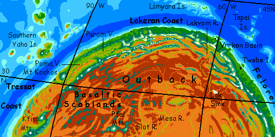
Three of these great valleys are especially notable (and visible from space: the three largest gold strips): to the east, Vrrken Basin along with parts of semiarid Lakvon Plain inland. To the west, along the Tressat Coast, the valleys of Parom and (larger, drier) Poma, each as large and fertile as the Sacramento or San Joaquin Valleys of California, or Lebanon plus the fertile parts of Syria; and like them, ideal places for irrigated agriculture. Surpluses here won't spoil as quickly in the dry air; an advantage over the rainy north and east coasts.
These three valleys may thus become cultural nodes even before the coastal strips, though I'd expect that once world shipping and trade burgeons, Port Kosh at the mouth of the Poma River in Tressat to the west will be a great cosmopolitan city culturally overshadowing the river-granaries of inland Lokeran. A kid that outshines mom.
Geography is destiny! Poor Vrrken and Lakvon, equally large and fertile, have coastal ranges a little higher; the Lakvon River flows south instead, into the desert, ending in dust, salt and flies in Lak Sink, not in a second delta and great city to rival Kosh. The Felore Coast will instead have a string of lesser ports; its people will look to the sea, not inland to Vrrken.
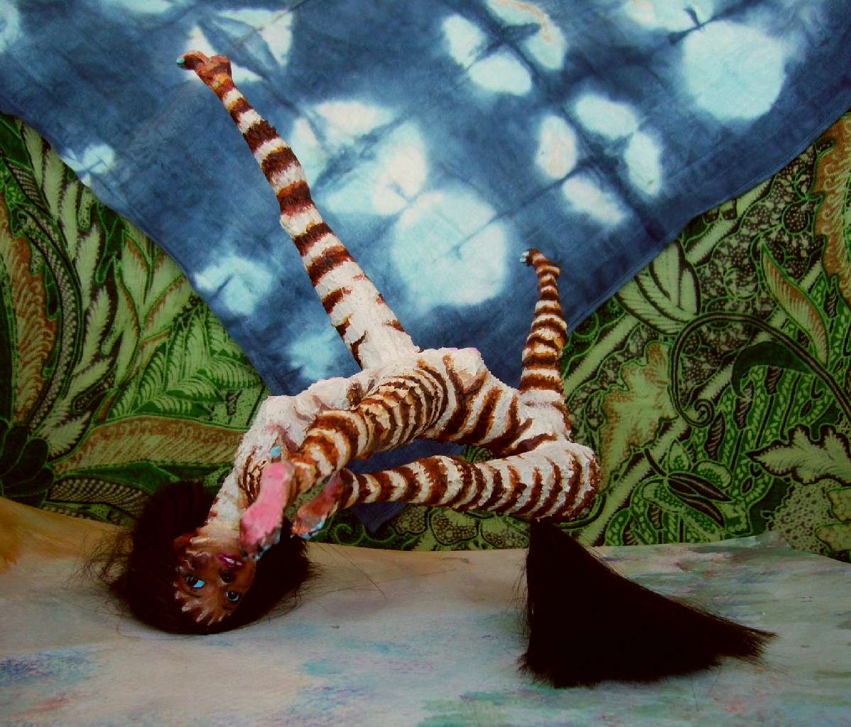
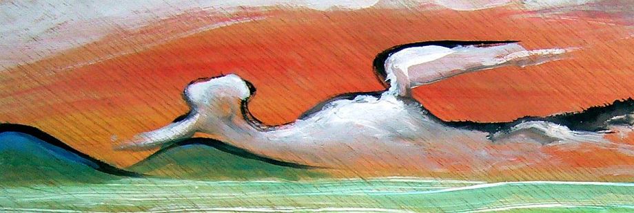
The Lokeran Coast, facing north, will be the coolest sealevel part of Fika; and one of the wettest. Snow hits these valleys, though it won't linger at sea level too long. Huge trees; a dark somber coast. In some ways its people are the same! Intricate woodcarvings, a mannered courtesy, a love of ceremony and theater (even for Kakaleans, I mean)... and equally dense interior lives focused on dreams and visions. The set design in Aifelle's dance, below, is typical; every surface patterned. The carvers of British Columbia would recognize their ecological kin!
The Tressat Coast, seaward of the long Parom and Poma Valleys and on southwest a bit past Kosh Port, is a gradient from cool Mediterranean in the north, through various flavors of California, to desert in the south.
Kosh Port, at the foot of Mt Koshos, is by far the biggest city, the largest in western Fika; its famous bridge crosses the Poma River near its mouth, and the river is navigable far inland. Rapids make the Parom Valley to the north less accessible, but still easier than carrying goods over the passes of the coast range, so nearly all shipping goes through Kosh.
There's one fertile region you won't see, and can't, no matter how much I eventually expand this section--the Kfisa Highlands. They're well inland, not visible even on the horizon from the desert coast. But the peaks rise over 3 km (10,000') and at least 50,000 square km (20,000 sq mi) are high enough to be wooded; and around this are good grazing lands, lower down. Earth's nearest equivalent is the Sierra Madre Occidental, a surprisingly big, fertile, well-populated but isolated highland lost in northern Mexico's deserts (why do I say lost? Its big green patch is visible from space! But not on most maps, and not, as far as I can tell, visible to the federal government. Might as well be Ethiopia).
You have a better excuse; you can't breathe at that altitude on Kakalea; oxygen equivalent is like Earth at 6-7 km (over 20,000'). Leave it to the local ranchers, weavers, vintners and cheese makers. Sail on. Embolism is no fun.
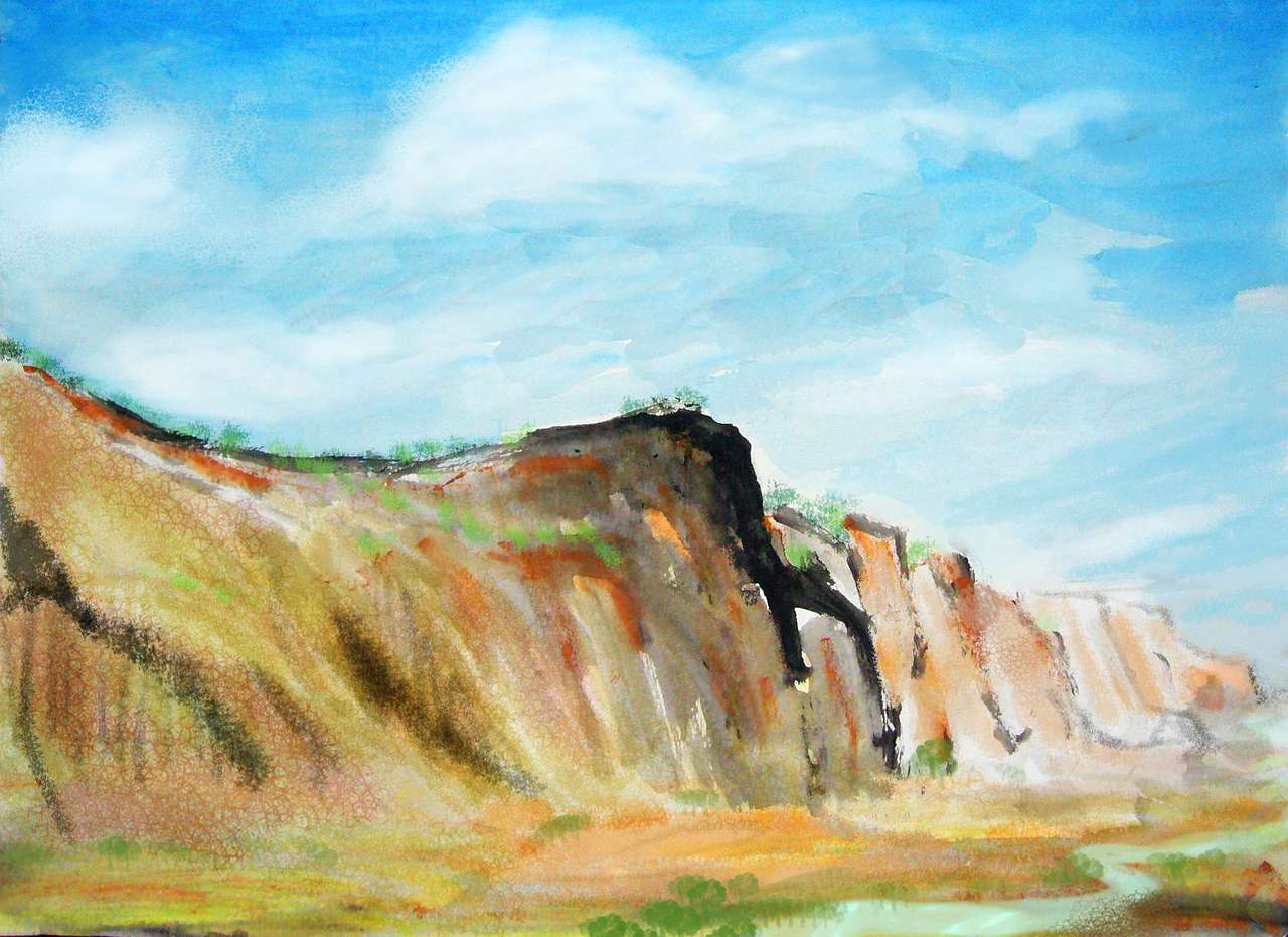
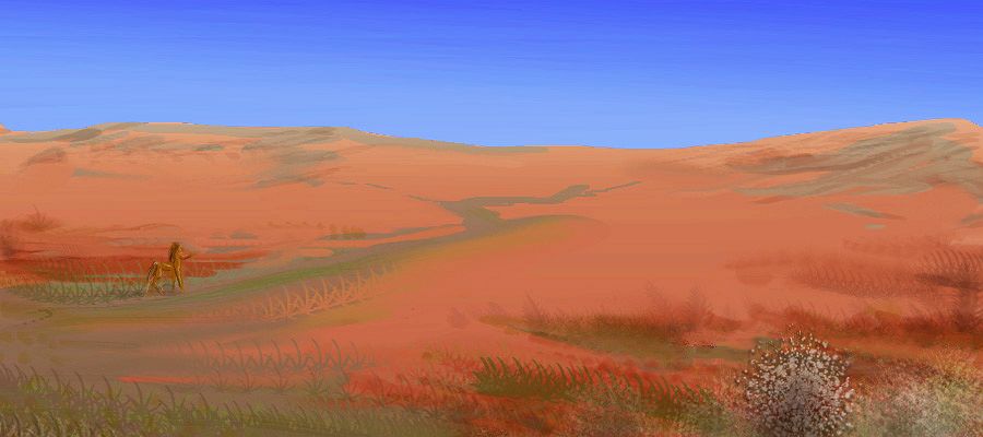
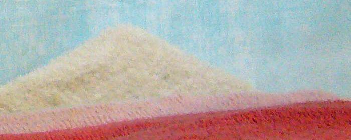
Fika's east-central deserts look classically Saharan: sandstone heads and hoodoos rising from tawny sand, and red windblown dust that's collected in basins and slot canyons--though a few of these get enough snowmelt or rainwater from the north to be linear oases. Not true Niles, rarely reaching the sea, but not utterly barren. Here's a paint-sketch of typical Eastern outback.
The black fields are punctuated by much younger, living volcanoes. By far the most visible chain is the Pfai Range; two small hotspots appear to be moving in tandem (well, the Fika Plate above them is what's moving, of course, pushed north by the equatorial Suma Rift).
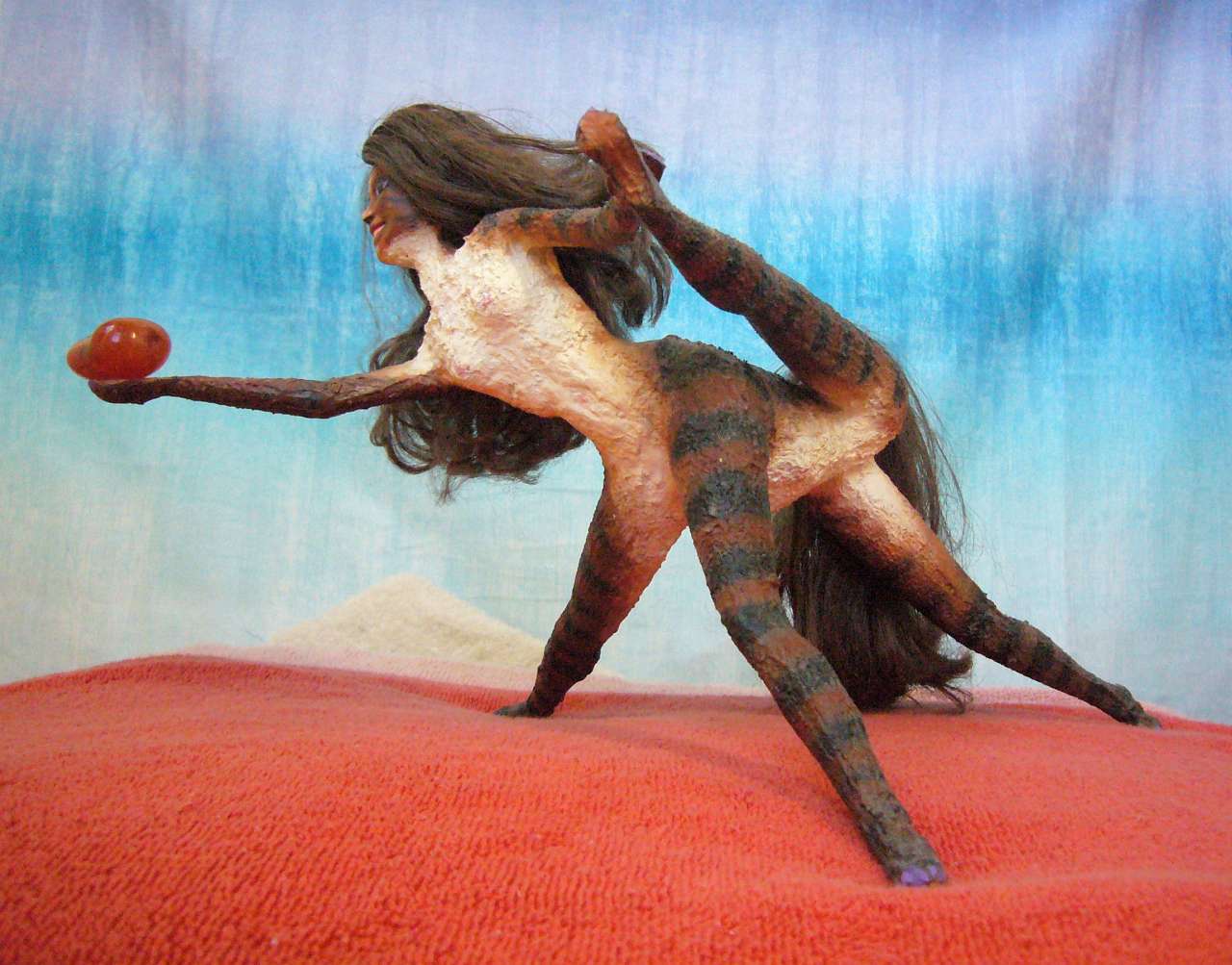
This is the loneliest stretch of the already sparsely populated Fikan outback. Just a few miners--and more prospectors who've never found a thing. Eccentrics all! Here's the dancer Lotora of Pfai singing the dream of striking it rich in the deserts at the feet of the Pfai Mountains...
The southernmost Pfayan volcanoes are the youngest; they're high enough to be snowcapped, supporting forests on their flanks. Sky islands! It helps that they're far south enough to be near the edge of the monsoon belt, of course. Think of them as Popo and Ixta. They're the sources of two little Niles that actually make it down to the northernmost bays on...
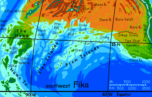
Fika's central south coast, from the Head in the west to the Irkup Scarp in the east, dances around 20° north--a bad latitude to be bordering a desert! It's low flat country with coastal cliffs and many islands and bays--a bit like Australia's Nullarbor Plain with a bit more rain. Dry gold grass most of the year, with two potential green seasons: summer thundershowers and brief winter rains.
I emphasize 'potential': both wet seasons are fickle.
A few of the central bays lick north so far their shores are almost rainless--miniature Red Seas, or Seas of Cortez. The heads of these bays have river deltas, but these are small; the basin and range country of northern Fika runs east-west, so none of its snowmelt makes it south to the sea.
Thus, rivers like the Dune or the Mesa are seasonal, rarely reaching the sea in winter months and mere muddy trickles spring and fall.
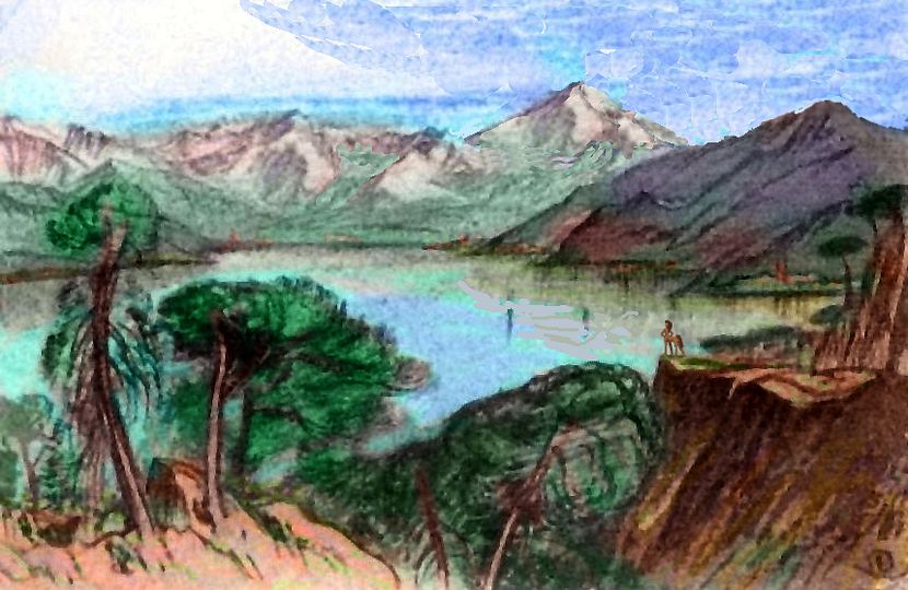
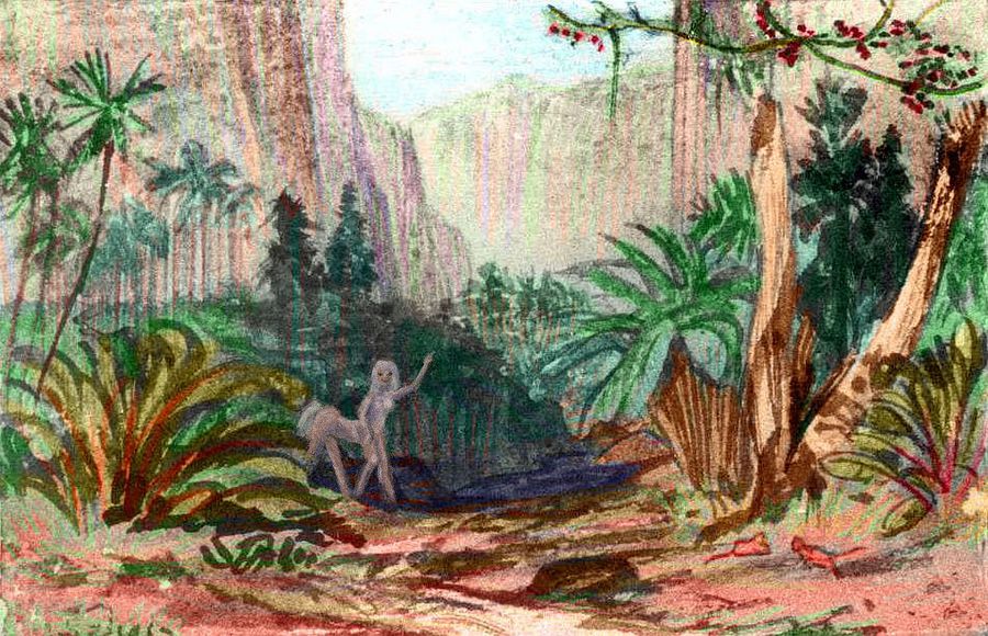
The Slot River is also small in flow, but never fails entirely, for it comes from deep shaded canyons getting snowmelt off the Pfai Range. Irrigated fields and orchards cover the canyon floor; cliffside villages cling above the flash-flood line. A beautiful little world. Well, terrarium. The horizon a hundred yards away. Does that constrain culture too?
Here's a watercolor sketch from the upper Slot River:
Only the East and West Pfai Rivers have steady year-round flows--they drain the nearby volcanic highlands, some of which is so high the water's snowmelt; that contribution peaks in early fall when lowland basins are driest. So the Pfai Valleys are true Niles, if small; their floodplains support the only extensive woods (and population) in central Fika.
Nearly all the south shore is veldt and desert, but the capes that thrust furthest south, into the true monsoon belt, have greener savannas with scattered trees. And the Vlen and Prem Islands, the two largest chains off these capes, run down close to the equator. More than a few trees there! At just 5-10° north, steady summer rains feed lush forests on even the smallest isles--and they're not all small.
S'sang Island is a good 500 km long, though narrow. Mostly grassy, but with trees, seasonal creeks and reliable wells, it's hot but far nicer than that dusty shore. Not always pleasant, though. Desert winds can sweep over S'sang, importing the mainland's heat and dust.
Kori, Jeo and Prem itself are smaller but greener, and are far enough out to escape the worst of the desert's influence.
Thus, most mariners crossing from the Tail to the Head island-hop, skipping the useless mainland. Even coastal traders' shipping routes hit the inner islands more often than the coastal ports. Fresh water, fresh fruit, fresh news! The desert offers only occasional curios and gems. Essentially, Kakaleans see the mainland ports as the scruffy fringe of a fertile archipelago, not the green edge of a continent. To them the desert is just another sea--a barren one you can't sail over.
Here's a quick paint-sketch (done on a wood scrap, all I had available) of a dusty sunset in the Inner Prems, south of S'sang...
In the far southwest, Fika narrows to just a few hundred kilometers, shore to shore; maritime influences turn desert to savanna. Beyond this isthmus lies the Head. Like the Tail, it's much greener than the mainland. It's as if New Guinea still had a landbridge to Australia, with north and south reversed. Desert north, jungle south! It's an oversimplification, of course; on the isthmus you only see "drier veldt north, slightly greener savanna with some trees to the south".
But the deeper you go into the Head, the richer it gets. In the north it's irrigated farmland, but the jaws around Rijila Gulf, especially Cape Shira and its attendant islands (which extend further into the tropics than the western "jaw", Cape Seskai) are lush, with forests worthy of the Tail. Muggy much of the year, though! But then most Kakaleans like it hot, and there's always the sea to cool off in.
Here's Lina again. You saw her at the start of this tour, thousands of kilometers to the east, on Tui Shar Savanna above Irkup Scarp. But here she is, back home, and though she sailed past the driest stretches--red rock and saltwater sounds--she still walked most of the way. For pleasure.
Notice how many people here have reticulate coloration, like a giraffe. While you generally can't tell a Kakalean's origins by color or pattern--they aren't races, just individual and family variations--this is an exception. Light net-patterns like this occur only in hot savanna and desert. Camouflage from predators? I suspect not. Even before they became serious toolmakers, ancient Kakaleans were fast runners; fight AND flight were both viable responses to large predators. Little need to hide! Kakaleans weren't hunters, but they weren't scared little rabbits either.

Instead, I suspect such netlike patterns confused much smaller predators: flies. Turns out zebra stripes work that way! It was never about lions after all.
Makes me wonder if Earth's history, supposedly all about our lions--kings, conquerors, gods--is misattributed.
Maybe the gnats have been shaping things all along.
LISTS AND LINKS: More worlds? Planetocopia! - dreams of other worlds - ecology - climate change - evolution - natural disasters - terraforming - sculptures and 3D art -
World Dream Bank homepage - Art gallery - New stuff - Introductory sampler, best dreams, best art - On dreamwork - Books
Indexes: Subject - Author - Date - Names - Places - Art media/styles
Titles: A - B - C - D - E - F - G - H - IJ - KL - M - NO - PQ - R - Sa-Sk - Sl-Sz - T - UV - WXYZ
Email: wdreamb@yahoo.com - Catalog of art, books, CDs - Behind the Curtain: FAQs, bio, site map - Kindred sites