Kakalea:
KITA
by Chris Wayan, 2012-2015
for the Inuit
Kakalea basics--map--geology--
creatures--
Building Kakalea
More worlds? Planetocopia!
Kakalea:
KITA
by Chris Wayan, 2012-2015
for the Inuit
Kakalea basics--map--geology--
creatures--
Building Kakalea
More worlds? Planetocopia!
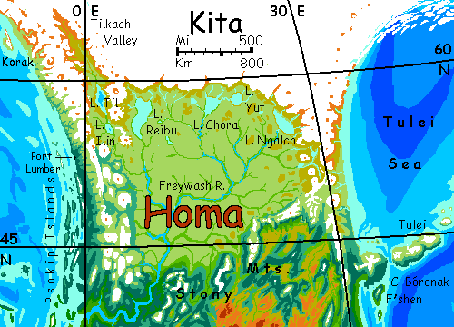
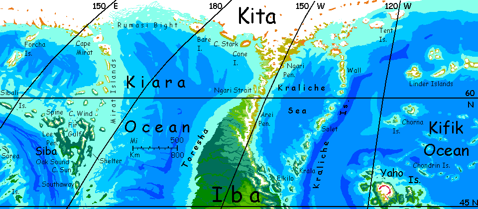
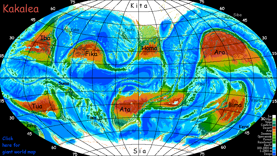
KITA AND HOMA
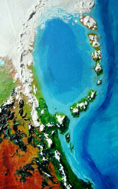
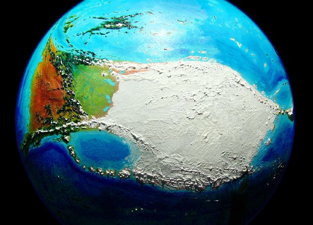
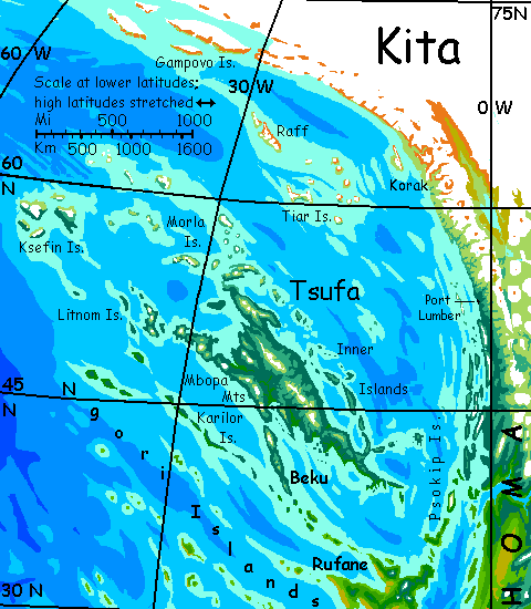
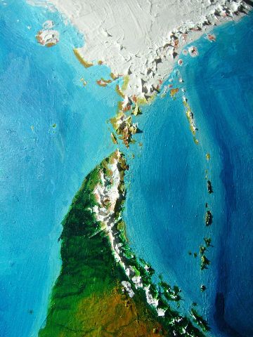
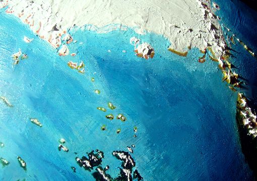
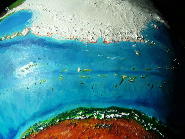
Kita-Homa is the biggest continent in the world--maybe. It's hard to tell. Kita, the northern half, is completely iced over, and the seas around it have weather nearly as bad as our Antarctic: not easy to explore. Not even easy to photograph from space--the polar high-orbital shot below had to be taken at a certain hour near the summer solstice, as Homa's deserts face another blazing day, the Tsufa Coast basks in a polar summer all of five degrees above freezing (top), while it's sunset in the Ngari Straits (right) and long shadows cast by the low midnight sun stripe the Kiara Coast (bottom). Some things are just too big to see clearly--and light properly. Siberians know what I'm talking about. How many time zones up there?
15M km2 (6M sq mi) of Kita-Homa is ice-free and has its own page--the subcontinent of Homa. But on this page we'll focus on the polar region, Kita. We'll skirt it--first trekking across Homa along the tundra and by the lakes at the foot of the ice, then take ship and follow the polar winds from Homa's west coast along Kita's shores (well, a safe distance south of them) three-quarters of the way around the world to Homa's east coast, our starting point.
The ice isn't as deep as Antarctica, for Kakalea is bigger than Earth, with higher gravity; glaciers don't readily pile as high. And Kakalea's air is thinner at sea level; snow doesn't precipitate as high, either. The mean ice depth is "only" 1.5 km (5000') and the cap tops out at 2.5 km (8000'); however, the cap covers 30% more area than Antarctica's ice, so the volume is similar. Just a flatter ice pancake.
But an Antarctic gone flat like a bad soufflé is still too cold to go wandering on; this isn't our mild Arctic with its tiny Greenland cap. We'll stick to the coasts, and often well offshore.
One more size issue. Kita's coasts are about as far (in degrees; further on the ground, since Kakalea's big) from the pole as Antarctica's. That means glaciers from the arctic cap calve straight into the sea along thousand-mile stretches; icebergs abound off those fatal shores. In contrast, the coast of the south polar continent, Sia, is mostly further from the pole; long stretches have seasonal sea ice and glacier-capped mountains, but few large bergs. The seas around this smaller icecap in the north are, paradoxically, more dangerous than the southern! The tours reflect this; distant here, while for the south I can follow a circumpolar expedition bravely mapping that only intermittently fatal shore. Sigh. Wish I could here, but no such luck.
TULEI
In far northeast Homa is a small sea, sheltered, if you can call it that, by the Tulei Islands, an arc of volcanoes quite like the Kurils on Earth--though some of the Tuleis are as big as the lesser isles of Japan. The Tuleis are windy, with harsh winters--that wind often comes off the ice sheet to the northwest. The sea's northern shore is a smaller ice sheet and its surrounding mountains are glacier-mantled--except of course when they erupt and send catastrophic floods of steaming mud in alluvial fans to the sea. South of this, the central coasts and Tulei Islands have much more open ground and some grass, bogs and even a few low trees. But overall, it's sparse country--more coastal Greenland than Iceland.
The southern lowlands, on the coast and the Tuleis, are still too windy for many trees, but they're green and support great herds of grazers--and possibly herders protecting them.
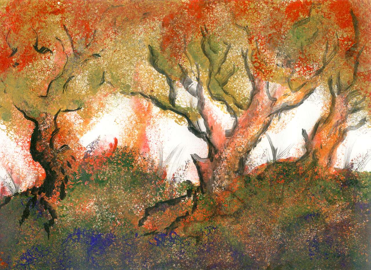
South of the Tulei Sea, true forests rise. Humans would find this strip quite habitable--tough humans at least. New England? Korea? Long cold winters, late springs, muggy summers, gorgeous falls as the leaves turn gold and red. Yes, that's an interplanetary phenomenon. It's cheaper to grow new leaves annually than grow ones tough enough to survive winter storms like these, roaring off the ice cap.
Your road lies inland, over the Coast Range. Well, path; it's barely wide enough for a single wagon, and you don't see a single one. All the travelers passing you are on foot. They're passing you because Kakaleans are lightly built centauroids; their natural gait is faster than human hiking.
It's spring and you'll be trudging through snow, but it's a safe, well-managed road for Kakalea. Cold isn't the main danger for you--it's altitude sickness. The pass is all of 1200 meters (4000'). Doesn't sound like much, but Kakalea's air is thin and a bit oxygen-poor to start with, and thins faster with altitude--high gravity holds the atmosphere tight. Oxygen in the pass is like Earth around 5500 m (18,000'). Expect exhaustion, headaches, insomnia and (most important) bad judgment. Listen to the locals. Their brains work.
NORTH HOMA
The pass doesn't just have you in a mental haze; you seem to be walking through time. From New England in the time of Thoreau and Dickinson back to the Pleistocene! Ahead and below sprawls a bare grassy plain with hulking creatures grazing in stiff, relentless wind, cold even now in spring. Dry cold air off the ice! Though it lies in our cool-temperate zone, from 40-58° north, the proximity of the ice makes this tundra seem Siberian most of the year.
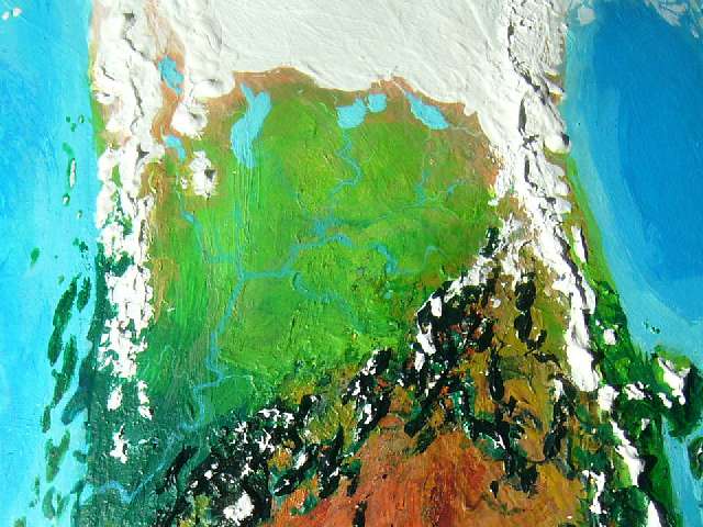
Well, one word of that was false: this prairie is not true tundra, that is, permanently frozen ground with just a surface layer thawing out in summer. Such permafrost (hundreds of meters, in parts of Siberia) is a relic of our last Ice Ages; but Kakalea hasn't thawed out from a colder time. This is it--about as cold as Kakalea ever gets, and that's little colder than Earth today. Kita's ice has spread this far south only because it's a big, confident polar cap (ice breeds ice!) with broad lands to build up on. An opportunistic tongue!
In contrast, our seas pen in Antarctica and Greenland. Sea ice stays shallow! It's only an accident of geography that Earth lacks such ice-tongues today, reaching far from the poles down into temperate lands. If the Antarctic Cap had a landbridge to follow, it'd probably swallow Patagonia. While the Siberian and Canadian icesheets were huge, and had land to the south to spread to, their centers weren't far enough north to survive the interglacial warming; Greenland's, though much smaller, persisted because the north end of the island is truly polar. (Well, it persists as I write this. Maybe not next week.)
So Homa's northern prairie isn't true tundra--just cold, wind-blasted and miserable by Terran standards. But to the megafauna that graze it (emphasis on mega; size helps keep you warm) it's not so bad. Plenty of food (if monotonous); predation and blizzards are their main worries. The year's cycle: a white plain, then a brown one, then green, then briefly gold, then white again. Mate a few times if you're lucky, then go back to eating. Maybe give birth and raise a calf. Grow a warm coat and dig up hay and lichen in the white; fatten up but get bug-bit in the green and gold. Repeat until death.
Not my idea of excitement, but it takes all kinds.
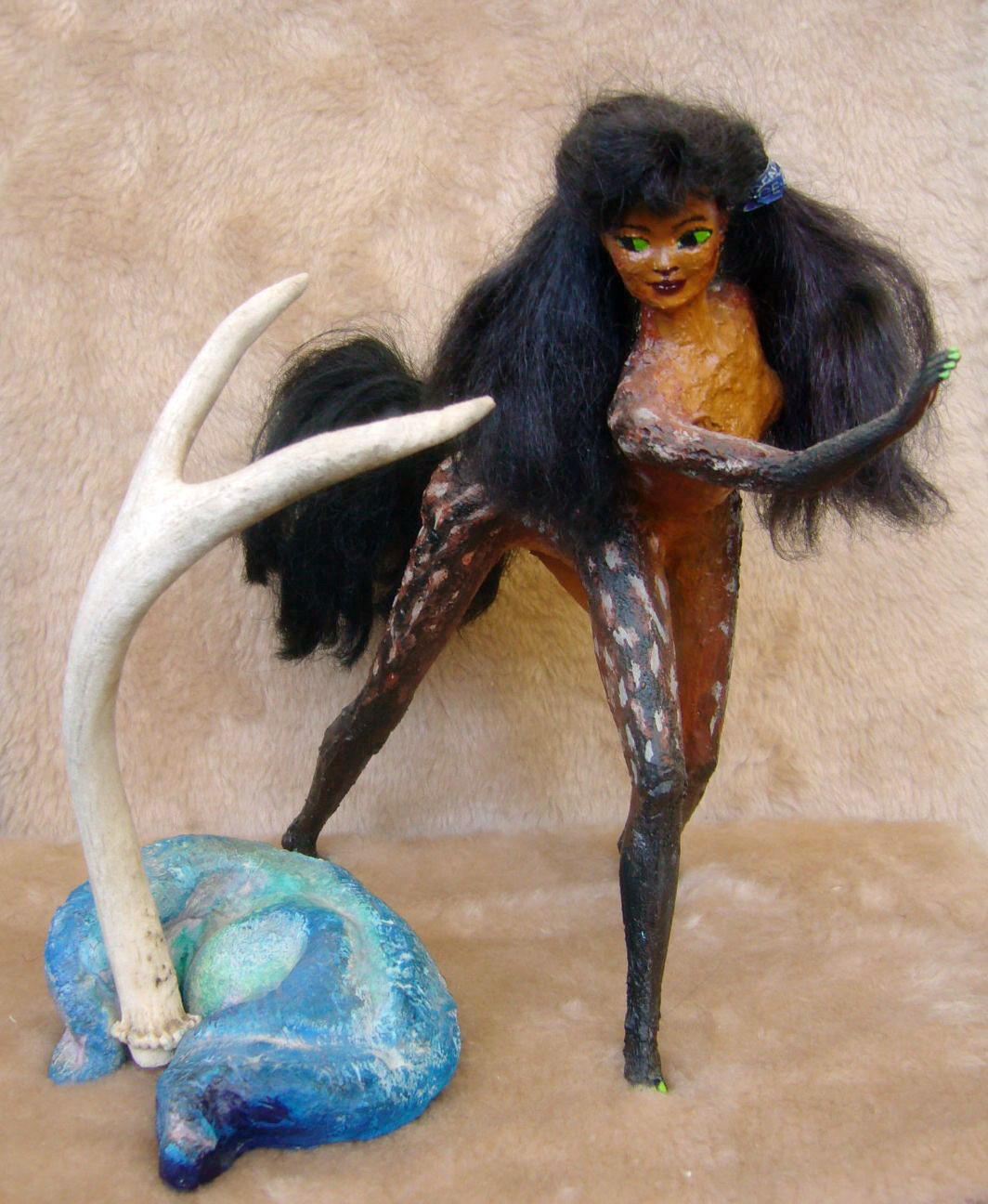
Frizia in her travelog-dance Tundra: Hornier than you Think |
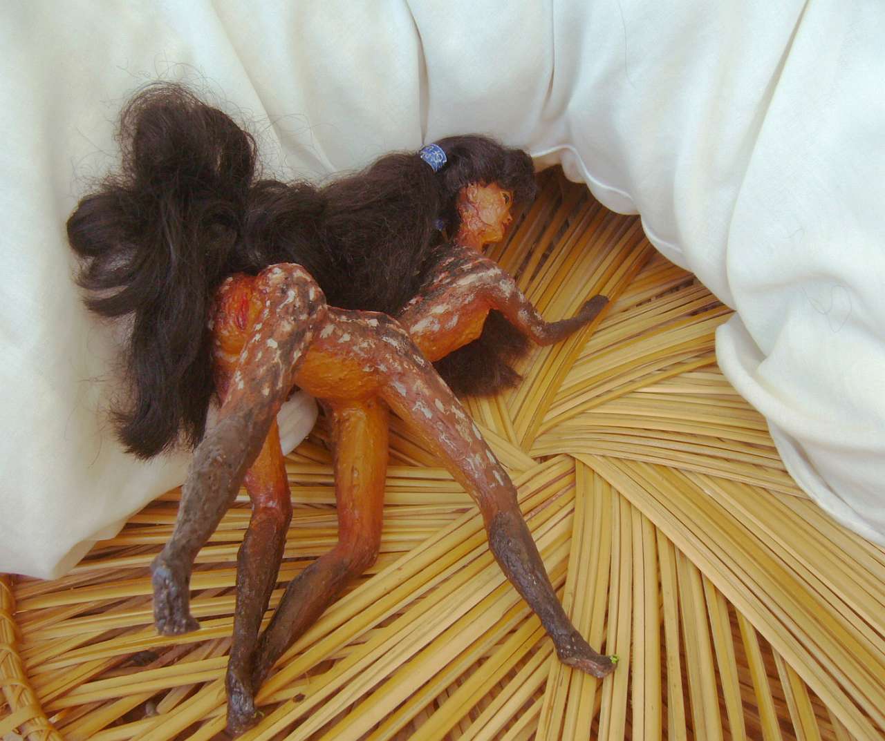
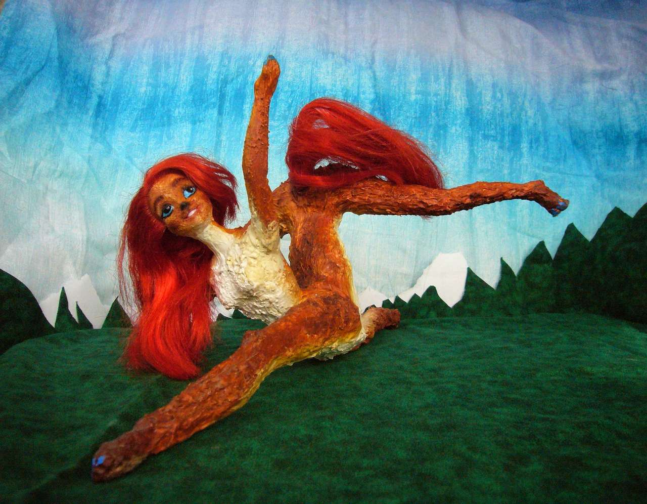
I don't have any sketches yet of the wildlife, but here's a Kakalean showing off a couple of finds that give you an idea how big the critters can get, up near Lake Yut at the foot of the ice. This girl, Frizia, is quite human-scale, about 160 cm tall (5'4"); so that antler off an oont is not much under 1.5m (5').
The twisted meter-long blue thing... well, that's a charming example of a local craft--an abstract sculpture made by molding a blue claylike substance ubiquitous on the tundra: mammoth poop. Well, grenla poop, but though a grenla is a centauroid too, like most Kakalean megafauna, one look and you'd say mammoth. Big, hairy, big, tusky, and big.
This isn't really the tundra, of course, as the furry background shows, but a dramatic performance I saw months later, back on Port Bóronak on Homa's east coast where we started, after the whole trip was over. Frizia was touring the coast with a popular show-and-tell (well, song-and-dance) of her travels around the North. Travel tales are more common than tragedies on the Kakalean stage; though romance and comedy are still more popular--Kakaleans aren't THAT alien. But you'll be seeing a disproportionate number of travel scenes in these pages, since geography and ecology are our proper focus here. I'd never stoop to cheap laughs or use nudity and sex to lure in audiences. No.
Kakaleans do. Oh well.
You spend the next few weeks steadily trekking (at Kakalean half-speed) across this steppe at the foot of the Kitan ice-tongue. You skirt the shores of a string of great lakes--Lake Ngalch, Lake Yut, Lake Chora, Lake Reibu...
Everywhere you go, you notice campsites are up in the low hills, not down by the lakeshore. Inconvenient for fetching water, but prudent. Even when the far shore is over the horizon, the glaciers calving into them can kill you. When a truly huge berg falls, the whole lake can suffer a freshwater tsunami.
And now and then, up on the cap itself, an ice-dam bursts and a subglacial lake drains torrentially into the lake you see. Such floods can be catastrophic--on the scale of Old Mars! The lake can rise 50-100 meters, then pour downriver, scouring canyons bare for two thousand miles to the sea.
All the streams you cross are shallow, braided and shifting, for they're full of glacial silt and often clog their own channels. They're all arms of one great river, the Freywash. Yep, all the catastrophes funnel down a single channel to the sea. Is that a good thing or a bad thing? Bad if you live in Port Freywash; good for everyone else, I guess.
NORTHWEST HOMA--or is it SOUTHWEST KITA?
Past Lake Reibu, we veer south to skirt the icemantled volcanoes on its western shore--the Tilnit Range--then north again to Lake Ilin, last of the Great Lakes--except for Lake Til, upstream, frozen most of the year, surrounded by icy heights. Save yourself the trouble--you face those right ahead. You have the West Coast Range to cross. Same hazard as crossing the mountains from Cape Tulei to the inland steppes--oxygen shortage. Go slow and keep your head.
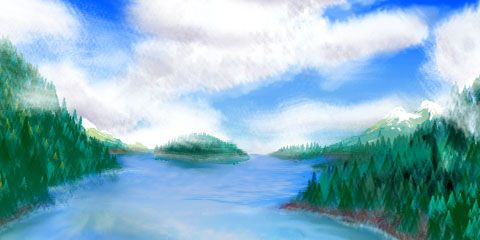
On the western slope, the winds off the ice cap are blocked. Another world! As you descend, forest grows dense, the trees huge--a true cool-temperate rainforest like our Alaska Panhandle.
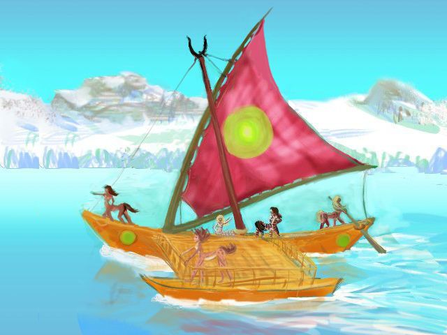
In Port Lumber (well, Port Lumiaberaha, but some wit shortened it long ago; and it is appropriate given the main export and all the carved... well, everything, including a fair number of the faces; lumberjacks live rough) you arrange passage on a trade catamaran heading northwest along the coast. Cats are the commonest rigs on Kakalea, even for cargo vessels; Kakalean cargoes are rarely heavy and the centauroid crews are more comfortable out in the sun, wind and even rain than cooped up below decks--on these vessels, that's strictly cargo territory. Except in the worst blizzards, you stay on deck. Bundle up or snuggle up. Kakaleans, evolved from herd animals, aren't as fussy about body contact as humans can be.
Here's a quick, crude sketch of your ship. Yes, you're sailing thousands of km on a boat this small. Kakaleans do this casually. It's not recklessness or primitive technology; they could build big Terran-style ships, and do for specialized purposes (like I said, lumber and stone); but Kakalean geography makes most voyages safe for rather small boats. The planet has less water; the oceans, though extensive, are rather shallow. Islands everywhere! If you're becalmed, at worst you'll have to paddle a few days to the nearest port--and that's easier if your boat is small. Restocking and repairs are easy. And because the sailing's safer--a whole world's essentially a big Mediterranean buzzing with coastal and island shipping, and has been since the stone age--the (nonpolar) seas are all well-charted. Even out of sight of land, you always know where it is--and it's near.
In short: my sketch is crude (I'm no mariner; damn ropes running everywhere!) but the boat's light catamaran build and small size are accurate. Outrigger, wishbone mast, steering oar. And a bone in her teeth! Even in a modest breeze this little boat can do ten knots--fifteen with a good wind. Not just easier than overland travel, faster, too. There's a reason Kakalean civilization (I heard you mutter "such as it is"!) is coastal.
So it only takes a few days' swift sailing north for the glaciers on the heights to grow and merge until they're a long narrow icefield. They're still a cut-off arm of the great sheet, just as in Ice Age America--the West Coast ice sheet often separated from the main one centered on Hudson Bay, leaving an ice-free corridor all the way from Montana to Alaska. Here, a similar long dry valley exists, the Tilkach Valley. But eventually, far north of Lake Til, Tilkach dead-ends and the coastal ice sheet merges with the main polar cap.
But even this partial separation has consequences: icy winds scream south down Tilkach to blast the steppes, but the winds rarely cross the coast range. It's milder here, as it was along the Pacific Coast during our Ice Age.
So, nourished by damp sea-winds, forests hug this shore, at least at first. To the south it's like Puget Sound or the Inland Passage--the Psokip Islands shelter the coast and widen this maritime forest. Two of the Psokips are bigger than Vancouver Island. Fishing towns all over. But north of Port Lumber, the coast is straight and exposed. Within days (but that's over a thousand km north; 12 km an hour adds up fast), the trees dwindle and so do the villages. Though they do have the distinction of being nearly the only people on Kakalea to call themselves Kitans.
After a week, the shore is just grassy fells, barren in spots. The last village of any size is in Korak Strait, sheltered a bit by rugged Korak Island from the worst storms. Still, it's gray stone huts instead of the wildlly carved and painted longhouses to the south. Wood shortage! Here your catamaran turns west, out to Korak--craggy, stormy, sparsely inhabited--and out to sea.
IN THE KIFIK OCEAN
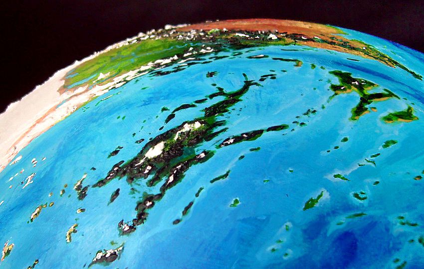
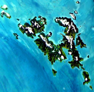
Remember how shallow Kakalea's oceans are? Even relatively modest seamounts can break the surface. Well, these aren't modest. Tsufa, the largest island in the Kifik, is comparable to Greenland stripped of its ice, and it really is green: one of the richest ecosystems on Kakalea. And its five hundred sisters range from Arctic to Caribbean, wet to dry--and from mere mountaintops to one giant the size of France. This archipelago deserves its own page: The Tsufa Isles.
A day out from Korak, you encounter the first of these islands, the Tiar chain. Korak had only grass, but to your surprise the Tiars have low trees in the riverbottoms and sheltering houses of the fishing village. Same latitude as harsher Korak, but farther from Kita's icy winds.
You talk the crew into a side trip northwest to long Raff, whose grassy but treeless south shore is half-sheltered from polar winds. Wool, furs, and dried fish--not much else to trade up here. You don't even try to talk the crew into going any further northwest, to the Gampovo Islands. No one there to trade with, and the seas beyond Raff are perilous: the Kitan ice sheet finally reaches the coast here, and great bergs calve into this sea.
So we sail west through the outer Tsufas, and keep close watch. Mountains dot this shallow sea, and a few of them aren't on our charts; they move. Icebergs.
Few bergs make it this far south--not because tthis cold sea melts them quickly, but because the Kifik's so shallow compared to our North Atlantic. Not just islands, but banks and seamounts all over; and even water a thousand feet deep (300m) can strand an iceberg and patiently chew its guts out with each tide--remember most of a berg rides deep. The shallows are a crude filter, but it makes the central Tsufas fairly safe for shipping.
Provided your lookouts don't doze.
For days we creep through the Morla Islands, on out to the Ksefins. Thousands of kilometers, dozens of craggy Nordic islands, their ridges snowy or wind-scoured bare, but lowlands on the south and east sides wooded. Timbered towns, almost Elizabethan, not the low stone crofts of Raff.
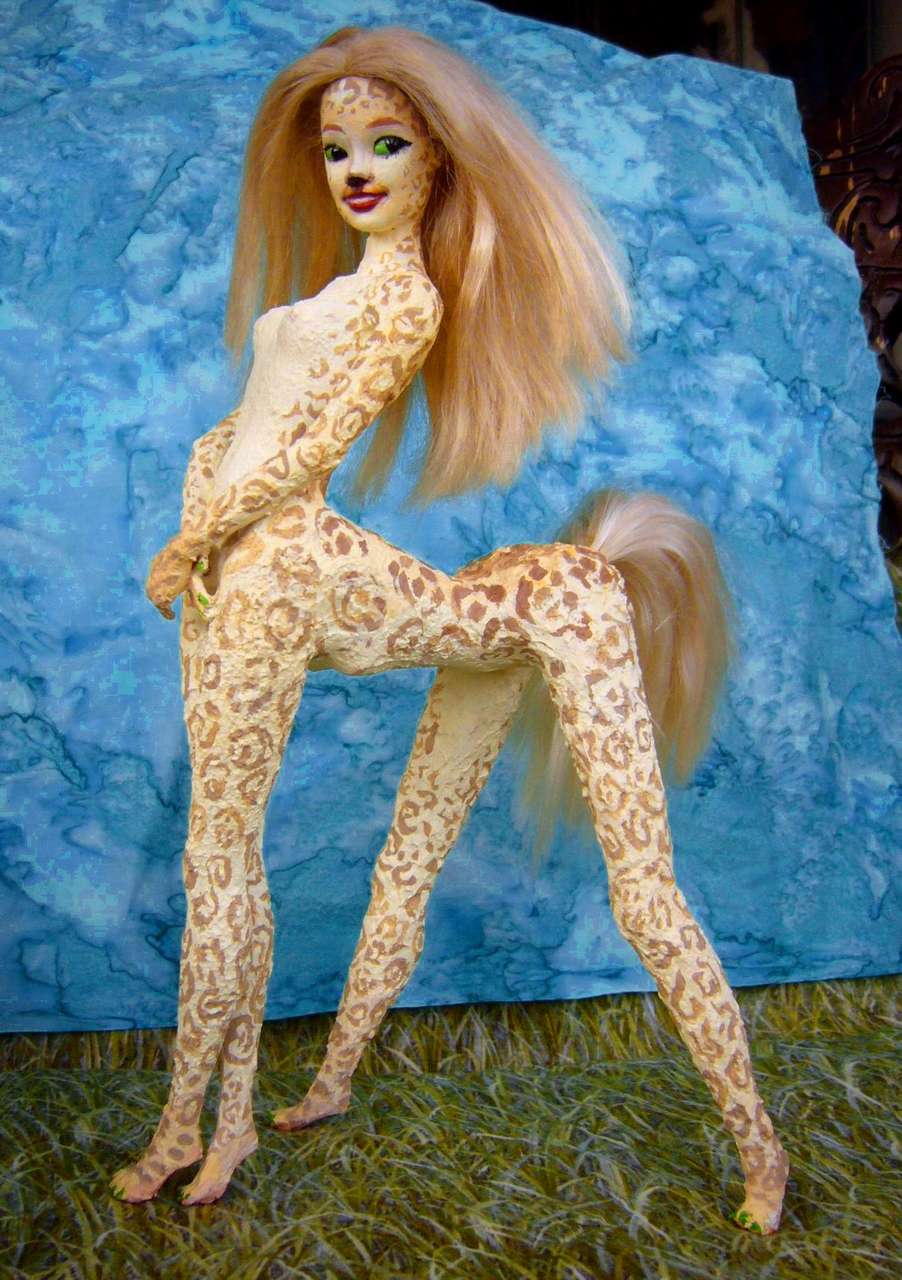
People here run large and shaggy. I don't just mean they wear furs, though they do, itchily and reluctantly, in winter. I mean the people themselves. Kakalean pelts are usually short--much of the land is hot after all--but in the Morlas, Ksefins and northern Tsufa, coats are long and shaggy year-round.
Here--on the left is Lia, a Morlan cabaret singer. She's no horse-bellied Greek centaur--her lower torso is more human or antelope than horse. Yet her coat's not antelopian--she's as shaggy as an arctic wolf. On the right is a typically short-pelted southerner, Shya, a dancer in a troupe whose floating theater circles the mostly hot continent of Ara. Shya is willowy, yes--dancers of any species often are--but her much shorter coat exaggerates that ballerina look.

Lia sings Morla's Fish Rule |
Shya backstage in Summer Heat |
Their nudity is normal, not a stage gimmick to attract audiences. Even short-furred Kakaleans only wear clothes in rain or severe cold--and just a sort of horseblanket, or in severe cold, a hooded cloak. Even these make them feel confined; fitted clothing's unheard of. Unnatural. Probably unhealthy.
After the Ksefins, large and well-populated, come the small, scattered Liekas. Local shipping angles southwest here, along the equally small but warmer and greener Sondrins toward the Yaho Archipelago, a huge chain like a temperate Hawai'i. Ten times the area, but geologically no larger--remember Kakalea's shallow seas! Hawai'i rises from waters over 6 km deep--20,000'. Yaho's shield volcanoes barely have their ankles wet; 80% of their immense mass (and height) is above water. By far the biggest isles west of Tsufa!
So sensible traders head Yahowards, where the warmth and people and money are, not due west through these windy little islands of the north. Such as they are. Most of the Liekas are inhabited, but small and poor. But being heroic circumnavigators, here we leave the trade route and commonsense, to head northwest.
Northwest of us is one last chain of chilly, subarctic islands, just 1250 km (750 mi) south of Kita's glaciated coast--the last gasp of the Tsufas. These five islands, the Linders, are half iced-over but so big that the bare halves are extensive; some sheltered southern slopes are quite grassy.
The Linders are the logical staging point for a dash to the pole--the Kitan coast nearest the Linders is the northernmost in the world, at 76.5°, and in late summer the sea ice is broken enough to reach that shore. Few bergs here--the warm Iban Current washes this shore, and the coastal range hems in the polar cap, so the few glaciers calving into the sea are local and relatively small. Those glaciers are convenient stairways through the jagged Ngari Mountains--passes are as low as 2500 m (8000'), with oxygen levels like Earth at 7000 m (23,000'). Then you just trek 1600 km (1000 mi) across the cap to the pole. Easy! Not much further than Scott or Amundsen's dashes to our South Pole.
Pointless, though. No Kakalean's ever tried it, or shown much interest. Of course, these centauroids evolve on hot savanna and never faced an Ice Age; they handle extreme heat readily, but frost badly. Kakaleans explore their deserts thoroughly, and consider that logical: after all, you might find a hidden spring up any canyon, a little paradise of your own; but you won't finding anything livable up on a polar cap! Kakaleans are pragmatic explorers.
Viewing our expeditions into clearly uninhabitable lands, they might ask: is our pointless polar obsession a legacy of our Ice Age? If Africa was our evolutionary mother, was the Ice our abusive dad? And will we ever just grow up and get over it?
Oh, well. Let's not go and say we did.
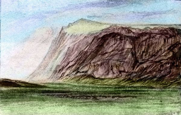
Here's Frizia again, in her travelogue-dance, miming a peek into an ice cave at the foot of a glacier on West Linder. "I touched the Great Ice!" she sang. And even though the glacier's quilted and the tundra a round rattan stage, the audience shivered and oohed. What courage!
Such, on Kakalea, is Arctic Heroism.
So instead of pressing north and actually SEEING Kita, the continent we're supposed to be touring, let's just continue west round its fringes--as the Kakaleans do. From the Linders, we tack into the stiff winds over a stretch of deep steely sea to Iba. Deep for Kakalea, I mean--as much as a mile! The mariners don't need to sound to know it's deep; it's easy to guess. Days without a single island! Extraordinary, for this freckled world. Oh well, it's room to tack.
NORTHERN IBA
First sign of Iba is the Kraliche Chain, an island arc like our Aleutians. They parallel a trench all of three km deep (10,000')--shallower than the average sea floor on Earth. But that's deep for Kakalea. We round the southern tip of Wall, a well-named ridge some 500 km long (300 mi), right across our course. High and rugged, gleaming with ice. It's enough to fool you into believing you've seen the Kitan mainland again, until the steerswoman shows you the chart. On the far side of Wall's wall isn't the Great Ice, just a few hundred more kilometers of open sea. Earth has a near-twin to Wall: South Georgia, off Tierra del Fuego.
Three more days across the Kraliche Sea, to the real thing: the Ngari Straits, where Kita and Iba meet. Northern Iba's Arei Peninsula resembles our Patagonia in reverse. It's flipped north-south of course, since this is the Arctic; but geographically, it's flipped east-west too! That matters. Winds here are the same as Patagonia's, always blowing east and from the pole; but in Patagonia the wet side of the peninsula is narrow--the forests of Chile are rich but right up against the mountains, while the dry plains downwind of the Andes are broad.
In contrast, Arei's mountains hug the dry, windy east coast; the wet side is quite a broad plain of cool forests, dwarfing and thinning near the tip to taiga, cold prairies, bogs and barrens. This land, called Toresha, isn't quite as wide a belt as the Alaskan woods, but it's still one of the larger snippets of Siberia to be found on Kakalea. And to the south, the coastal forest grows slowly milder. Big trees. Rain. Seattle, then San Francisco, then...
...hmm, I think I'd better go write the Iba tour.
Even north of Ngari Strait, on Kita, the islands and shores of Cape Ngari have stony meadows in sheltered valleys and fjords for hundreds of km. Centauroid moose feed in the bogs, and caribou, hare and pika graze grass and lichen in sheltered upland hollows. Small fishing villages dot the coasts: more actual Kitans! Though of course they're culturally and genetically Iban settlers. They proudly call themselves... Ngarans. Kita? What's a Kita?
Beyond the settled lands, dry valleys and barren but ice-free shores extend another 1000 km before the ice swallows all. No large life inland, but bear and fox hunt seal along the coasts.
The Kitans--sorry, Ngarans--even insist there's a sort of trunkless woolly mammoth (who needs a nose when you have two strong arms?) They show you a skeleton--that's one BIG centaur! At 3-4 meters tall, a couple of tons at least. But you're unsure if this is a Piltdown or Bigfoot faked to promote tourism, or a real species gone extinct, or just very rare.

No mystery why life extends right to the base of the Great Ice! Cape Ngari reaches several degrees further from the pole than our Antarctic Peninsula--more like the Falklands and South Georgia, if the ridges linking them to Antarctica were bared by low sea levels. Windy, cold, ice hulking on the mountaintops like a polarbear on your roof, but the ice hasn't swallowed all. And never will; this is as cold as Kakalea ever gets. So Ngari is a refuge for Kitan land species unable to swim or blow seeds across the straits.
When Kita drifts off the pole at last and starts to thaw, Ngari will reseed the new-bared land.
West of Cape Ngari, Kita's coast recedes north in a long gulf: Rumasi Bight. There's a permanent ice shelf here up to 300 km wide. Cape Mirat to its west cuts Rumasi off from milder subarctic currents; winters are harsh. Here the great ice-mantle calves directly into the Bight, pushing the shelf outward: it's no smooth ice plain but a stacked, ridged, groaning maze.
Not a safe or easy place to explore, and it exports its trouble: bergs. Although the Mirat Islands cross our path west, leading north to the Cape and the Bight, your vesselsteers well south and keeps a constant lookout, even far from land. We head east-southeast toward a warmer, safer port of call at the very south end of the Mirat chain...
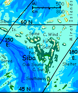
SIBA
2000 kilometers southeast of Cape Mirat rises a Siberian archipelago just as big as Iba's Arei Peninsula: the serendipitously mnemonic Isle of Siba. If you pried Norway loose from the rest of Scandinavia and threw it in the sea...
No, it's even bigger than that. I keep forgetting Kakalea's diameter is 12% larger than Earth; land areas are 25% bigger than they seem by their apparent size against the curve of the globe. So toss in Denmark or maybe southern Sweden...
Its character is also Norwegian, not Danish. Much of it isn't farmable--the rugged interior and the north coast. Dark evergreen forests, rugged ice-carved horns, waterfalls, sheltered sounds full of fish...
The population's almost entirely coastal, plus some settlements strung along the few navigable rivers. Fishers, loggers, woodworkers, especially shipbuilders.
But not many farmers. There are some orchards of cold-tolerant fruit and nuts; and most communities have a cleared garden. But these aren't high-yielding or large, except on Southaway and the southern half of Siba proper, around Oak Sound and the Lee Peninsula--the warmest parts of the archipelago. Only a tenth of the area. On the other hand, these areas have half the population!
Sibans look different, and are. They're a distinct cold-tolerant subspecies. Shaggy, big-boned (big stays warm better! Less surface area, proportionally), with a lot of blondes and redheads, as with human Nordics and Celts. No mystery why. Most of Kakalea's populations live in low latitudes with strong sun, needing pigmentation as a shield. Not up here...
Sibans are striking, but... odd. Some of the "redheads" are really red--and of course it's both mane and tail. Here's Ariel, a well-known dancer from misty Fir Gulf:
I just worry the Sibans will turn out to be too Norwegian--use their skill with boats to go a-viking to escape those long dreary winters.
Probably not. Kakaleans just aren't fighters; while not strict herbivores, they tilt more that way more than humans do: gatherers and fishers, but not hunters. And what's viking (the verb) but hunting displaced?
The Kakalean hunt, and dream, is for fertile land, not gold or other portable wealth. On a world with thousands of scattered islands in its shallow seas, it's not that unrealistic a dream, either; someone stumbled on Siba only a few millennia ago. (No, not centuries like New Zealand or Hawai'i--millennia. An island chain leads to Siba from the southeast--not Scandinavia-big but Taiwan-big, and with pleasant climates. It didn't take sophisticated mariners like the Polynesians to reach! Still, for Kakalea, with its slow development, settlement a few short millennia back IS recent.) It's still audible in the placenames--on most continents I've just transcribed the sounds of native names, but Siba's young names still translate intelligibly as simple descriptions coined by the first settlers.
Note how they sum up Siba's borderline nature, too: obviously Fir Gulf isn't lined with Terran fir trees, nor Oak Sound with true oaks, but it seemed to me appropriate and informative to rough-translate the treenames this way, even though the twisty Kakalean "oaks" are all strongly deciduous, with bright fall displays, and produce nuts lacking tannins but with an aromatic-resinous taste, half pine-nut, half cinnamon bark. They're still oaky.
Details, details! Stick to the big picture: northern and eastern Siba is subarctic; the southern and western shores, sheltered from Kitan blizzards, fully temperate. Oak Sound, the Lee Peninsula and Southaway are much milder regions, and support most of the population. Understandable; the first place on our long voyage where winter snows are modest and melt early.
Some sheltered coves rarely see snow at all--just long Seattle rains after the fall display fades. With occasional hailstorms or sleet. Ugh! Snow is drier.
THE LONG NORTH RIDGE
From Spine, just north of Siba, we sail west through the Kiara Ocean along the Sibali Islands. This long subarctic chain, mostly volcanic, is a mid-sea ridge flanking a spreading zone, like our Mid-Atlantic Ridge but in water shallow enough to partly expose it.
South of the Sibalis, the rift zone creates deep water--for Kakalea at least! As deep as two km instead of half to one km. South of the rift rises a second chain, the Sorea Islands. They're milder of course, being many hundreds of km further from the ice--cool, rainy, wooded in sheltered valleys, grassy uplands. Snowy winters, but the Soreas are pleasant enough most of the year.
Really, both chains are mild for their latitude; off our Antarctica, they'd be icy. But size isn't everything: this ice cap is big but not as isolated as Antarctica. The high mountains of Iba and Homa stand across the path of the wheeling polar winds, and the Kiara Ocean has a north-running warm current quite like our Gulf Stream--well, by this point the Tulei Stream has cooled and bent to a tepid current east, but it still keeps this stretch of Kita's coast relatively ice-free--more like Greenland's southern coast than the ice-mantled shores of Rumasi Bight. The largest glaciers still calve into the sea, but the feet of the coastal range have many barrens and dry valleys. The Mirat Isles south and west of the cape even have grass in sheltered hollows.
And the Tulei Stream also shields the Sibalis and Soreas from the cold dry winds pouring out from Kita--the mild humid air over the Stream clashes with the polar air, creating a stormbelt that can get quite ugly--but stays mostly north of the Sibalis. The Mirats' curse is the Sibalis' blessing.
We don't want to sail along Kita's shallow, berg-dotted shore--far too dangerous--nor offshore in the current--it's flowing against us--but the Sibali-Soreas run south of it. They'll do. In the Soreas, the southerly chain, prevailing winds blow east--headwinds for us. The Sibalis, well to the north, are nearer the belt of strong winds blowing west that centers on 60&dge; north, created as cold dry air off the polar cap condenses and rushes outward, south, only to be turned west by the globe spinning under them. This force, the Coriolis effect, is quite strong on Kakalea, as the planet spins fast: the day's a mere 18 hours. No thousand-mile-an-hour winds as on Saturn, but pretty stiff gales. But gales in our direction! Cold or not, the Sibalis are our road--at first.
So we head west along the Sibali Chain from Siba--first Spine, then lesser islands for a week. But... the weather's cold, and the chain arcs steadily further north. At last the crew confers and votes to angle south to the Soreas. Two days southwest over the Rift, deep and islandless...
Landfall's not encouraging. Long U-shaped Chorreba is an island unluckily vigorous: its main ridge, the lip of the Rift, was high enough to glaciate, and in this damp climate, the ice spread. All but the sunny south face of the ridge is iced over now. Your catamaran rounds the east point and hugs the warmer south shore. Winds blow south off the long icefield, chill but useful: the cat can reach, not tack, speeding your journey. Two days in a long sinuous curve... the second day, either your attitude's mellowing or this end really is greener. It's not illusion; more rain here, more winds off the sea not the ice. Small fishing villages and scattered herder's steads.
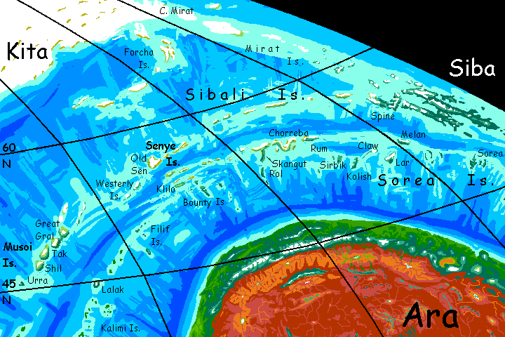
Across a narrow channel is the long T shape of Skangut, the largest of the Sorreas. The crossbar of the T is, like Chorreba, a long icecapped ridge; but the south-stretching limb of the T is low and ice-free--indeed, as fertile as much of Siba. Some 500 km long and about 100 across (300 by 60 mi), it's all conifer forest with a few glades. After the last windy week or two it seems paradise. Your cat restocks with fresh fruit and produce. Kakaleans won't sail on hardtack, weevils and grog! And no reason to, with such island-rich seas.
A few days west of Skangut is a strange knot of islands where the rift valley narrows so the Sibalis and Sorreas meet in one cluster, the Senye Islands. The largest, Old Sen, is unfortunately both northerly and mountainous; its heart has iced over and even the rim is windblasted and barren. You're glad now the crew restocked.
Klilo and especially the Bounty Islands are just a few hundred kilometers farther south, but their long low ridges, while snowy in winter, never glaciated. The shores, especially on the south side, are quite livable. The Bounties even have broadleaf trees. Denmark? Scotland? Cool and rainy, but another world from Old Sen. Altitude matters as much as latitude!
West of the Senyes, the rift and its attendant chains all start curving south. You can follow for a while, as the islands warm from Nordic to tropical, in the Artaho Archipelago--the Filifs, Lalak, the Kalimis, the Perazhis... they go on and on. Most trading ships do head on southwest--the mid-oceanic rift rises more consistently above water, creating a cluster of long green super-Azores sprawling over from the temperate zone to the equator. If you broke up a Portugal or two--maybe even a France--and scattered it over 5000 km of shallow sea, you'd have Artaho. Rich country. Practically Earthsea. A pleasanter tour.
But not our tour.
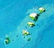
To complete your full circle around Kita, you must head northwest, back into foul weather. First stop: the Musoi Islands. Sorry they're mere silhouettes in the sun-glare in the big photo; here's a close-up shot on a better day. Ice on the heights--we're nearing Homa's ice-tongue and the weather's poorer for this latitude (45-50°) than in the Kiara Ocean behind you. But the Musois aren't quite the Aleutians--low trees on the sheltered southwest shores, especially the isthmus linking the halves of Great Gral (farther from the ice; real farms here), and the south shore of Shil and little Urra, both lower isles and thus relatively ice-free.
Musoi's neither a cultural oasis nor wealthy enough to have much to trade, but your catamaran can at least restock--smoked fish, berries, cold-packed greens and sauerkraut/kimchee, in exchange for copies of the newest books available back in Oak Harbor on Siba. Sound currency anywhere in this ocean! Places like Musoi don't get the regular trade that equatorial and subtropical island-chains do.
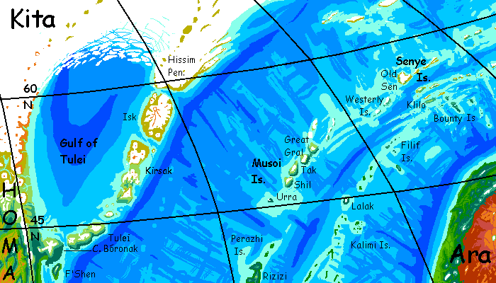
Still, it's galling to sail over 3000 km to travel just 2000.
But all dull things come to an end. On the fourth day, you sight ice-peaks to the northwest, then the boggy shores of Tulei Island. A long day's sail down its southeast coast, over the strait to Cape Bóronak. The Homan mainland!
Next day's a steady run down and around the Cape's southern head--real trees again!--farms! PEOPLE!--into Port Bóronak where you began, setting out on foot months ago. You're home!
There you'll notice that your travel journal and the local calendars are now one day off. Congratulations, Magellan! That discrepancy's proof you've circumnavigated the world--in a small, chilly way, at least.
LISTS AND LINKS: More worlds? Planetocopia! - dreams of other worlds - ecology - climate change - evolution - natural disasters - terraforming - sculptures and 3D art -
World Dream Bank homepage - Art gallery - New stuff - Introductory sampler, best dreams, best art - On dreamwork - Books
Indexes: Subject - Author - Date - Names - Places - Art media/styles
Titles: A - B - C - D - E - F - G - H - IJ - KL - M - NO - PQ - R - Sa-Sk - Sl-Sz - T - UV - WXYZ
Email: wdreamb@yahoo.com - Catalog of art, books, CDs - Behind the Curtain: FAQs, bio, site map - Kindred sites