World Dream Bank
home -
add a dream -
newest -
art gallery -
sampler -
dreams by
title,
subject,
author,
date,
places,
names
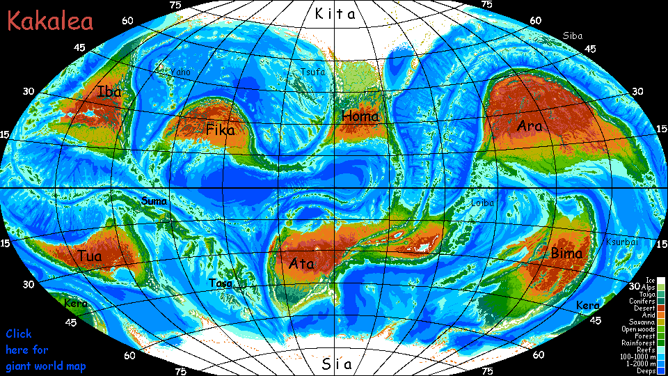
Kakalea:
SIA
by Chris Wayan, 2012-2015
for the penguins and my other fans in the Banana Belt, and
Hui te Rangiora, who sailed to Antarctica c.1400 years ago.
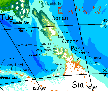
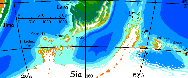
Kakalea basics--map--geology--
creatures--
Building Kakalea
More worlds? Planetocopia!
INTRODUCTION
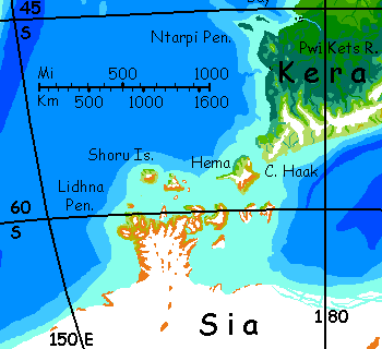
Sia is just Ice pronounced backwards. Its name is its fate--for the moment. But only for the moment. Sia's not quite centered on the south pole, and a young rift zone (south of the Tasa Archipelago, which it created) may soon push the icy continent further off the pole--"soon" as in "less than 100 million years." So don't wait up. It's gonna be a long winter.
But Sia still isn't Antarctica. It's twice as big, some 28 million square km (11.25M mi2). No, no, that's a good thing: not all of Sia's iced over--not quite. Instead of a lone peninsula groping outside the Antarctic Circle, where life's clung grimly on, much of Sia's coast is that far from the pole. Or farther--Sia has five large peninsulas (why have a great idea just to utter it once?) and all of them reach latitude 60°; two approach 50°! Their climate is more like Tierra del Fuego than Antarctica. Cold, windy, but habitable.
TOUR
For other continents we can sail round the coasts with a few ventures inland--a pattern common on Kakalea not just for trade but for culture; merchants bring goods and carry mail, floating theatrical troupes bring news and entertainment. But no ships circle Sia; even though its coasts are well north of Antarctica's and fewer glaciers calve into the sea, there are still icebergs. Not safe waters.
So for Sia, we'll follow an exploratory vessel as it attempts to circumnavigate the continent (and, thus, the planet, though at a high latitude) for the first time--a risky venture, despite its stubby, reinforced hulls.

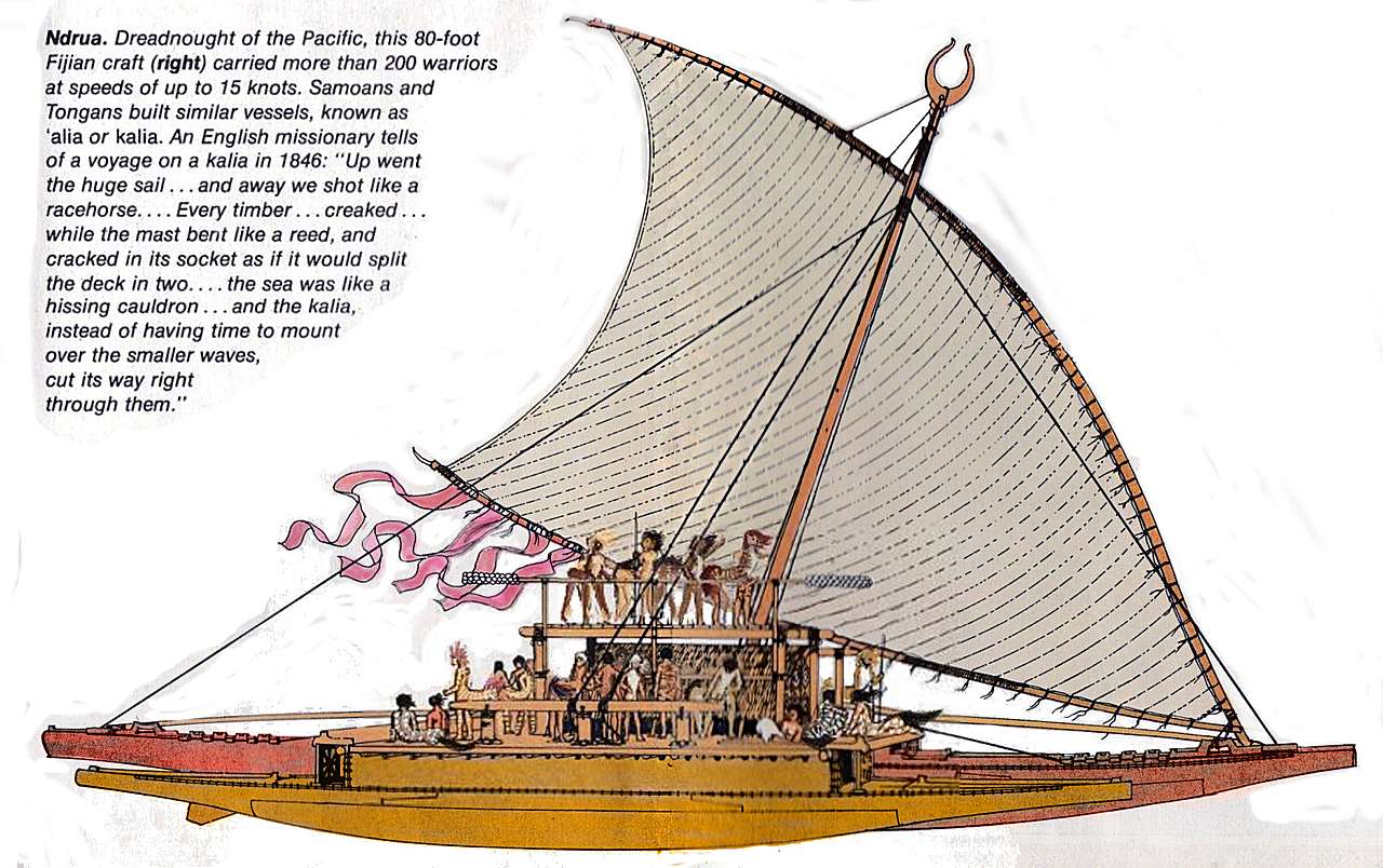
The Circumsia, based on a drawing of a Fijian ndrua by Herb Kawainui Kane, from a 1974 National Geographic map.
Yes, hulls. Plural. A single ship with decks straddling a big leeward hull and a smaller windward one--still massive, and heavily packed with stores. Most Kakalean vessels are catamarans or outriggers. The Circumsia (hm, that sounds like a painful religious rite! But that's how her name translates. Sounds more optimistic in Trade) is broader than most of our cats, and with a rather stubby lateen sail (wishbone-shaped)--Sia's icecap generates harsh winds like our Roaring Forties, so a standard-sized lateen isn't needed. She's barely 25 meters long, and even fully laden weighs well under 60 tonnes.
The Circumsia's no clipper ship or racing yacht by Kakalean standards, but even she can routinely tack 250 km in a day, and reaching or running before a stiff wind, 400 (and remember, Kakalean days are short, just 18 hours; she'd do 5-600 on Earth).
So the Orathians plan to try and circle Sia in a single summer, unlike Earth's early Antarctic explorers, who were slower and had to voyage a long way from their suppliers and outfitters. They had to winter over, requiring massively reinforced hulls and mountains of supplies.
But instead of a multi-year marathon, the Circumsia plans a summer sprint.
The Kakalean year's 320 days long. So this round-the-world dash will have a certain resonance for Terran readers who recall Jules Verne's Around the World in 80 Days. Though the Circumsia will be even more rushed--her eighty summer days will be short. But full of light. If not warmth. Antarctic summer!
Oh--one more difference between Earth's Antarctic explorers and this expedition: the Circumsia is Sian. Well, loosely speaking--the Sian mainland lacks much timber, so the Circumsia was built on wooded Doren Island off Sia's Orath Peninsula.
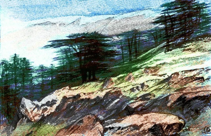
Timber above Southport, Doren Island, between Sia and Tua
But she was commissioned by the Orathian Longhouse (the peninsular assembly of village delegates) and Orathians form most of the crew. Rather than pale, all-male weirdos from the opposite hemisphere extending their maps (and plans for domination) of the world, this crew of sixty--males and females, light and dark, shorthairs and shaggies, singles couples and triples, even a few families with older cubs--is trying to unify and reconcile the fragmented cartography of their home.
So the Circumsia sets out from Southport Shipyard on Doren, sailing down the great island's west shore, then along the Gale Islands across Orath Strait... a trial voyage of just a few days.
Orath Peninsula and Doren Island (bottom)
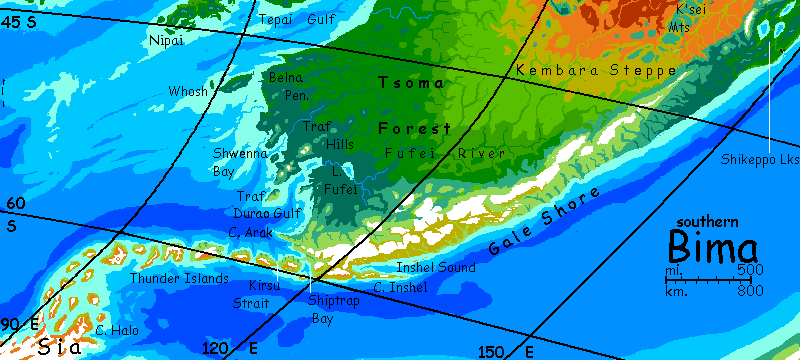
ORATH
First stop: home! The Orath Peninsula lies south of Doren. Bigger than Korea--probably twice as long, though it's hard to be sure; the base is hidden in ice. But the northern tip of Orath is cold but livable; it reaches 52° south, the same latitude as London. It's far colder--a great ice sheet lies to the south--but certainly not Antarctic in our sense.
Along the east coast, several hundred km of lowlands have sparse grasses, and hundreds more south of them are mostly barren--windward and windswept--but still ice-free. And the central mountains--ice-mantled volcanoes up to 3 km (2 mi) tall--shelter the leeward west. This is the true Orath: the ice-free zone here stretches well over 1000 km.
The west coast and the tip have scattered tussocks even on the hills, and true meadows in lowlands--even low woods in sheltered spots--more Iceland than Greenland.
This coast, and a few outposts in the windward east, are permanently inhabited--one of three Sian peninsulas that are. The Orathians are colonists, of course, from Doren and Tua--they didn't evolve here... but they are native in the sense they've born here.
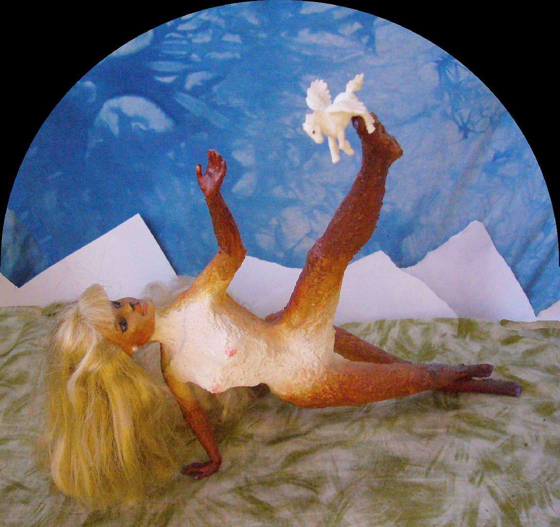
Riraa's fur cloak; a scene from Circumsia as played in Port Orath
|
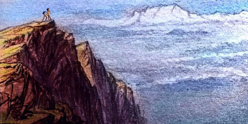
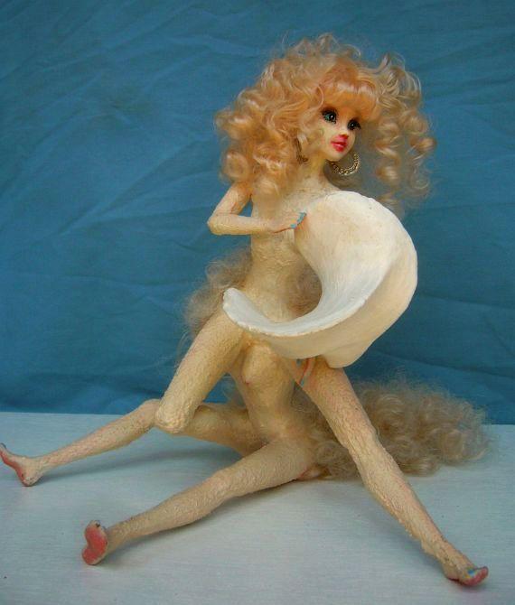
Or hatched. We don't know what species they are--yet. I said a crew of sixty, not sixty what. Details, details. Whether furred or feathered, they'll be large and shaggy--their Dorenian ancestors had to be. Though it's further from the pole, Doren's so mountainous it's not that much warmer than Orath.
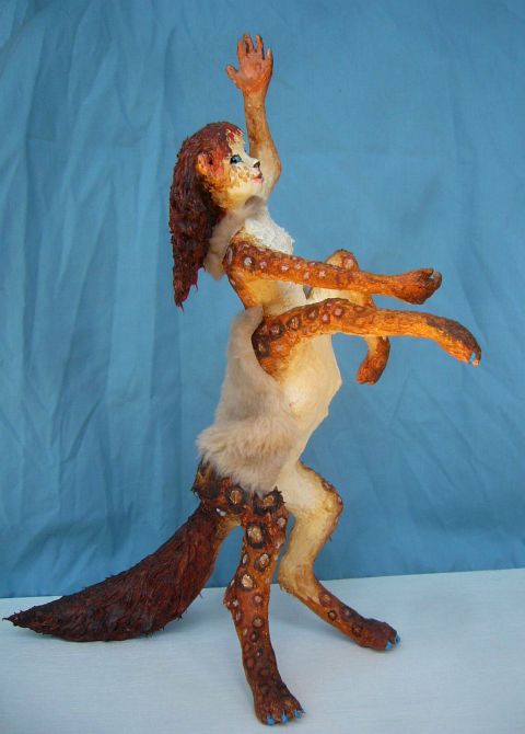
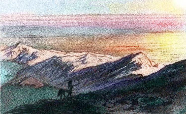
Oh, all right. We'll make them Barbies. Shaggy centauroid Barbies. Even thick fur is not enough--here's Riraa, one of the navigators, wearing a sort of scarf and cloak--well, more like a horse-blanket. This is about as clothed as a Kakalean gets; confined arms legs or tails make them uncomfortable. Oh--the rings are decoration; Riraa's natural coat does have spots, but nothing this elaborate.
From the log:
[If the following log entries look blocky, you may lack a font that looks hand-written. Tempus Sans ITC or Segoe Print are good; AR Cena, Monotype Corsiva and Gabriola are decent.]
DAY 1: We set sail on Summerday, longest of the year. That afternoon it gets hot for Orath; 18°C (64°F). A good omen. With luck, the southland coast may hover near or even above freezing for the next 80 days or so--as warm as it gets in Sia.
South along the shore of Katai Bay, in the lee of the Orath Range. Trees huddle, then straggle, then vanish. Late in the day, the grass grows sparse. So do settlers--and they're all on the coast. A few fishing villages. In the Barrens, the sea's the only sustenance.
DAY 2: no one. By noon, floe ice grows thick, then becomes a maze whose passages of dark open sea trail off, dead ends. 96°W, 59°S. We've hit the current edge of the ice shelf covering the southern half of Katai Bay.
We turn west along the edge, and run with the wind. Two islands rise to starboard. Volcanic, their heights seeded glaciers that have spread over most of the lowlands. Barren.
Oh, well.
Through the strait between islands and mainland. A long straight coast ahead--a bare shore, but rising to ice. Deep water, relatively berg-free; we run all afternoon and anchor off a point at evening at slightly less than 60° south.
DAY 3: Dawn, but a few hours later, reveals a broad crescent bay ahead, swept free of ice--the shore an ice shelf reaching south an unknown distance. No mountains in view save behind us. A long day's run, dipping south to keep an eye on the bay. By 62° south the edge runs due west; soon, northwest again. White hills loom ahead--some fingers of the mainland, some islands. We skirt the mass; no habitable land, not even much bare rock. Anchor at 117°W, 61°S.
Sunset brings news. Mare's-tail cirrus clouds above us turn gold then pink--but with startling midnight streaks of shadow. Somewhere over the horizon ahead of us, jagged black teeth between us and the sun. Must be 200 km off or we'd see them; but they're there.
DAY 4: By noon those peaks grope above the horizon. Volcanic cones. We run northwest until we near this toothy coast around 60°S.
At 59°S and 126°W, between two peaks, a passage--scarce more than a cleft, with savage crags--opens west. We enter to measure the bay. It curves southwest, then due south. We expect to see the icecap ahead, but the sound goes on. By sunset we receive a shock: the passage opens to a huge sea of blue and white--great flat floes reddening in the low light. The edge of a great ice shelf. And on the shore, barrens; sheltered by the mountains, ice-free. As are the inshore waters; winds push the ice out, leaving a broad road for us.
We head south a bit and anchor that night at 62° south, off a wide ice-free shore. Little grass and no trees, of course. Too far south for that. But the first anchorage fishers might use.
A curiosity. Heavy, but we cannot leave it. A great meteorite, or so it seems, grey, pitted and cracked, standing out amid these red rocks and white ice patches.
Proni's meteorite, a scene from Circumsia as played in Port Orath
Proni, one of the discoverers, shows off the meteorite. This looks staged because it is: it's a scene from the play Circumsia, summarizing the expedition's finds, a musical now popular around Kakalea; the scenery is so simply stylized because it's the original, hastily prepared scene from the Orath Harbor production on Autumn Day, with Proni played by Proni and the stone by the stone. All the ground-level images from the Expedition are either sketches or staged re-enactments; the Circumsia had no cameras.
DAY 5: the ice-free channel narrows; we head back north. Rather than re-enter the passage, we run on up the lee coast of this unknown peninsula. Two volcanoes, ice-mantled. Then a wall to the north, jutting west. Round its head. Anchor just north of the tip, in a windsheltered cove--back at 60°S. Unknown land some 200 km off mainland Sia, away from its pernicious influence! We have great hopes for the morrow.
THE GRASS ISLANDS
DAY 6: those hopes are fulfilled. On the northwestern lee side of this great ridge, grass flourishes. Low plains and hills. Due north another 150 km before we round a point and head east. Not easy, in the teeth of the wind, but we tack despite the tedium of unstepping the boom.
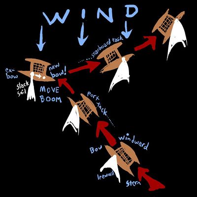
[The Circumsia, like most Kakalean ships, doesn't tack like a European ship at all, but like Polynesian catamarans--the bow becomes the stern! You don't speak of fore and aft, you speak of her windward and leeward sides; she's built with one side always facing the winds. There's a fixed mast and a movable one, which we have to call the boom, though it's stepped like the mast. But removable; to tack, you shift it to the other "bow", restep it--hard work--and the ship reverses course. So... the Circumsia's slow to come about, and takes fewer but longer tacks; but she reaches and runs faster than a (much larger, topheavy) clipper ship! Narrow catamaran hulls and lightly-built superstructures have advantages.]
Within a day, it's clear this is an island--Grass Island. The central ridge is ideally oriented to block the winds and trap sun, creating a broad wedge of lee shore 150 km on a side--cold but livable. North shore anchorage: 59°S. We drink to the sun and dance on the grass ashore. New land!
DAY 8: we follow the chain northwest. More treasures! Crags of red and white on the windward side hide a second isle 160 km long and half as wide. (100 by 50 mi). Mostly mountainous; narrower coastal plains on the lee side, but again, grass. Decent anchorages in coves, too. Habitable, certainly for fishers, and possibly for herders too. We name it Herd Island.
[No, no pun here on our own Heard Island. Just because the locations roughly match... very roughly. You are a geo-literate but over-suspicious reader. Plod would not stoop to Puns.]
DAY 9: the island arc curves due west. Islets and stacks all morning, but nothing substantial. Veer north of the chain; this pays off. Ahead, at 58°, a long island with a sunny north-facing shore, narrow but grassy, at least 200 km long (125 mi). We name it Long Island.
DAY 10: a long fast run past islets--mere tips of volcanoes--until a line of red-rock crags marches over the horizon to the southwest. It takes a day and a half to circle this mass and verify it's an island, the largest yet. The east face, barren, windswept rock. Ice-mantled heights. But the lee side has three long heads, and the twin bays between are good ice-free harbors with a little grass--less fertile than we'd hoped, but it is more polar; extending as far as 61° south.
We don't name it anything; it's known! Gultubu Island. The furthest windward that the colonists of Kogmi Peninsula have ever reached--a long hard sail to windward for them. If we're right, the next thousand km should be familiar from our charts.
DAY 12: Shorpa Peninsula--a ridge of crags running west for hundreds of km, a long days' sail. Their sunny north slopes are icefree, but these are rugged, stony hanging valleys and crags; little grass. 59.5°S, 155°W. There may be a second reason Shorpa's sunny side is so barren; the isles we found were far off the Sian mainland, but we're nearing the icecap again; Shorpa's glaciers are its first finger.
KOGMI
The Kogmi Peninsula is the largest and mildest of Sia's five great peninsulas. Like Orath, it reaches 52°S. We're talking actual trees. Woods only in sunnier wind-sheltered valleys, but still! Don't stow your parka away yet... but you could live here. And many unique Sian species do. So do settlers from Kera, the small but fertile continent northwest of here.
The Rotarbi Islands rise off the Kogmi Peninsula's warmer lee coast, stretching north as far as 48° south. The southern ones are Icelandic or Greenlandic; the northern, positively Danish. All five main islands are over 125 km long; some, two or three times that (75-225 mi).
Beyond the Rotarbis, the rise forks; two island chains stretch north, forming a V thousands of miles long. Small and scattered and mostly low, they're still pleasant if isolated places to live. Quite Polynesian in structure, like a sprawling version of our Marshall Islands, but climatically...
well, that's not the Circum-Sia expedition's job. Those isles are known and long settled. We have a long way to sail...
DAY 15: the Kogmian settlers have explored the lee coast well south; we expect few surprises. Run nearly two days west-southwest into barrens, then an ice shelf, then a blue-water gulf, open and navigable to 66°S. Sia's mainland retreats here, probably well past 70°; no sign of hills or the icecap to the south.
DAY 18: today we passed 180°W--or should I say east? From now on we're in a new hemisphere; our longitude decreases hourly.
DAY 20: at noon, near 65°S, 165° E, our swift run is halted by a massive ice-mantled mountain wall. The shoulder of Sia's third great peninsula:
LIDHNA
DAY 21: On up the rugged windward coast of what is surely Lidhna, though we have yet to confirm it by meeting locals. No steads yet. Understandable! A wary day and half, winding between volcanic islands, bare-skirted below great scoops and cones of ice. Still, already mosses and scattered tussocks streak and dot the rocks and flats with green. Late in the day we thread Onchar Passage, at 60.5° south, and anchor in the lee of Onchar Isle's great peak. The flats are green--a gladsome sight, the first meads since Kogmi. We meet herders here, who verify our reckoning is sound. This is Onchar, no Polar Hallucination. We are tempted to reach due north to the steads of Hema Island and the Shorus to top off our supplies; but Kogmi was less than a week ago. We're well stocked, and the isles well mapped. We hold brief conference, and decide to head west along the mainland. Also well known, but the shortest course back to our task: the unknown.
Lidhna, though colder than Kogmi, is also a refuge for Sian species waiting to resettle once the mainland drifts off the pole... though they may have a long wait. But even now, Lidhna's more fertile than our Antarctic Peninsula: it stretches further north, and Kakalea, for all its climatic flaws, hasn't suffered a recent Ice Age; this is as cold as Kakalea gets.
Even if we stabilize Earth's climate without severe warming, our Antarctic Peninsula may green substantially over time; it's still recovering from the last Ice Age. In the long run, if we prevent further Ice Ages, our Antarctic Peninsula could look much like Cape Lidhna, or even Hema, with its Icelandic farmsteads.
Hema, the isle just offshore, is as big as Tierra del Fuego, and considerably more fertile: its central arc of icy mountains shield the north and west from the biting winds off Sia's icecap. Wide grassy downs and plains; even some forests in sheltered valleys. The same is true of the Shoru Islands to the west, and even, to a lesser extent, the Lidhna Peninsula to the south. Trees on the antarctic mainland! Few, haggard and low... but still amazing.
Though the expedition found all this life annoying, too.
DAY 21, LATE: The wind-sheltered side of Lidhna, though it has meadows, bogs, and berry-thickets, also harbors (in the warm season; and our voyage would be possible in no other) midges, mosquitoes and horseflies of great size and persistence. We swat, flick tails and kick, but nothing does much good.

Flora kicks a Lidhna horsefly: a scene from Circumsia as played in Port Orath
TO CAPE HALO
Most southeast shores on our journey have been wind-sheltered. But past 60° south, Lidhna has only low grass and barrens. The icefield on the peninsula's spine is extensive and more broadly linked to the main polar cap than Orath's or Kogmi's. Cold dry winds can be generated locally, too! And so...
DAY 22: round Cape Lidhna proper, at 60°S, 159°E. Within hours of heading south, the grass tussocks and moss straggle and fade; we're in barrens again. At least the flies abate. Lidhna's so close to death! Yet life hangs on.
DAY 23: at 63°S, 157°E, the coast bends sharply. We run due west along an ice-bound shore all day. It slowly turns southwest; we creep poleward daily for two days, passing the Antarctic Circle at 68°S. A day later the shore bends due west, around 70°S; our nearest to the Pole yet.
DAY 26: or so I call it, but the sun never set; merely wheeled low like a bird wary of perching and flew round us... We're at 123° east: a complex of low rocky capes, pushing us north toward the Circle again.
 DAYS 27-29: We spend three more days mapping sounds and heads. One near-island pushes us north right to the Circle. Deep water offshore; no hint of habitable islands further north. A fascinating region, much of it ice-free, but 69° seems too far south for land life; even now in summer, afternoons barely thaw.
DAY 30: the hills and fjords recede southwest again. Deep water, pack ice but not a shelf--at 72°S! But our longitude, 100°E, made us expect we'd be in charted waters again--the fourth peninsula, south of Bima.
DAY 31: we were impatient, that's all. Mountains appear to the west as well; this seacoast is no more than the east shore of a huge fjord. We head north all day.
DAY 32: sadly, our poor charts for this area are confirmed: this cape does run up out of the Antarctic Circle, but just barely: the north tip is at 67°S, 92°E.
A halo of mountainous isles surround us, from northeast, north, west, southwest. A mere string of dots on our Biman chart--clearly wrong. Not a simple chain! We sail north through the archipelago, charting as we go. Beyond the five volcanic isles visible from the Cape--we name it Cape Halo--a sixth appears, to the northwest. Next day--there are days and nights here, which we've grown unused to beyond the Circle--we find twin chains heading due north.
A day and a half later, and over 500 km north as the gull flies, the chains fuse at a greater island and then turn, a single chain now, east toward Bima, a mere 1600 km away (1000 mi). This island appears to be the outflow of a volcano much larger than its kin. It's the only one named on our Biman chart: Mount Thunder. The isle, and those to the northeast, have icy heights but green shores; we're at 61° south, and, more to the climatic point, a long way from Sia's icecap. We know from our Biman map that the isles ahead for days are still treeless, unsettled, and rarely visited; but known.
DAY 35: anchored in the lee of Thunder, we crouch in council and decide to return to our mission: the unknown. We'll sail back down the west side of the archipelago and on round the other half of Sia.
BOREDOM
A long maze of barren and icecapped isles and heads in the lee of Cape Halo. We spend a slow fourday charting. At last we emerge; a straight coast southwest. Run free for a day... we're nearly at 72°S again. The only explanation for this clear water, even at high summer, is that the main Sian icecap is blocked by the mountains of Cape Halo and this leeward maze.
DAY 41: Islands at 70°S, 75°E. Two days charting--a diagonal chain northwest; two over 100 km wide, two half that, and many islets. All are barren, but for the ubiquitous nesting birds.
DAY 43: west along an ice shelf at 70-72°S. No mountains inland--Sia's true shore must be far south of us. Two days' run.
DAY 45: around 60°E, the shelf's edge veers northwest. Two slower days--much floating ice--leading us back north to 70. Late that day, a large island, its shores the first icefree land we've seen in 1250 km (750 mi). Likely a shield volcano, icemantled--like a lost stray from the flock around Cape Halo. We circle it in the next two days to chart it. Oval, 160 km wide, 200 long (100 by 125 mi). The northeast shore is icefree but barren: 68°S. We dub it Predictable Island. Possibly we're getting bored.
A day west, our boredom ends.
ASTONISHMENT
DAY 49: a wall of rock and ice ahead. Still a featureless ice shelf south; we're far off the Sian mainland. We've either found a huge island or an unknown peninsula; more likely the latter, as the great rock fangs hulk off to the southwest over the horizon. We sail north along the windward shore. And north. And north!
DAY 52: the barrens are barren no more. Grass, moss. We have great hope of the leeward shore.
The cape's tip is at 62°S., 45°E. We name it Cape Astonishment.
A great fleet of islands to the northeast; long ridges, not high enough to glaciate. Their lee shores are grassy; moss in the cracks above, contrasting beautifully with the red rocks. It's not Orath or Kogmi, but life! We name them the Life Islands.
Later, the Expedition's name for this archipelago had to be rescinded; for it turned out these islands were known! Just not reported. Fishers from the Solitude Islands (over 1000 km to the north) had, in the last century, occasionally summer-camped here, calling them the Sphagnum Islands for their mosses. Indeed, they knew of one more isle that the Expedition missed--west of the others, and a little north, it was just over the horizon from the Circumsia's course.
No one settled the Sphagnums year-round; the islanders were themselves recent colonists from the larger and much warmer Oriza Archipelago south of Ata. The Orizans had a tough enough time adapting to the cool green forests and long winters of Solitude--and as recent settlers, they faced no population pressure.
So the fishers didn't explore too much. They never realized Cape Astonishment was any more than the largest but furthest and least useful of the islands. So Sphagnum was acknowledged and Life struck down... but Astonishment stands.
As does the Circumsia's achievement. The lee shore of Cape Astonishment is icefree for 1000 km. Its grassy north, though treeless, is overall more fertile than Cape Lidhna, and more extensive. Even though Astonishment's a bit closer to the pole, it's much further from Sia's icecap.
The Orathian sponsors of the expedition and the Lidhnan All-Talk [nearest thing to a Peninsular government] are jointly planning a fishing, herding and agricultural station on the west shore of Astonishment--a test village, really.
Moral: discovery without publicity is as empty as publicity without discovery.
BARRENS
Then comes a very long stretch indeed, on the map--fully a third of our journey. But not in days, or in memory.
DAYS 53-56: a fourday spent charting the isles at the base of Cape Astonishment--long, low, barren red ridges with little ice between them, despite their latitude at 69°S--we've seen other "dry canyons", but no coast with so many as this. Presumably they're snow-starved, lying downwind of the high, narrow spine of Astonishment; much as coastal mountains cast a rain-shadow inland. Snow-shadow?
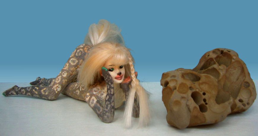
Dlana shows a huge bone or shell found west of Cape Astonishment
|
DAY 57: a long steady run west. Through a strait between mainland and a last great island, from 10 to 5° E (still 69° south). The northern, sunnier shore is ice-free but barren.
Here Dlana stumbles on a curio to rival our meteor--a gigantic bone, hollowed and light enough to lift easily. A vertebra, perhaps, or a piece of skull, but why such spiral shapes?
And of what beast? If in proportion, a ship-sized monster. Nothing like is has ever been seen in the seas around Orath or Doren. More proof that the peninsulas do divide the south sea into life-provinces unseen.
DAY 59-60: west along a straight coast where the ice calves into the sea.
DAY 61: Having crossed the Prime Meridian, we are now at 70°S and 1°W. All today (and it nearly was a true day now: the sun set briefly at midnight. Summer's ending!), the coast crept north a little, extending nearly to the Antarctic Circle around 30° west. Yes, we travel that swiftly; in dark water with few bergs, the Circumsia runs a longitudinal degree in well under two hours; but remember, ere you deem the builders wizards or your chronicler a liar, that the meridians crowd tight, this close to the pole; scarce 45 km apart!
It's hard to make an exact comparison here--18-hour days, larger degrees than Earth's--but I estimate this to mean the Circumsia was doing nearly 25 kph--14 or 15 knots. Fast, but quite possible for a catamaran in a stiff wind--such as you can't avoid off Sia! But the passage was written for Kakaleans. Their Age of Sail has lasted millennia; a native reader thinks in "degrees per day" as we would in miles or km per hour. But most Kakaleans live near the equator, where a degree east or west is full-sized, not the squeezed little thing it is near the poles; so unless our native reads closely and notes the implication of that "longitudinal", she'd hear a claim that the Circumsia was nearly three times as fast as any sailing ship in Kakalean history! She'd think the chronicler a liar, until "but remember..." brings home the point that conventional measures fail near the poles; implying, I think, that low-latitude readers should not judge other narrative oddities too hastily.
Sound advice for Terran readers, too.
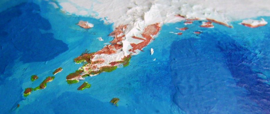
DAY 62: at 45° west, the coast turns rough indeed--fjords and heads in quick succession. Islets close in. But a far greater land on the northern horizon. We come about. Such a sighting was hoped for; not because any ship has ventured so far south, but because the southernmost Tasa Islands are due north of us now; except for Doren Island, the nearest land of any real size to Sia. The rift that created the islands runs along their eastern edge; whether it extends south to as far as Sia was one of the questions we'd come to explore.
DAY 63: the island to the north is about 180 km long and half as wide (110 by 55 mi) at latitude 67-69° south. Craggy islets trail as far north as 66°. Alas, all are barren save a little grass on the northwest shore. But fruitful to the mind if not the body. For this set of rugged north-south ridges looks much like the southernmost Tasan Isles--stripped bare of the verdure the Tasas are famed for.
And when we return to the mainland coast, the "fjords" suddenly look not ice-carved so much as a continuation of the island's north-south ridges, suggesting the Rift does enter Sia.
DAY 65: further evidence! The land falls away south. A deep black sound. We head south a full day, past a head we expect to be the end, but yet again the land falls away. By midnight, the sun glares low over pack ice thickening to a sheet; we come about at 51°W and just past 72°S, the southernmost point yet attained, still with deep water under our keels. If not a Rift, then what?
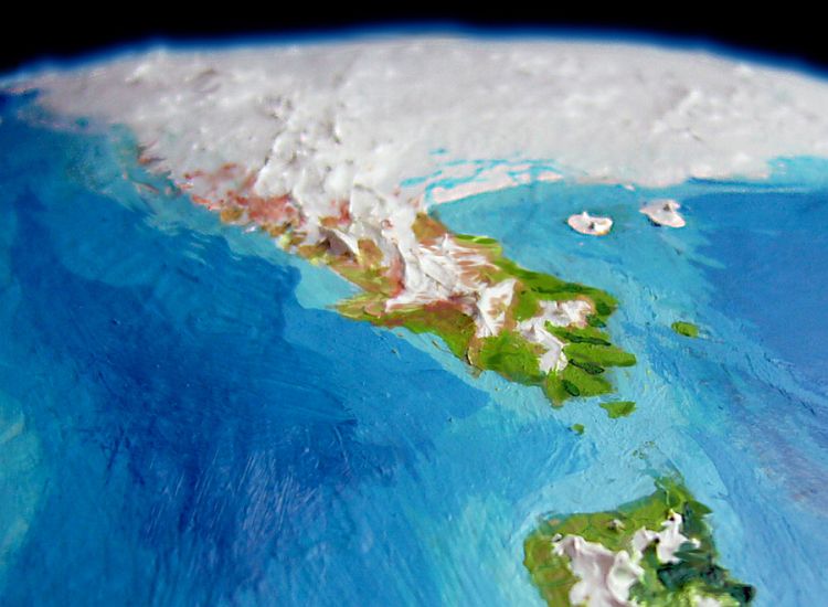
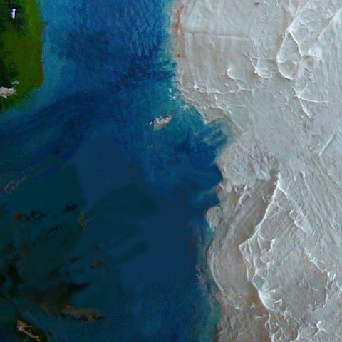
It's easier for us, of course. This satellite photo shows the Tasa Islands in the lower left (faintly!--sorry, it's dusk down there). The Rift slashes diagonally, gouging bays into Sia's coast, then vanishes under the ice; but the great mountains flanking it are visible in the upper right. The Rift curves east to emerge again as the backbone of Cape Astonishment. This wedge of Sia may be splitting off! If so, the bulk of Sia may indeed be pushed slowly off the pole. Not Sia proper, but Kogmi and Lidhna and the small continent of Kera would benefit first, slipping north into warmer waters; but eventually, even this frigid Sian coast would thaw.
DAY 66: we thread through floating ice--low slabs, not bergs. A few hours later, the water grows paler, shallower--icy ridges rear before us and off to port. A blunt cape we name Cape Angle. Round it, the ice mounts higher, dropping in a great wall to the sea. Here it seems there's no snow-drought. A grand, severe landscape of drastic simplicity.
Hours pass; degrees pass. Only a few bergs, but huge ones--turquoise castles, fantastically carved, higher than our masts; the first on such a scale. Since only a tenth of a berg rises above water, that implies ice mountains lurking beneath. Their calving must be inconceivably violent; the wave alone, even at a distance, might well drown us. We bear away from the deadly shore.
In the high fifties--degrees west, I mean, not south--another ice wall, far too high not to be stone-supported. It does look like the ridge to be expected on the far side of the Rift. This high icemantled peninsula runs north nearly to 68° south, ending in a ragged succession of capes and calving glaciers. Though we're just inside the Antarctic Circle, the sun sets long before midnight; the ice coast looms that high. Well, and summer's ending. We veer north a bit, back into the low sun, and run west across the mouth of a bay. Open water south to the horizon, where an ice shelf gleams and distant hills rise slowly to the cap. White and blue and endless wind.
DAY 68: west to the far shore. Again a massive wall--the icecap thick, fed by sea-winds. We can only go north. Well, north all afternoon, northwest all evening, west all morning, then northwest nearly two days, twisting through an obstacle course of bergs--big ones at first, then lesser stuff as sea-stacks and islets appear, blocking all but the flattest bergs.
HOMECOMING
DAY 71: we're in a hurry now. It's near fall now by our reckoning, and this miraculously fair summer can't hold much longer.
DAY 72: it doesn't need to. Bare rocks appear in coves, then along sunward ridge-faces and windswept ridgetops. Three days out of the rift zone, the ice has retreated to the heights, valleys have icy streams, and traces of green streak the bottom lands. We're at 90° west and 58.5° south.
DAY 73: And north! And north! Rugged mountains, then a great valley with a winding stream. Meadows dotted with red and brown greep
[the dodolike local equivalent of sheep, domesticated for their warm feathers and copious eggs].
The first settlement we've seen in months--since Lidhna, two-thirds of the way round the world. Chongra Valley on Orath! We're nearing home.
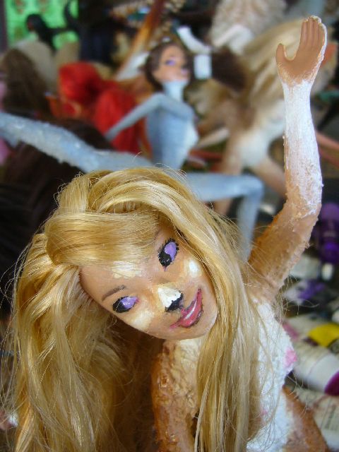
Filia at the Autumn Dance, Orath Harbor
|
DAY 74-77: We relax a little, now that it's clear we won't starve or be crushed by bergs--calculations of longitude are all very nice, but not quite as convincing as seeing grass, fresh water, friendly faces.
Besides, all Orath helped build the Circumsia; so after we round barren Beak Point, and enter the relatively sheltered northern third of Orath, we take it slow, pulling into every port. Formal presentation of findings to the Longhouse will come later. We want a little welcome, and they need to know we're home.
DAY 78? We arrive in Orath Harbor on the 78th day by our reckoning. Though we're startled to discover our tally is one day behind the calendar! Well, Krashku, our best navigator, isn't startled; indeed she wagered it'd happen before we set out. To explain it, she led us to the globe in the Merhorse Inn, walked a foreclaw round the globe to mark our course--and turned the globe not at all, very slowly, faster... Always a one-day discrepancy. Try it yourself.
What matters to us is that we anticipated a full day to recover from all those welcome-home parties before the Fall Equinox. Wrong! The Autumn Dance is tomorrow. Oh, well.
No matter what the species galaxy-wide, if it can metabolize alcohol at all, there's a mysterious polar penchant for liver damage from binge drinking at seasonal festivals. Consider Icelanders, Norwegians, Russians...
Oh, well.
But for once, it's not a sad "Oh, well." Home, alive, with friends and lovers... now and then, even on Kakalea, you get happy endings.
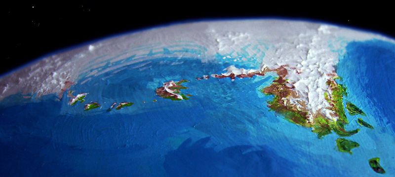
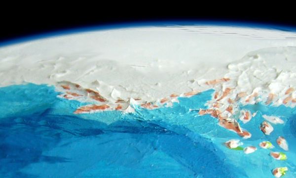
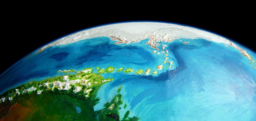
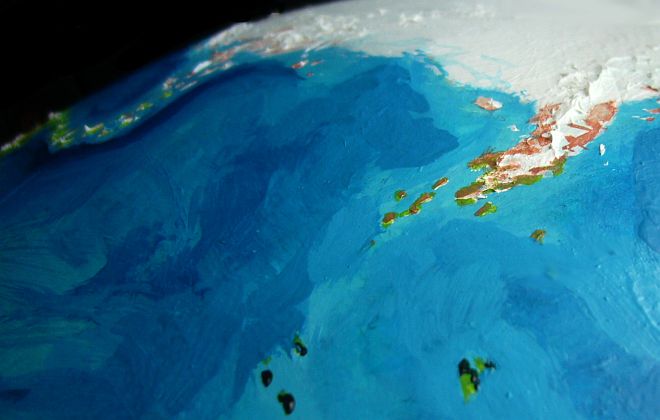
I apologize for the following big, blah, underexposed orbital photo (the only way I could catch Sia at all, given its icy glare) stuck here at the end. I did want to give you an idea what the Circumsia Expedition faced, unknowingly; but I didn't want to spoil their discoveries by making you omniscient, either.
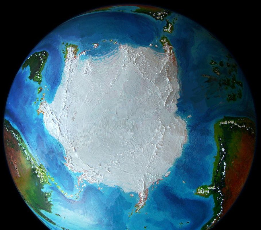
When contemplating those coasts, remember--Sia's twice the size of Antarctica; the ice reaches much farther from the pole. Why? Kakalea's no colder than Earth. But given a cold landmass, icecaps, well, snowball. It's oceans that tame ice.
There's an upside to Sia's appalling scale. Those habitable peninsulas are also far bigger than they seem.
But so's the central icefield. Sia is a true Kakalean landmass! Friendly fringes, deadly heart. No 800-mile dash to the South Pole would work here. Try dashing several thousand kilometers--and back.
Better yet, don't. Even on Earth, such treks anger the ice-gods, don't they, Mr. Scott? The Circumsians kept their ambitions realistic--and survived. Ursula Le Guin (who knew her polar treks: see the latter half of The Left Hand of Darkness) recently wrote an interesting essay on modesty--a Roman concept, originally: modesta. It did not mean humble or prudish--Christian clerics corrupted the meaning later. By modesta the Romans just meant realistic. Unpretentious, practical actions respecting the limits of your resources.
The Circumsia Expedition showed modesta.
My human readers should now go look up the Greek word hubris. I begin to think those words are cognates.
Oh, well.
 Kakalea basics--map--geology--
creatures--
Building Kakalea
Kakalea basics--map--geology--
creatures--
Building Kakalea
LISTS AND LINKS: More worlds? Planetocopia! - dreams of other worlds - ecology - climate change - evolution - natural disasters - terraforming - sculptures and 3D art -
World Dream Bank homepage - Art gallery - New stuff - Introductory sampler, best dreams, best art - On dreamwork - Books
Indexes: Subject - Author - Date - Names - Places - Art media/styles
Titles: A - B - C - D - E - F - G - H - IJ - KL - M - NO - PQ - R - Sa-Sk - Sl-Sz - T - UV - WXYZ
Email: wdreamb@yahoo.com - Catalog of art, books, CDs - Behind the Curtain: FAQs, bio, site map - Kindred sites