
Kakalea:
TASA ISLANDS
Only outline plus maps
by Chris Wayan, 2012-2015
for the extinct Tasmanians
Kakalea basics--map--geology--
creatures--
Building Kakalea
More worlds? Planetocopia!
Kakalea:
TASA ISLANDS
Only outline plus maps
by Chris Wayan, 2012-2015
for the extinct Tasmanians
Kakalea basics--map--geology--
creatures--
Building Kakalea
More worlds? Planetocopia!
The Tasa Archipelago is big; at least as big as Indonesia and perhaps as big as the USA east of the Mississippi--it depends where you draw the boundary. The Tasas rise southeast of the almost-continent of Suma; if you start right offshore, then the Tasas are nearly three million square kilometers (over 1M sq mi); three-fourths that if you exclude obvious satellites of Suma--there is a gap between these and the main Tasa cluster. Great Tasa, the archipelago's heart, is almost as big as New Guinea; nearly half the area of the whole cluster.
The Tasas are basically temperate--rare on Kakalea, where most of the habitable coasts are subtropical. But the archipelago sprawls, and sprawls generally north-south, so climates range from subtropical through Mediterranean, temperate, Nordic and subpolar.
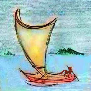
The isles are close enough so even modest boats can easily run its length; we'll book passage on a smallish catamaran and circle the Archipelago.
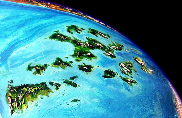
In the photo, taken in orbit over Suma, the south pole is to the right, Tasa central, and the deserts of West Ata to the upper left. Note how rugged the archipelago is. Ice-capped peaks run down the spine and main arms of Great Tasa and many of its satellites. Tasa is a region under pressure!
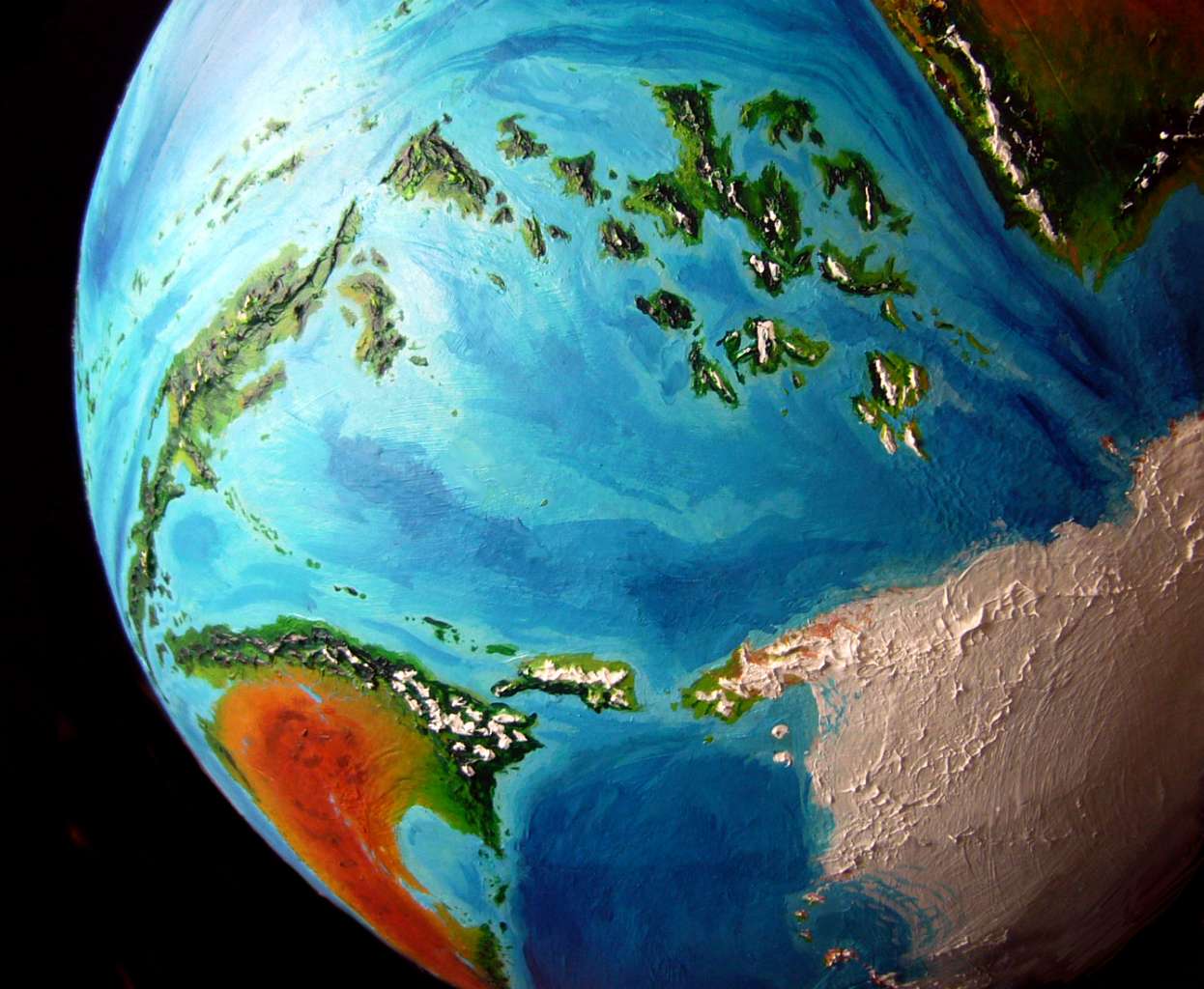
Below is a higher-orbital shot from over the south pole showing the region as a whole. It forms a great leaf- or lens-shape (left-to-right in center), suggesting Suma and Tasa ride atop their own tectonic plate reminiscent of our Philippine Plate, though larger. The trench and ridge creating east of Suma clearly extends east of Tasa, too; the western plate boundary runs along the Kizmida Islands (lower left), the huge Isle of Koren, and equally large Orath Peninsula on the antarctic continent of Sia (lower right). The southern Orath Mountains are buried under Sia's ice mantle, and the Kakaleans haven't traced them very far--they're generally not polar explorers. But this space-based shot shows the Orath Range extending under the cap to re-merge with Suma's riftzone south of the Tasa Archipelago (far right).
Our itinerary is still skeletal. But at least we have decent maps now, and an outlined itinerary.
The general route and direction of the tour were inevitable; there's only one logical choice, given the prevailing winds. We'll sail clockwise, from...
Cape Shinsa, the northwestern tip of the Madagascar-sized island of Hin Shoi. This almost-continent has a sunny, open (but not desert) west, a mountainous spine, a cloudy, drenched south and east. Just sailing down one coast will take days--this section will expand a lot.
We sail east along the sunny north shore, then south to Cape Tuka. This east coast isn't rainforest, but certainly rainy and emphatically forest. Few clearings. The mountains inland are mostly 1500 meters or lower (5000'), and snowfree, but they're steep and relentless--wooded ridge after ridge, nowhere open, nowhere flat. Fog-dragons writhe through canyons and cling to ridges.
Most people here live in shore-villages or the rare riverbottom wide enough to get much sun--mostly deltas. Inland, populations are sparse--just occasional miners, specialty loggers and woodcarvers, berrypickers (a sort of hot-sweet-sour huckleberry common on sunnier ridgetops is famously healthy) and mushroom hunters--berries and shrooms, dried, are prized and pricy exports.
From the tip of Cape Tuka we say farewell to the big island and sail southeast to...
Tropical Suritu. Lower and gentler than its neighbors, Suritu has no peaks to snag clouds or block storms; hence, no true dry or wet side. Rain is moderate and woods patchy--opener on the northwest coast, perhaps, but there are no great stretches of savanna as on western Hin Shoi; woodsier on the southeast side, but no true rainforest. Then...
Azar, warm and Mediterranean--except for the central mountains where several snowcapped volcanoes reach 3-4 km in height. These cast a small rainshadow; while not extensive, the savanna on the west coast is nearly treeless--the nearest thing to a desert in Kakalea's largest desertless region. Not that Azar as a whole is any drier than Suritu--the eastern slopes are rainforest rising to sunless cloudforest, then alpine fern-fells. Next we sail southeast to...
Cape Tel and the Sun Coast on Great Tasa, perhaps the pleasantest land in the Archipelago for Terrans, with its sunny beaches and open landscape of meadows and groves. This is the driest stretch of Great Tasa. Unlike Suritu, the big island has a formidable mountainous spine, blocking storms from the south and east.

The Inland Sea, zigzagging from port to port on Great Tasa, Natwi and Mokari (which may take weeks. Dense population, high culture). These three isles, while huge and fertile, are mostly mountainous; the wealthiest ports are those with wide floodplains behind them. Some of the largest:
Kirash Bay. The north end benefits from trade over the mountains, from the Sun Coast.
Rukap Plain, dominating the Inland Sea region by sheer size of its hinterland--a huge, fertile flood plain.We'll skip Kanshu Inlet, similar but smaller, and North Bay on Natwi, ditto... but we'll have to sail east past the little ports of rugged Cape Thol and the microscopic ports of Cape Jal (sea-cliffs so relentless there just isn't room for a city--even Kakaleans aren't mountaingoats) to reach...
South Bay on Natwi, nearly as big as Rukap Plain, if less central. A bit drier too, as it lies in a slight rainshadow, so Natwians raise different crops--the two regions trade a lot.
Several days southwest past Dark Head and along the southeast coast of Great Tasa. Fertile but hilly and exposed to southern gales in winter. The Kaura Mts loom inland. Between water and ice.
Slip north of Lirlak through the strait and into Feli Bay. Here we've entered the true temperate zone, with at least brief snows down to sea level in most years.
Back east several days. There's no simple course in the Inland Sea! You'll always miss something. The austere south shore of Lirlak, with its cliffs and pines.
Stop in at little Tol (little but central, and thus in the know: a veritable Isle of Roke, for Earthsea readers). This being Kakalea, you don't just restock on perishables and catch up on shipping news and update your charts for South Tasa, as your navigator insists--you also attend to that other essential: the whole crew goes to see Bergia in her latest erotic dance-narrative about the Southlands--the drama of their slow colonization and development naturally gets her (being a Kakalean) hot.
Or as hot as you can get in south Tasa.
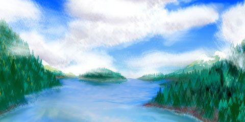
Always that little anxiety. Not Edvard Munch, not Russian gloom--Kakaleans are too present-centered and sensual to get that guilty or grim--but the somber greens of the set reflect something real. We're mortal. The snow will come. Do you still love me?
On to Jom Valley on Mokari--huge, the third great economic center of the Inland Sea after Rukap Plain and South Natwi. Big fertile bottomlands, but distinctly cooler, with a narrower spectrum of crops. Orchards all over. And, as your steerswoman says, "more conservative theater".
The ragged coast along the Lepcha Peninsula--rocky heads and little coves. You find the scenery romantic and the folksongs in the pubs charming, but your crew grumbles they're clichéd. Fuss, fuss. The better-traveled sailors are, the tougher they get as critics...
Between Mokari, Piao and Kilai--slightly melancholy coasts. Perfectly habitable temperate lands, but shadowed a bit by the warmer and more sophisticated shores of the Inland Sea to the north... Forests grow dark and piny, farms and orchards smaller, winters white. You sense Bergia's theme even now, in high summer.
Southwest to Cape Tail on Piao. Maybe detour a little west along its sheltered north-facing shore, the warm side, restocking before heading into the harsher lands to the south...
Southeast now, to Kilai. Misty, drizzle every other day even in summer. Huge hoary trees. Fishing villages. The interior's unsettled.
Argh! This outline is like giving one sentence to cover, say, Denmark or Quebec or Belgium. Ridiculous.
Beyond Bare Point. Further south to...
The chilly Leeward Isles. Wind, wind and more wind. On Hiru, low trees at first--scraggly and groping. Then none--the central hills cast a rainshadow. Distinctly Patagonian.
Stony, windy Tsil has some grass at least, but it's a dreary coast. Tsil's spine isn't that high; this isn't a rainshadow problem. It's a windblasting problem.
Rounding Chrr at the Leewards' tip, near sixty south, the storms shift from rains blowing up from the northwest to blizzards or cold dry gales from the southeast, off the antarctic continent of Sia. In those desiccating, endless salt-spray winds, poor Chrr is mostly cold desert, a bit like our Tierra del Fuego. Our catamaran rides those gales hundreds of km a day, west to...
Hwin. Harsh... but not all equally harsh. Fair Bay on the north shore is a blizzard-haven facing milder northwestern winds and rains. Only a little warmer, but much wetter--as dark-forested as southern Norway. Next...
The Tolwin group. We'll be tough and tack east, into the wind, between Tolwin's stark, mountainous southern coast (definitely Norway!) and Orchard, a rather quixotically named island settled only a few centuries back and still greening. But it's more honestly named than Greenland; there are producing orchards now (and even small vineyards) on the sheltered north shore at least.
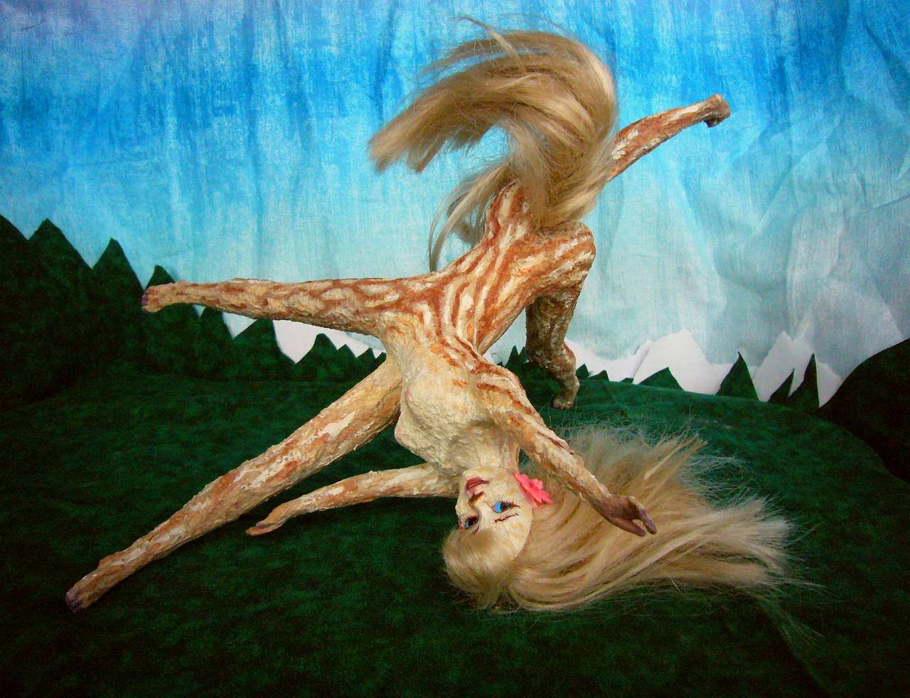
Bergia's subtheme of settlement and frontier living was realistic. The northern Tasas were inhabited for thousands of years, but the south is raw and young. Kakaleans are heat-adapted and dislike wearing clothes--the bindings feel itchy, rub their fur the wrong way, make them restless. So they've been slow to penetrate perfectly fertile temperate zones. They're slowly doing it, by a sort of nonfatal natural selection: those who CAN tolerate cloaks and ponchos, plus those with naturally shaggier coats, tend to move south.
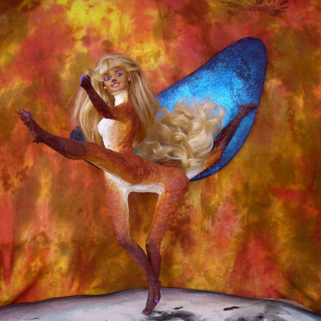
Below, Bergia the southerner looks short-necked, busty, muscular and shaggy, compared to equatorial people like tall, slender, short-pelted Zara (left) or Shya (right).
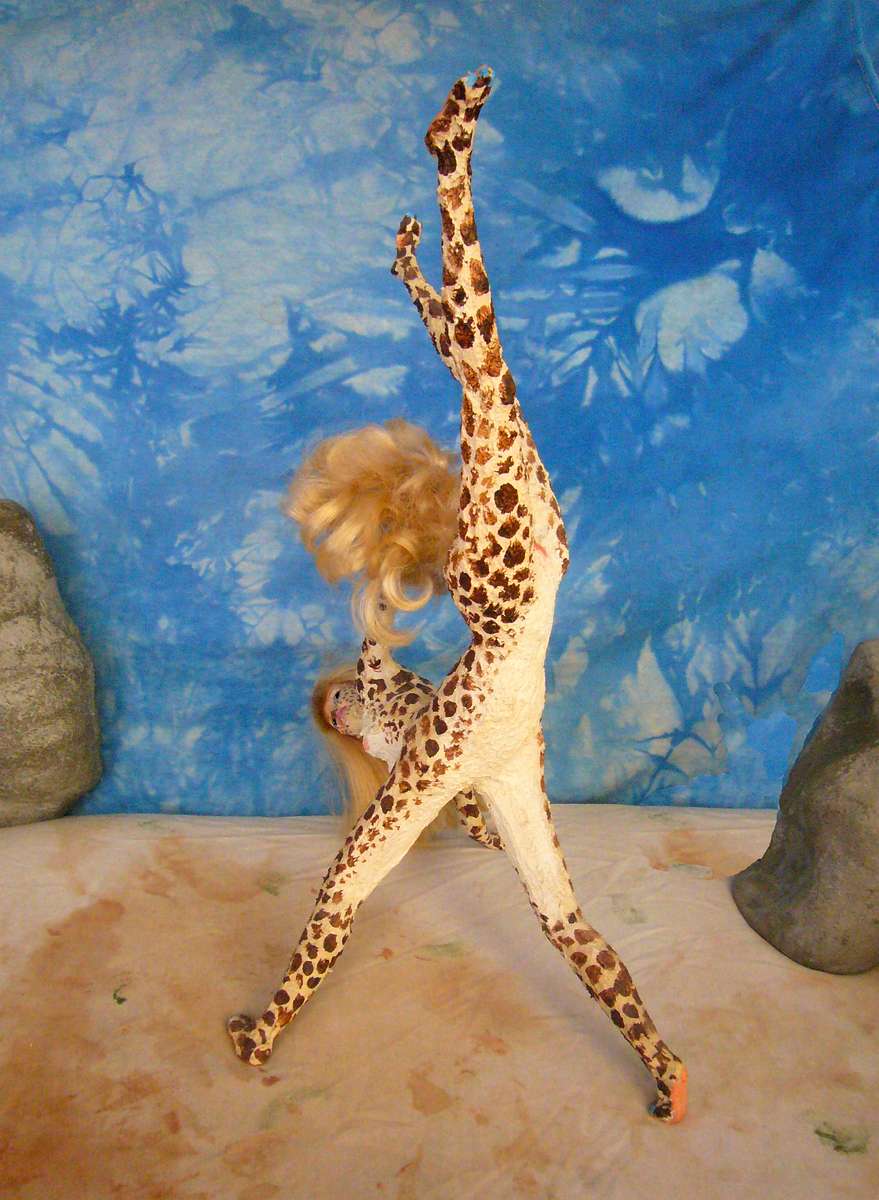
Zara in Flirt with the Sun |

Bergia, stage portrait |

Shya, in My Savanna Jewels |
North all day past Cape Aspen--with just as many orchards as Orchard, you notice.
Across the mouth of Fruit Bay and round the delightfully named Fruit Head ("where in the world is Carmen Miranda?")
Up the sheltered shores of Nurthoi Strait. Positively civilized!
At the northern tip of Tolwin, let's sail east to Crimson Bay--a little out of our way, but worth it for the scenery. It's not named for some bloody battle staining the waters red--Kakaleans have many flaws, but are less violent than humans (evolving from herbivorous herd animals will do that). No, it's the hills. The island has a climate much like New England's; in fall, hardwood forests here turn gold, then flaming red, inspiring singers, poets and dance troupes all over Tasa. And of course pulling in tourists.
From the mouth of Crimson Bay we reach northeast to...
Great Tasa's west coast, stopping in the dozen ports of South Sea and Foi Bay... Like the Inland Sea on the far side of Great Tasa, this is a densely populated strip, one of the richest in the Archipelago--indeed, in the hemisphere. So this section will eventually expand a lot as Tasan culture comes into focus.
A detour to fertile Thwei, the Garden Isle. The least mountainous of the major islands--even the inland valleys are snow-free most years. Other Tasan islands, though lacking central deserts, still manage to mimic Kakalean continents (fertile shores, barren hearts) using ice instead of drought. Not Thwei! The one isle densely populated from shore to shore. Much trade with the South Sea coast and the isles to the north.
On to Horunsu, with lovely farm country rivaling Thwei's, below jagged snowy mountains. Though scenic, they discourage farming, transport and settlement. Horunsu is nearly as big as Thwei, yet has only three-fifths its population.
Northeast along the spectacular cliffs of rugged little Spine--a coast that lost its island. Seabird-paradise!
Back briefly to Great Tasa; the fertile shore of Cape Chirai. Then north to...
Fertile little Egg--a miniature Thwei. Western Azar, sunny and Mediterranean; we've left the temperate zone far behind now. The Islands of No Mo Snow!
West to lush little Fei, Pon, Shawi and Ret--well, little like Corsica or Taiwan is little! The climate is like our Riviera. Back north to...
...The southern tip of Hin Shoi and up its rather Greek west coast--stony hills, groves, brush, meadows. Two or three days of open country till we reach the northwest corner, Cape Shinsa, where we began.
LISTS AND LINKS: More worlds? Planetocopia! - dreams of other worlds - ecology - climate change - evolution - natural disasters - terraforming - sculptures and 3D art -
World Dream Bank homepage - Art gallery - New stuff - Introductory sampler, best dreams, best art - On dreamwork - Books
Indexes: Subject - Author - Date - Names - Places - Art media/styles
Titles: A - B - C - D - E - F - G - H - IJ - KL - M - NO - PQ - R - Sa-Sk - Sl-Sz - T - UV - WXYZ
Email: wdreamb@yahoo.com - Catalog of art, books, CDs - Behind the Curtain: FAQs, bio, site map - Kindred sites