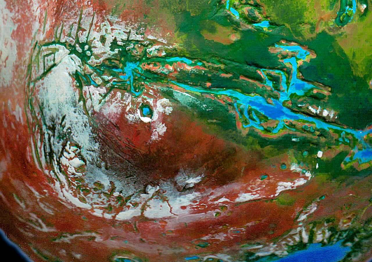
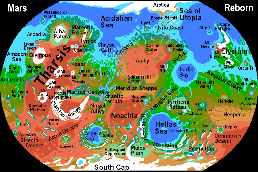
CLARITAS RANGE
by Chris Wayan, 2003
Mars Reborn: homepage -- Index: Martian place names -- Planetocopia: more world-models
Called Claritas Fossae (cracks) on old maps, this is really one of Mars's highest and longest mountain ranges. From the Noctis Labyrinthus at the head of Mariner Canyon, the Claritas range runs south, then east as the Coracis Fossae, then north again as Melis and Nectaris Fossae, ending on the brink of Mariner Canyon; an arc of some 2500 km (1500 mi). The highest peaks reach over 6000 m (20,000 ft); even the lower east end is Alpine.
As the name Fossae suggests, it's an odd sort of range, full of cracks, grooves, scarps, winding ridges, solitary peaks and rangelets, many at right angles to the overall curve. In many place Mars has clear, drastic features where one geologic (or meteoric) force overwhelms all others. Not so in Claritas. The least clear topography on the planet! What happened here?
Claritas rivals our Andes, and the peaks are nearly as barren--the heights of Claritas generate snowstorms, but the summer snowmelt is modest, and streams quickly sink underground--porous soil. The land would be dead, and perhaps glaciated, if it weren't so near the equator. Even so, it's so high the air is thin; animal life is sparse. Grass and even low pine woods fill some sheltered valleys, but the heights are nearly as stark as Tharsis.
In the photo's center is Oudemans Crater, small (by Martian standards) but deep; an oasis of dense forest around a lake, draining north into the Noctis Labyrinthus.
|
|
World Dream Bank homepage - Art gallery - New stuff - Introductory sampler, best dreams, best art - On dreamwork - Books
Indexes: Subject - Author - Date - Names - Places - Art media/styles
Titles: A - B - C - D - E - F - G - H - IJ - KL - M - NO - PQ - R - Sa-Sk - Sl-Sz - T - UV - WXYZ
Email: wdreamb@yahoo.com - Catalog of art, books, CDs - Behind the Curtain: FAQs, bio, site map - Kindred sites