
CONTINENT 3
by Chris Wayan, 2006-9
Pegasia's homepage - Map - Geography & climate - Evolution - Critters - Gazetteer - Sketches - More worlds? Planetocopia!
First-time orientation--strongly advised! Pegasia is weird.
Overview - The Lure of Names - The Steamy North - the Eastern Arcs - the Chilly South - the Cosmopolitan West
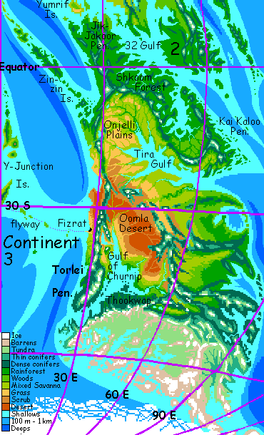
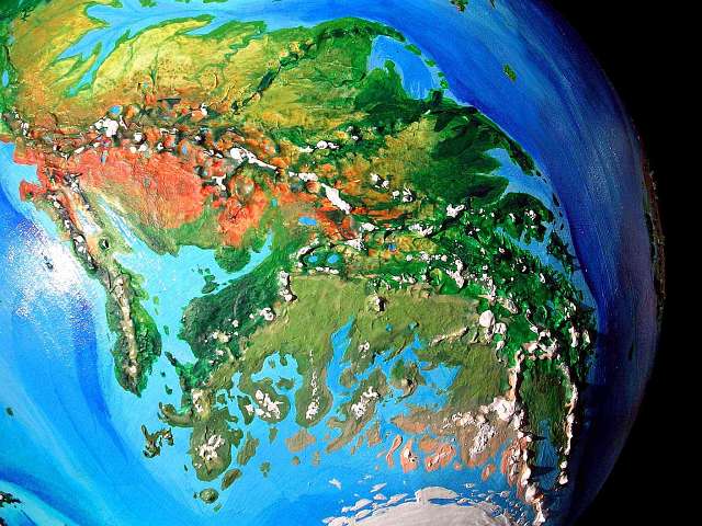
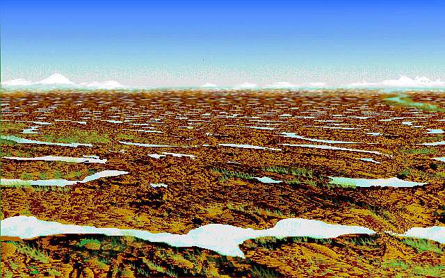
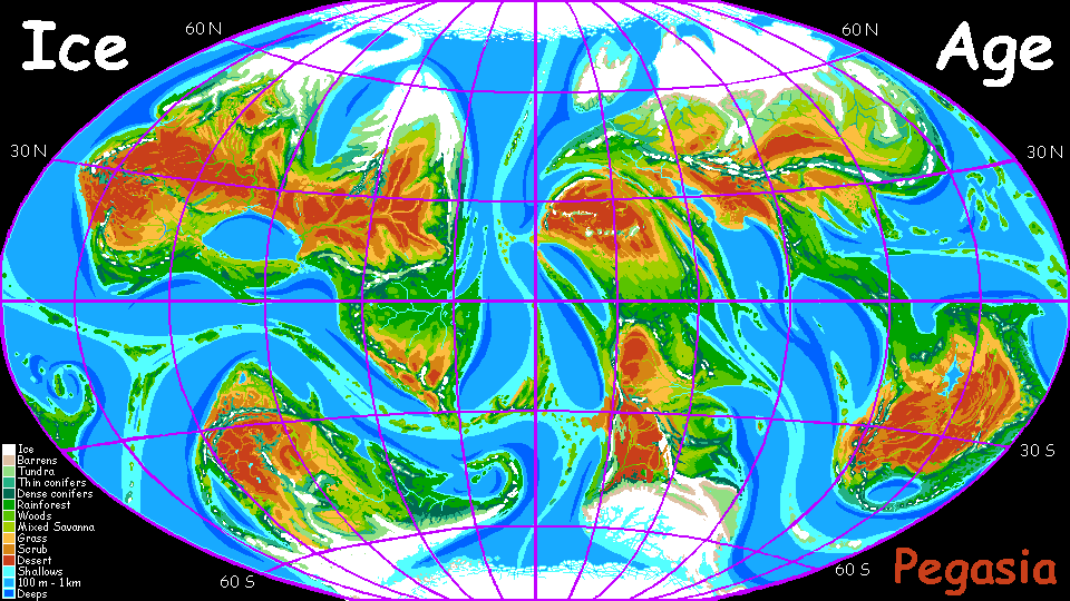
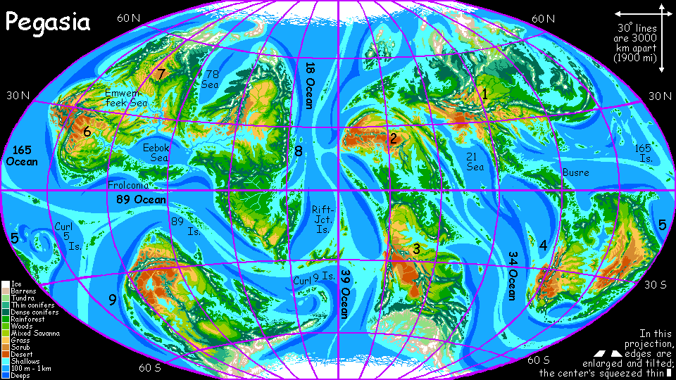
Continent 3, in the high orbital photo below, is the great landmass at the bottom. Fully a third of it is subarctic or arctic, though this polar portion is foreshortened at this angle; the rest is diverse, from deep green rainforest through golden savanna to red desert. Above it are the deserts of Continent 2; upper right is mountainous Continent 1. Over the horizon to the east/right, two smaller continents end this continental arc, Pegasia's equivalent of our Old World.
While Continent 3 is the southwestern end of the group, not its heart, an island-chain off its west coast (lower left) is by far the best flyway to the Inner Hemisphere (left horizon). Due to trade with that hemisphere, western Continent 3 may thus be relatively cosmopolitan--quite possibly the most innovative region in the hemisphere.
Continent 3 is huge, nearly as big as South America (it looks still larger in the orbital photos, but remember Pegasia's smaller than Earth), and so diverse that it's hard to generalize about; for it's a north-south strip cutting across many climate zones.
Jared Diamond argued convincingly in Guns, Germs, and Steel that civilizations on such north-south strips often have more diverse life-strategies and cultures than on east-west strips, but that their most important cultural inventions (the new crops and domestic animals they breed) cannot travel well; climates and day-lengths and seasons are too different, just a few hundred kilometers north or south--never mind many thousand! It took a thousand years to adapt Mexican maize to, say, Ohio; potatoes never made it. Meanwhile wheat spread from Spain to China! East-west is easy, but Continent 3 is handicapped by its orientation.
Of course, moving a bit inland sometimes solves the problem: Continent 3 has tall mountains all down its length. And when it comes to crops and climate, altitude (as the Inca knew) often conquers latitude.
Pegasians have one great advantage over, say, the ancient Americans: in the denser air and lower gravity, many of them can probably fly. The long north-south mountain chains of Continent 3 lie directly across the prevailing winds; one slope should have steady updrafts for thousands of kilometers. Not barriers, flyways! The Aztecs and Inca never traded, and may not even have heard more than rumors that another great empire existed. That situation is inconceivable on Continent 3, where fliers (even you, in your cheap rented wings!) can ride these invisible highways along the mountains from equator to pole in just a couple of weeks.
What kind of fliers, what kind of people? You tell me.
Overview - The Lure of Names - The Steamy North - the Eastern Arcs - the Chilly South - the Cosmopolitan West
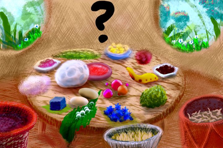
Continent 3 is the site of an experiment. On Pegasia, I've held off on naming features, leaving you readers to send me proposed placenames in the languages of your proposed natives. A good if extreme example of the result is southern Continent 6, home of the frolcons. But submissions have been slow and hesitant; and emails from some world-builders have suggested that many readers who want to create their own people feel intimidated by this extra task. It is hard to create a convincing language (and good names)--just as hard as the hard-science knowledge needed to invent a good alien and the artistic skills (verbal and visual) to depict it.
So here on Continent 3, I'll try out a new model; if it works, I'll extend it to Continent 2, and perhaps the whole Outer Hemisphere. What I'll do is name Continent 3's features and introduce more detail about what I see, making it as real and detailed as I can without limiting the appearance or biology of potential natives. My placenames will come from several hypothetical languages with clear, standardized spelling and pronunciation guidelines. And I'll group these placenames by hypothetical language on a hidden page for species designers, in the hope one of these tongues will seem plausible for a species you have in mind.
Or maybe the names will evoke a species for you. For me, one of the great pleasures common to travelogues, good fantasy and science fiction is the tremendous evocative power of names. It's no coincidence that Middle Earth and its peoples are real to millions; Tolkien was a philologist and his names and languages are admirably consistent. In contrast, consider two of his contemporaries. David Lindsay's A Voyage to Arcturus and E.R. Eddison's The Worm Ouroboros and other books rival Tolkien in originality and philosophical sophistication (Lindsay advocates a form of Gnosticism equally fascinating to punks, goths, Loren Eiseley and Harold Bloom. You try managing that!) But their names are either awkwardly allegorical (Lindsay) or derivative of Earth languages (Eddison); and I suspect that's one reason they're cult classics rather than simply classics. I'd argue that Tolkien's real rival is W.B. Yeats: his otherworldly poetry loots and reworks Celtic mythology and names so thoroughly it might as well be a new, entirely invented mythos. And why do you think J.K. Rowling is a billionaire? It's partly that she can coin names like Snape, Quidditch, Hogwarts, and (my favorite) Blast-Ended Skrewt. Here's that world-renowned expert, Albus Dumbledore, on the power of names: "Before we begin our banquet, I would like to say a few words. And here they are: Nitwit! Blubber! Oddment! Tweak!" I may have just driven a lot of highbrows off this page, but Rowling knows what wizards always have: names alone have real magic; a few words can evoke a world.
So I'll add names in the hope they'll manifest the creatures who coin them! Sympathetic magic, really--akin to the cave artists of Lascaux and Altamira. But then isn't that what all fiction does? Summon people out of words? It's still up to you the reader to picture these people... and to actually send me the pictures! C'mon, don't be shy...
Overview - The Lure of Names - The Steamy North - the Eastern Arcs - the Chilly South - the Cosmopolitan West
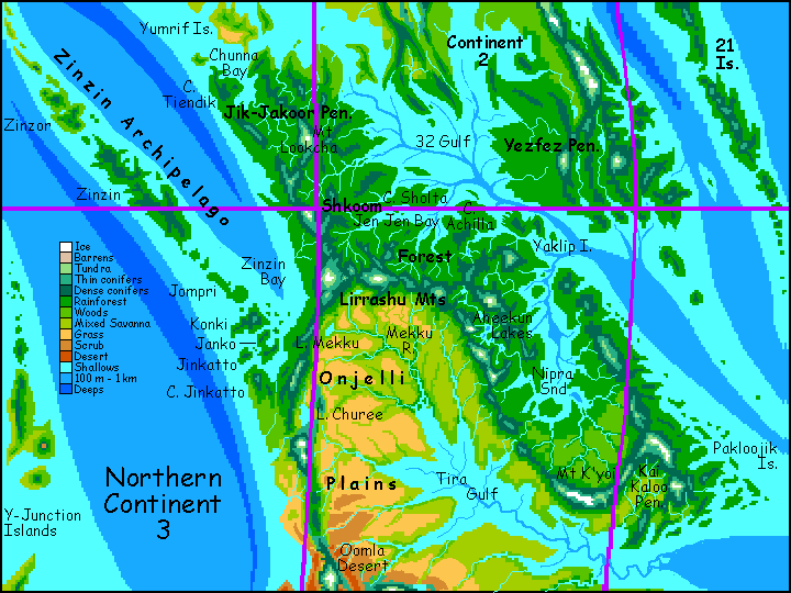
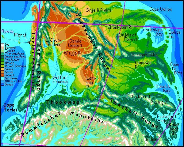
The rainforest stretches more like 6000 km if you include the long volcanic arc of the Zinzin Islands far to the west--no, not those blue hills on the western horizon across Chunna Bay: that's just Cape Tiendik. The Zinzins are ten times as far out, over deep water, and nearly as big as Sumatra; bigger than Japan. But less likely to be insular, in the Terran sense: the Zinzin chain forms a second bridge from Continent 2 to Continent 3, and will see at least some travelers and trade, if not flocks of tourists.
The analogy to Indonesia may be cultural as well as geographic. Along these fractal shores, fishers will do well--the reefs are an endless smorgasbord. Something amphibious, dextrous, and intelligent might well make the leap to civilization, fueled by this rich environment. Otters? Octopi? Something beginning with O.
Not oysters. Please, not the oysters again.
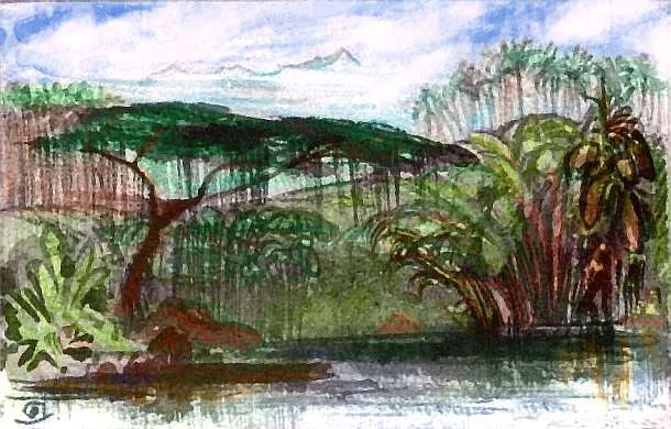
But inland, in this immense forest, people will probably fly, and nest in the canopy, up in the sunlight and fruit and flowers. Why live in the shadows below? It's a Pegasian life-pattern you've seen before on southern Continent 1 and southeast Continent 2, and you'll see it again. Of course this forest canopy is friendlier to intelligent life than Earth's: low gravity and dense air rich in oxygen combine to triple the maximum practical flight-mass from Earth's 15 kg (35 lbs) to around 45 kg (100 lbs); with hollow bones, fliers as large or larger than the average human will be possible, though I expect most intelligent creatures to weigh only half that, to retain agility in these dense sky-reefs. Even human tribes tend to run small in dense rainforests--it's just easier to slip quietly through branches when you're small. Though there's always the counter-example of gorillas! And there will be some equivalent: the low gravity also encourages larger arboreal flightless creatures than on Earth.
But the advantages of flight are large; so I'd still wager that the dominant Shkoomians, who call themselves weksheks, will be smaller fliers who live up top, in basket houses with epiphyte gardens in swaying canopy towns... but I could be wrong! You tell me.
A full-length tour of Shkoom Wood is inadvisable, since the far end trails off into the 21 Ocean; we'd have to retrace our path for days. Intercontinental travelers all ride the easy flyways along the western mountains instead. As a result, though the Kai Kaloo Peninsula is scenic and fertile, it's culturally rather rustic.
Yet there are attractions in the east: Lake Aheekun, a scenic, twisting mountain lake 200 km long in central Shkoom, is just the largest of a cluster of lakes between the volcanic cones of the Lirrashus. Cliff-walled in spots, Lake Aheekun is probably a chain of old calderas, though the lush rainforest makes geology difficult.
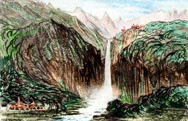
Further southeast is Mt K'yoi, Pegasia's Ruwenzori: a long snowy east-west ridge 5 km high (16,400'); K'yoi's south face has the only glaciers for 2000 km. Indeed all Kai Kaloo is dramatic, lovely country, But it's a long flight back over Tira Gulf; I think you'd be safer just heading south.
Even crossing Shkoom Wood north to south will take days. It's at least 1200 kilometers down the Jik-Jakoor Peninsula, from the equatorial sea to the Lirrashu Mountains--two or three long Pegasian days on the wing, through updrafts that at times in the afternoons get almost too vigorous--cumuli tumble around you, boiling up into flat-headed thunderclouds that trail sheets of slaty rain as if they were monstrous jellyfish. The air's dense and damp enough to convince you all this talk of flying's a mistake: you're really swimming through God's aquarium tank...
But all sweaty things come to an end. That evening, you rest and dine in a wekshek village. Tasty bugs! No, really, it's a delicious cuisine, varied and rich--yes, the pickled larvae take some getting used to, but half a dozen treetop fruits and as many more oilseeds and nuts, plus aromatic leaves and shoots for salad. The only thing missing, really, is root vegetables. Nobody wants to trawl that dark, clammy abyss for those!
That night you sleep in a guest-house, 60 meters up (200'). You dream queasily all night that you're a sailor on a stormy voyage round Cape Horn; the eyes may close but the body senses something very wrong, as your bed--and bedroom--bobs and heaves. And it's not a stormy night. But a noisy one: all night there's a tune stuck in your head: "When the bough breaks, the cradle will fall..."
More than this, I can't say; the weksheks are shy, not having been defined yet. You tell me--as soon as possible! I'd rather sleep in a galloping sky-bed than endure Heisenberg's limbo: the curse of being potential. (Some of you know exactly what I mean; my condolences). Oh, well! Let's define what we can...
On the second day, a long range of hills to the east mounts steadily higher until a dark, massive wall vanishes into the clouds. You have to chug up a kilometer up through cloud-canyons of gray then white then gold and blue before you get a glimpse, but it's worth it: beyond the huge white castles all around you, one far bigger stands, unmoving, shouldering the flimsy clouds aside: the snowy summit-ridge of Mt Lookcha, 5 km high (16,400')--rivaling Mt K'yoi far to the east as the highest peak in the Lirrashus, and another reason I didn't want to detour; not with Lookcha right on our path.
Ahead to the south, the clouds pile up in a traffic jam, and the green carpet wrinkles into a confusing mass of ridges. It's a maze of rainforested valleys and cloudforested peaks. Most are far lower than Lookcha, but over the next day, a couple of others reach high enough for snow, though you're nearly on the equator. The air's merely warm, not stifling now; you're inching up out of the steambath.
And late the next day, across our path, rise the Lirrashu Mountains, of which the Lookchas are just a long spur. This barrier averages 3 km high with peaks up to 4500 m (nearly 15,000'). Yet the Lirrashus are easy to cross, being a broken-up crowd of ridges fraying off into dozens of spurs like Lookcha. Tsintsip Pass, our way south, is only a mile high; the only snow is a peak far to the west, glimpsed once through the cloud-herd. Still, the Lirrashus are high enough to trap most of the rain from the many summer storms arising in the equatorial 32 Gulf.
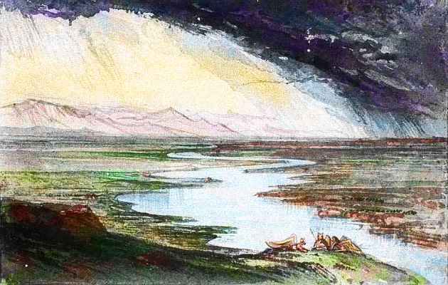
As soon as you're through the pass, the clouds fray into wisps. In the clear high air ahead you can see 200 km south, east, west. All is gold, veined with olive green. Lying in the rainshadow of the Lirrashu Range most of the year, the Onjelli Plain is dry savanna with only riverine woods all the way to Tira Gulf. There's one broad sheet of pale blue, Lake Shooj, right beneath us at the foot of the pass, and a far bigger silvery line far to the southwest: huge Lake Mekku, at the foot of the western mountains: the Lirrashus bend south here, cupping Onjelli. That lazy tangle of looping dull-green snakes (the only woods out on the plain) is the Mekku River, largest in the basin. Rather than follow the river down to Tira Gulf, let's head for Lake Mekku. As the winds off the Gulf hit the mountains, they rise, generating one of those long hawk-highways Continent 3 is known for. So you skirt Onjelli, soaring like condors. Mountains right, plains left. Miles without flapping a wing.
So much for rainshadows! An hour or two down the long flightway, an unseasonable thundershower sweeps through. Looking back, the plain is dark and patchy, but the Lirrashus stand brilliant in the sun, reflected in the winding Shooj River.
Is Onjelli more African or Australian? Mud towers of quasi-termites dot the dry plain like medieval castles: city-states each guarding their little hectare... Burrowing insectivores would love Onjelli, but would they be too specialized to become intelligent? The grasslands will support huge herds of ruminants too. Can they collect enough energy from grass to fly as well? On Earth, no; but on Pegasia, where flight is much easier, maybe. Flying antelope, kangaroos? Huge, grain-cracking parrotlike birds? And as long as they've invested in a big head anyway to anchor that seed-cracking jaw, why not a big brain too? Some of my omnivorous readers may feel skeptical that herbivores could evolve high intelligence at all; my herbivorous readers will instantly think of elephants, parrots, gorillas and themselves. My silicon readers probably find the whole project tediously carbocentric; you're only reading this so you can write a short, scathing undergraduate paper for your art history class, pointing out the copious scientific (and literary) errors of an archaic ape.
Ah, hindsight is such sweet sorrow! Be kind. You too will be someone's archeology paper some day.

CHOICES
South you go, riding thermals during the hot afternoons--and it gets oppressively hot; here in the Outer Hemisphere, there's no noon eclipse. Zeus is never visible from Continent 3; unless the locals are credulous enough to accept travelers' tall tales of a red-hot, ridiculous, paisley monstrosity in the antipodal heavens... they'll believe they're living on a planet, not a megamoon. I hear some of the hillfolk think their deity created the universe just for them. Six thousand years ago. Poor, vain, ignorant savages!
The next day south you camp by a much bigger sheet of silverblue nestled in the hills: Lake Churee, a good 200 km long and 70 wide (125 by 45 mi). Or perhaps you'd like to stay in a farm village--you can rely on Pegasian hospitality. Or sleep in a little thatched pyramid, one of hundreds in a temple complex for pilgrims who seek healing. Or if you like, you can sleep in an inn in a quaint shoreline resort town where tourists from all over northern Continent 3 come to sun and swim and gamble for dream-fungus and mate with strangers the folks back home would disapprove of. Hard to say what the local culture's like until certain lazy readers invent said locals...
Here you face a route-choice: Churee is a continental crossroad.
Overview - The Lure of Names - The Steamy North - The Eastern Arcs - the Chilly South - the Cosmopolitan West
Golden savanna rolls on for days. Dust plumes mark great herds of... what, if the people here are herders? Or who, if the grass-eaters are the people?
On the second day we cross two narrow arms of Tira Gulf. These are drowned river valleys: like Earth, Pegasia experiences Ice Ages. During these, the sea level drops and Tira dries up. Without its moderating influence the plain reverts to desert not savanna. But Tira is now at its maximum: a huge inland sea, 2500 km long and averaging 300 wide. It's mostly shallow coral reefs, but a sunken canyon winds down the middle: the flooded Ice Age canyon of the Mekku River.
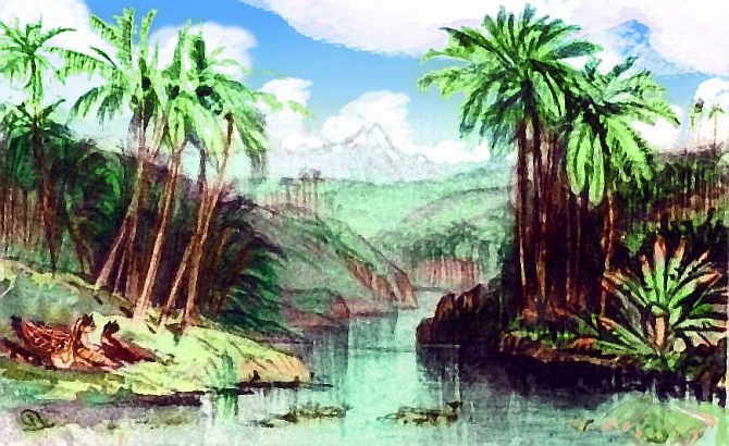
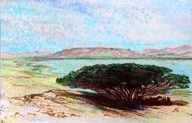
Even now, in a warm wet era, only the river-valleys have trees. Well, a few low spreading loners like this one give precious shade on those hot afternoons. I don't know who those people are, resting in that pool of shadow, but I do know they'll be fine storytellers with an elaborate, leisurely rhetorical style. They have to be. What else are you going to do? Pegasian days here are just as hot and twice as long as any West African griot ever had to fill.
This great eastern forest is lower than the giants of equatorial Shkoom Wood, and full of quite different species; the Onjelli savanna isolates these two rainy coasts botanically.
Are we heading from Sahara to Senegal, Oklahoma to Georgia, or Paraguay to Rio? None exactly, but Rio is the best analogy. This isn't the flat Sahel, or Dixie's flat eastern seaboard! Hills rise south of us, and more than hills; by afternoon we ride soaring, muscular updrafts along a coast where dark mountains, shaggy with tall conifers, hulk out of the sea. The sea-wind's facing us, but we make steady progress--let the wind lift us in spirals up the mountain face, glide five miles east into the wind, losing altitude till we're skiming the sea-cliffs, spiral up, repeat... Almost due east now.
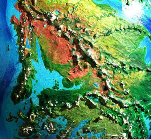
Pause a moment. Spiral higher. No, higher still, until you've topped out, gasping in the thin air, barely Earth-normal--after these weeks on Pegasia your blood's thinned to a watery orange to protect you against oxygen-burn, and now that's working against you. All right, that's high enough, don't faint! Now... peer south over these bristling mountain-shoulders. To the southwest, a nappy green plain fades into haze: Onjaleet Wood. It's one of the continent's great forests. But due south and southeast is turquoise and silver: the shallows of a huge, sheltered, subtropical bay! We're on a peninsula, Cape Dalips--the base of an island arc much like the Zinzin Isles, eight days back.
Continent 3's east coast has a vast, simple architecture: three such great bays, sheltered by capes and island arcs, much like our Sea of Japan, Sea of Okhotsk and Bering Sea, though smaller and much warmer.
The first, over these hills, is Chukalapp Bay--subtropical, rarely if ever seeing snow. Sheltered by Cape Dalips and the Dalips Islands, Chukalapp's outer waters are rich coral reefs; silt from the Chenkoom River creates less scenic but equally rich clambeds along the east shore.
Whether the villages are on the ground or in the trees, there will be a fair number of them. Though Onjaleet Forest thins and frays into prairie 1000 km inland (625 mi), it's rich land. May look wild to the Terran eye, but these are orchards, game parks, tree-cities.
But be satisfied with just a coastal taste. I don't want to guide you up the Chenkoom River, through the strange hill-cultures below the icefields of the wild, bony Thakkenkor Range...
Late the next day, you leave the Chukalapp Basin. Over the piny Supsoot Hills, you're surprised to find open prairie with only groves and riverbank strip-forests. Why so much drier? While Dukduk Bay is nearly as large as Chukalapp, the bay lies 1000 km east as well as south--Continent 3 isn't really a north-south strip, but a twisting diagonal. So we're well inland here, and the forest, though extensive, has thinned.
Wheel to the left--let's head down to the shore. Soon the prairie shatters into meadows and then mere clearings. This forest, unlike Onjaleet, has plenty of evergreens in the mix: it's temperate, getting winter snow for a month or more (and with a year of just seven months, that's significant).
A long day's flight down the Klambek River to Dukduk Bay... No coral here! Rock and mud, kelp forests, musselbeds. Like an enlarged Delaware Bay--pre-pollution, of course. This too is rich country, though I'd bet most of the population is coastal, exploiting the rich fisheries. The long winters decrease orchard productivity, but the cool sea's generous year-round.
We'll keep heading east, up the one horticultural exception: Cape Iz Bits, sheltering Dukduk Bay. Its outer shore tilts north toward the sun and catches rain; there's a narrow but lush wooded strip just 50 km deep, but 1000 km long. It's not just the sun keeping Iz Bits relatively mild even in winter; a warm current offshore. Orchards here grow chulaps, a roughly octahedral fruit smelling like allspice that requires a mild marine climate. Fresh chulaps are exported all up and down this coast, and dried ones all over the continent.
The third arc is less defined. Psokaleet Sound is cool-temperate, with heavy snow for two months or more (one-third of the seven-month year). Brr! At its mouth, a great rugged island much like Newfoundland: Kolahoot. Behind it, Psokaleet Sound is just as long as its two warmer sisters, but narrow, with many small fjords. These shores are all dark evergreens. Even in summer, snowy peaks loom above the trees...
Overview - The Lure of Names - The Steamy North - the Eastern Arcs - The Chilly South - the Cosmopolitan West
The coast doesn't end at Psokaleet, by any means; next comes fully 1600 km (1000 mi) of deep, dark-forested valleys leading hundreds of km inland between snowy mountains: the last fingers of the transcontinental Rummlenchak and Imesholl Mountains.
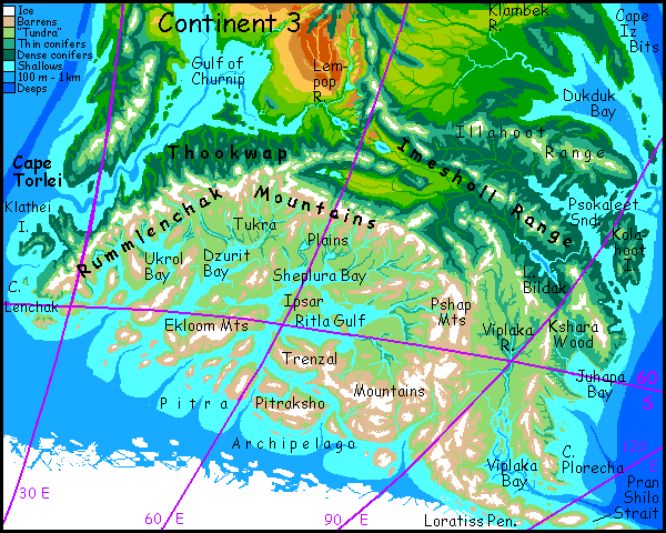
Inland, nestled in the mountains is Lake Bildak, 400 km long (250 mi). Bildak resembles Siberia�s Lake Baikal in more than name: long, narrow and very deep, its shores are cold evergreen forest; despite the harsh winters here, the lake never freezes due to hot springs a kilometer down.
"Harsh winters" here just means snowy and mostly below freezing for 40-60 Pegasian days--but remember, that's three or four Earth months or half the Pegasian year! Life here isn't as frost-adapted (no ice ages!) so even a few weeks of a hard freeze feels practically Siberian. Even this coast, despite a maritime climate with a mild current offshore, looks rather Siberian or Alaskan. Thinning conifers, meadows bogs and barrens under leaden skies and sleeping white domes of ice: the volcanoes of the coastal Plorecha Range. One final forest, Kshara Wood in the lowlands of Juhapa Bay, and the trees shrink and straggle. Further south it's just grass, rocks, ice and fire.
Past Cape Plorecha, there's one more great arc-sound, Viplaka Bay; but the Viplaka River basin's lower reaches are almost bare of trees; we've entered the Antarctic.
If you headed inland, and lived to make it over the Loratiss and Pshap and Trenzal Mountains, you'd discover a wide but lonely land, broad and cold as the Canadian Shield. It's not true tundra, for there's no permafrost: it's been a million years or more since the last Ice Age. But summers are short, just a couple of months, and winters harsh: these plains are bare to polar blizzards. To the south, the windy plains break up into a maze of islands and sounds below glacier-capped mountains--none over 2.5 km high (8000'), but this near the pole that's plenty! In the north, the Rummlenchak Mountains pen in the blizzards. The lands on the far side vary--first, rough mountain-and-basin country reminiscent of Wyoming, then bony mountains sheltering the green valleys and fingerlakes of Lempop, and the temperate, fertile Thookwap Coast, tilting north to face the sunny Churnip Gulf; Thookwap has lush evergreen forests like Oregon or Washington. Fly over the mouth of the Gulf, and you've reached cosmopolitan Torlei--a Pegasian California. But it's a long hard way northwest; simpler just to click ahead!
I can't imagine civilization rising in this unpromising land, short on sun, summer, building materials, everything. But it's immense; and the grass is there. Elephants have human-size brains and one quasi-hand; so did mammoths, and they thrived in tundra. Arctic wolves have the largest canine brains known, as big as chimps'; and arctic ravens are huge and ingenious too. Adversity breeds brains! So perhaps you can design a species that can build a civilization here. The prize: millions of square km of undisputed land. Not charming land...
 ...but big.
On second thought, don't bother. Aleksanteri Nevalainen has been doing some species-designing, and the Drimrol are settling in--or rather, they've been here all along, unnoticed in their burrows. Over the next few months, as I fill in the map of this anti-Canada above, more Drimrol names for the features of their antarctic heartland will gradually appear. With luck we'll be able to visit one of their pleasant underground clanhouses.
Wait--one more thing, before we head for sunnier country. I had a reason for bringing you so far down the southeast coast. Ahead, down the Loratiss Peninsula, lies a potentially important gateway, analogous to the Bering Strait on Earth: the only landbridge to Continent 9. Until and unless any nonflying peoples develop deepwater ships, this is their only gate between hemispheres! And a cold bridge is better than none.
The bridge won't be a blind discovery like Siberian tribes spreading through the Americas; Pegasia's wingless peoples will know exactly what they're looking for, due to fliers' maps and news. And the motive won't be settlement or exploration (the lands ahead will be settled too) but commerce! Summer trade runs, first of specialty goods, later of bulk items too heavy to fly in. Though this may never take off in a big way; I doubt the seaports along this cape will rival the airport I've postulated in Torlei below. The arctic route's just too long, cold, and treacherous, compared to island-hopping... with or without a ship.
But either way, Continent 9 ahead is the loneliest on Pegasia, lying apart from the rest of the Inner Hemisphere too; it's likely to have developed in biological and cultural isolation. Intelligent fliers are less likely to evolve on a single continent than on a whole cluster, so settlers from the Outer Hemisphere are more likely to cross from Continent 3 than the other way round. Still they may not find it entirely unoccupied; Continent 9 is no Antarctica or Australia, but a huge, fertile, diverse land where intelligent life could well evolve.
Fliers, of course, will prefer the subtropical flyway through the Rift-Junction Isles. If flying species do evolve and communicate with ground-dwelling peoples (as seems likely), once either species has serviceable deepwater ships, they'll parallel the flyway instead; it's shorter, easier, well-traveled, familiar.
Overview - The Lure of Names - The Steamy North - the Eastern Arcs - the Chilly South - The Cosmopolitan West
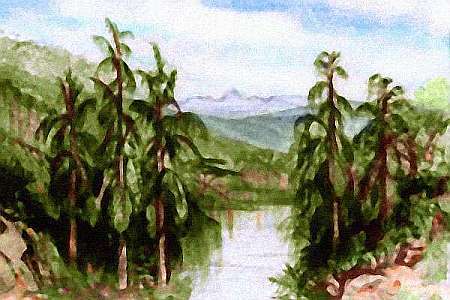
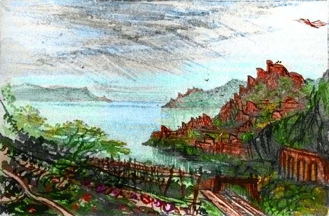
Here's a sketch of a small port at the mouth of the Wejjo River. Note those graceful shell-like roofs on many buildings, like Sydney's Opera House; these are seen all over western Continent 3. I suspect they're wind-funnels, perhaps for low-tech air conditioning in this hot climate, but just maybe they power crude wind-turbines--power looms, for the cottonlike fiber grown upriver? Or maybe they're just roof-shades to hang out under when it's too hot in the house. Hard to say without getting closer, and if we did that we might discover what these people look like, and we can't have that... can we?
In the far west, long Torlei Peninsula shelters the Gulf of Churnip. Torlei has a mild climate, running from a warm dry Baja-like stretch at the north end through a long, quite Californian middle down to a cool rainy English tip. Torlei, with its spectacular snowy mountains above Californian shores, seems to me one of the most desirable strips of real estate on Pegasia.
But Pegasia's a winged world; that single fact makes it inevitable that this quasi-California will nourish one of the world's great ports. And I'm not assuming any particular level of technology. Even stone age people will build a city here--a cosmopolitan one. For to fliers, Torlei is a crossroads. Not a seaport, an airport!
I've explained how mountain chains, especially those that lie across trade winds, have fairly steady updrafts on their windward sides, which winged people see as natural flyways--a transcontinental transit system as fast as trains. In some places, these flyways go intercontinental: most Pegasian continents have at least one neighbor only a few hours' flight away. But they do form two clusters with wide seas between them: the Outer and Inner Hemispheres (right and left halves of the world map, respectively).
Trans-hemispherical travel is hard: and that's why Torlei has a great port, Cape Fizrat, halfway up its west coast. It's just west of L-shaped Lake Churnadrai (upper left of orbital photo, left). Several hundred km offshore of this little point is a line of three modest islands, 16-50 km long (10-30 mi); there's another, hundreds beyond (off the photo), and a larger archipelago past that; not easy flights, any of them, but a fit flier can expect, in four long, hard Pegasian days, to reach the huge, fertile Rift-Junction Isles in mid-ocean, a rugged land reminiscent of Japan. Here fliers can recover before heading on west to Jumpoff on the coast of Continent 8, and from that port, fan out through the Inner Hemisphere.
Not an easy trip; but ten times faster than any sailing ship, and requiring no maritime technology--just the bare knowledge that those islands (invisible even over the wide horizon of a flier a mile up) are there.
So once contact between the hemispheres begins, it will cause a cultural revolution--here. Few material goods, few riches, may pass through Port Fizrat, for fliers travel light. But it will see a steady stream of ideas, art, musicians, maps, books, gems and seeds.
Torlei (always rivaled by Jumpoff, the west end of this invisible bridge on southeast Continent 8) will be world centers of innovation--entirely due to a few small islands. Stepping stones across the pond. Geography creates culture!
Just south and inland of Torlei's southern tip is a second long rugged cape thrusting southwest. Its north shore is a mild, fertile strip called Thookwap. Though the ice-capped peaks of the Rummlenchak Range loom inland, these valleys all tilt north toward the sun, making them warmer than the latitude suggests. A gigantic Puget Sound? Winters are typically cool and rainy, but it rarely freezes or snows, at least near the water.
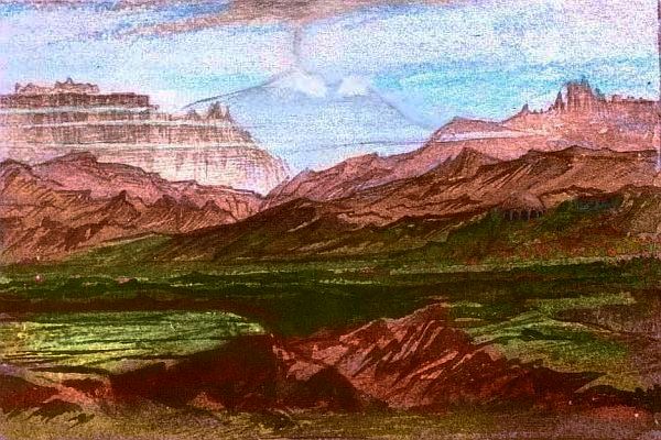
If we fly east along Thookwap's coast, past its forested promontories and rich deltas, over the next two days the land grows slowly drier and more open. The middle Lempop Valley, with its lovely fingerlakes nestled in spurs of the huge Thakkenkor Mountains, could almost be Northern Italy.
Further up, the Lempop River is like the Oomla Desert canyons, a great linear oasis of green bottomland--though instead of red desert plains, treeless mountains loom--just brush, grass and stone. More Silk Road than Italy now! This inland climate's harsher than Torlei or Thookwap, but the lush valley floor, miles wide and hundreds long, could sustain a major civilization. Instead it's lightly populated farm country. Why?
Flight, I think. Though Thookwap and even Lempop are nearly as fertile (and scenic) as Torlei, their location enforces relative rusticity. Good land, but off the flyway! And Pegasians, even the wingless ones, use that phrase as we say out of the loop, behind the curve... clueless. "He is so off the flyway." It's sad that such fertile, scenic areas would acquire that epithet. Epitaph, almost--I think that snarky little phrase has actively discouraged immigration. But every enlightenment casts a shadow; for every glittering port, a backwater. So it goes! Even without wings, humans know a little something about flight from farm to shining city...
But is the shadow that dark? Thookwapians don't think so. Each rivermouth has its own port, and upstream villages and towns like a string of beads worn by giants with snowy heads: the great peaks of the Rummlenchaks. River after river, each with a proud local culture; civic competition, both artistic and agricultural, is a constant here, with fairs every season.
Local arts include fiercely competitive drum-song-drama troupes and narrative mythic tableaux in local woods (three-dimensional comics, we might say), part-carved, but part found shapes--a twisted, useless tree is, to a Thookwapian eye, a figure struggling to burst from its bark-womb. Fizratian perch-up comics often parody this tendency to personify anything woody by showing yokels from Thookwap falling in love with lamp posts and banisters. Thookwapians, crude peasants that they are, simply retort that Fizratians shouldn't talk, since they'll mate with anything. Given the species-diversity of Port Fizrat and Torlei around it, the accusation's not idle; just unclear. Is that really scorn, or envy?
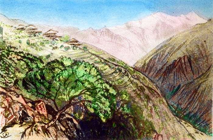
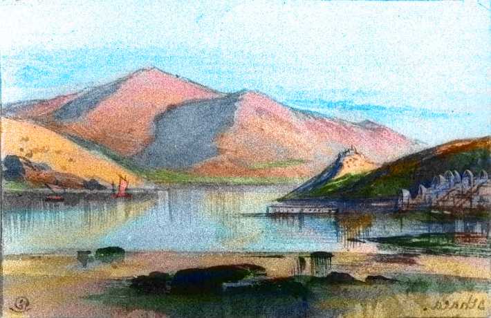
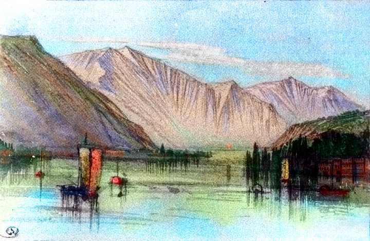
I do promise to put a sketch or two showcasing Thookwapian arts, eventually, but I can't get too close until we know what they look like. Here's one sketch from high up a canyon, near treeline, in eastern Thookwap, not that far south of the Lempop Valley. The so-off-the-flyway end of the strip. It's drier out here, more continental--the mountains are taller, bonier, more Montana than Oregon.

The inns and meetinghalls, fairs and drumma troupes of each valley have distinctive flags and signs. Maybe they'd remind you of medieval Terran heraldry. But it says much about the Thookwapian mind--the Pegasian mind--that they're topographical or botanical; the proud, stylized heads of cabbages and volcanoes, not kings. Provincial, compared to the cafes of Port Fizrat, yes, local not global--but at peace, and proud of their modest diversity. How many Terrans these days can say the same?
World Dream Bank homepage - Art gallery - New stuff - Introductory sampler, best dreams, best art - On dreamwork - Books
Indexes: Subject - Author - Date - Names - Places - Art media/styles
Titles: A - B - C - D - E - F - G - H - IJ - KL - M - NO - PQ - R - Sa-Sk - Sl-Sz - T - UV - WXYZ
Email: wdreamb@yahoo.com - Catalog of art, books, CDs - Behind the Curtain: FAQs, bio, site map - Kindred sites