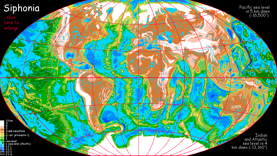
Siphonia:
DAVIS SEA
by Chris Wayan, 2006-9
Siphonia - map - regional tours - People, Creatures - Evolution - (don't click yet: Gazetteer - Glossary) - more worlds? Planetocopia!
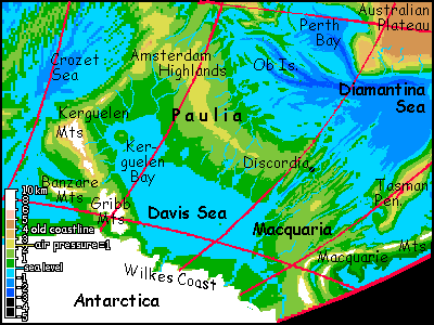
Davis Sea
This midsized sea is the southeastern corner of the old Indian Ocean.
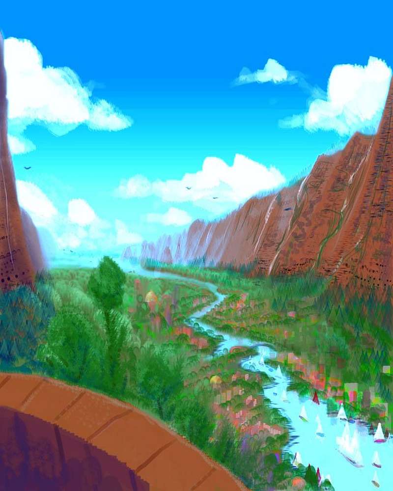
Though Antarctica looms over Wilkes Coast, Davis's southern shore, all the tongues of Antarctic ice end a kilometer up and many miles inland; cold milky streams wind across a broad tundra to the sea. It's much like the cool tundras at the foot of the temperate-zone caps during our Ice Ages, where huge mammals grazed within sight of the ice. The high latitude (50-65 south) is countered by the basin's depth--fully twenty thousand feet below the ice cap. Cold winds off the glaciers compress so much they heat up. Air pressure is 1.5 atmospheres, retaining warmth and moisture.
So the east shore, Macquaria, is like British Columbia or northern Europe: forested down to the water, with mild but overcast winters and prone to rain, fog and mist all year. Conifers up to 75 m tall fill the valleys. It's plant heaven, but somber inland--dark unbroken forest. Most inhabitants live along the coast, though they export lumber all over the Davis basin (and beyond; many dry zones around the east end of the Indian Ocean basin--now the Australian Ocean--use Macquarian cedar and pine).
The western shore, under the rugged Gribb and Kerguelen Ranges, is a cool windy steppe--not true tundra, for there's no subterranean permafrost. But just a few miles inland, away from the salt winds, trees root. They straggle up the slopes in a belt over 100 km wide in places, and up to a mile high. These forests are lower and patchier than Macquaria, but sunnier too; winters are colder (just as New York's or Tokyo's is colder than Vancouver's), but it can get genuinely hot in summer; the Kerguelen coast is the furthest from Antarctica. New England, not Siberia.
Paulia, the long north shore, is truly temperate--warm to hot in summer and with only light, occasional snows in winter, as mild as Macquaria's, and much sunnier. It's the most populous land around the Davis Sea, both because of its milder climate and its sheer size. Several Frances or Germanies.
Discordia: Strait or Canal?
The Davis Sea may well be linked to the Diamantina Sea (part of the Australian Ocean) to the north. Though some Earth maps still show an unbroken mid-oceanic ridge between these basins, accurate newer maps will show a jagged fracture zone, though only one out of ten bothers to name it: the Australian-Antarctic Discordance, on Davis's northeast shore. With the new sea level, the Discordance is exposed: hundreds of km of fjords, many over a mile deep, one of which goes all the way through the highland very near the new sea level. Valley or channel? Do we call it Discordia Strait or will the locals have to dig the Discord Canal? The third possibility is that precipitation in the Davis Sea will be high enough to raise it a bit above its neighbors, until it spills out through the Discordance--a salt-water river like the Bosporus. The Davis Sea is so big I doubt it'll ever become freshwater, even with a one-way flow; it's far bigger than the Black Sea, which is still salty.
No matter which hydrological scenario is right, we can expect the narrow point of this passage to nourish a great port, Discordia, handling all the shipping for the Davis Sea. Despite the name, it's probably a fun town; port cities tend to be tolerant and cosmopolitan, and Discordia's climate will be at least bearable for all the intelligent species I expect to find taking advantage of Siphonia's new ecological niches. The land itself encourages a diverse and rowdy cultural mix. And the scenery should be spectacular! Crags all round; the strait or canal's setting will rival Alaska's Inland Passage. Only warmer. A big, crazy terrarium full of fascinating creatures--all the fruits of 90,000 years of Darwinian fever (when the going gets tough, species get going).
Discordia illustrates the fact that the Davis Sea, whether or not it's part of the neighboring Australian Ocean, may be way out at the end of the complex of seas filling the old Indian and Atlantic basins--but though for trade purposes it's cut off by the Ninety East Ridge and the Kerguelen Range (no ships are sailing over those!) it's still at about the same level; it's part of the complex. Geographically as opposed to hydrologically, Siphonia's lowlands are truly split between the Pacific Basin and... everything else.
|
|
Siphonia's homepage - map - peoples of Siphonia - Siphonia's evolution - Gazetteer
LISTS AND LINKS: More worlds? Planetocopia! - dreams of other worlds - ecology - climate change - evolution - natural disasters - terraforming - sculptures and 3D art -
World Dream Bank homepage - Art gallery - New stuff - Introductory sampler, best dreams, best art - On dreamwork - Books
Indexes: Subject - Author - Date - Names - Places - Art media/styles
Titles: A - B - C - D - E - F - G - H - IJ - KL - M - NO - PQ - R - Sa-Sk - Sl-Sz - T - UV - WXYZ
Email: wdreamb@yahoo.com - Catalog of art, books, CDs - Behind the Curtain: FAQs, bio, site map - Kindred sites