The Lesser Seas
by Chris Wayan, 2004
Serrana - map and regional tours - Creatures and People - Culture - Evolution - Gazetteer - How I Built Serrana -
More worlds? Planetocopia!
The Lesser Seas are, north to south:
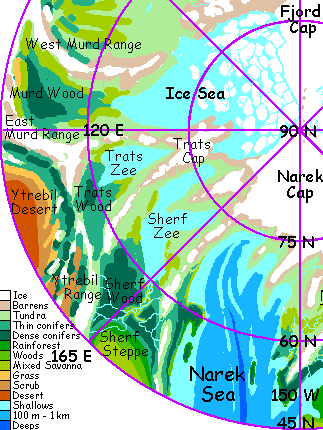
When Serranian natives speak of the Lesser Seas, they generally mean only the warm southern three of these: Narek, Niirg, and Leas. They're what I'll focus on below. But here's a sketchmap of the cold northern seas and the lands around them. For a closer look at this huge wilderness see The Northlands.
Serranians around the Eamet Ocean also include the Aburros Sea (to the east) as a Lesser Sea, for it's a puddle compared to Eamet; still, it's bigger than all six seas listed, poured together. Big enough for its own tour! Besides, the six smaller seas form a distinct chain with a common geological origin; in wetter times, all but Trats (surrounded by mountains) were linked into one long, snaky, marginally deeper ocean--still very shallow by Earth standards.
How shallow? If you poured all the water in all six modern seas into our Mediterranean Basin, you might fill it and have enough extra for the Black Sea; but don't bet on it. Serrana is dry.
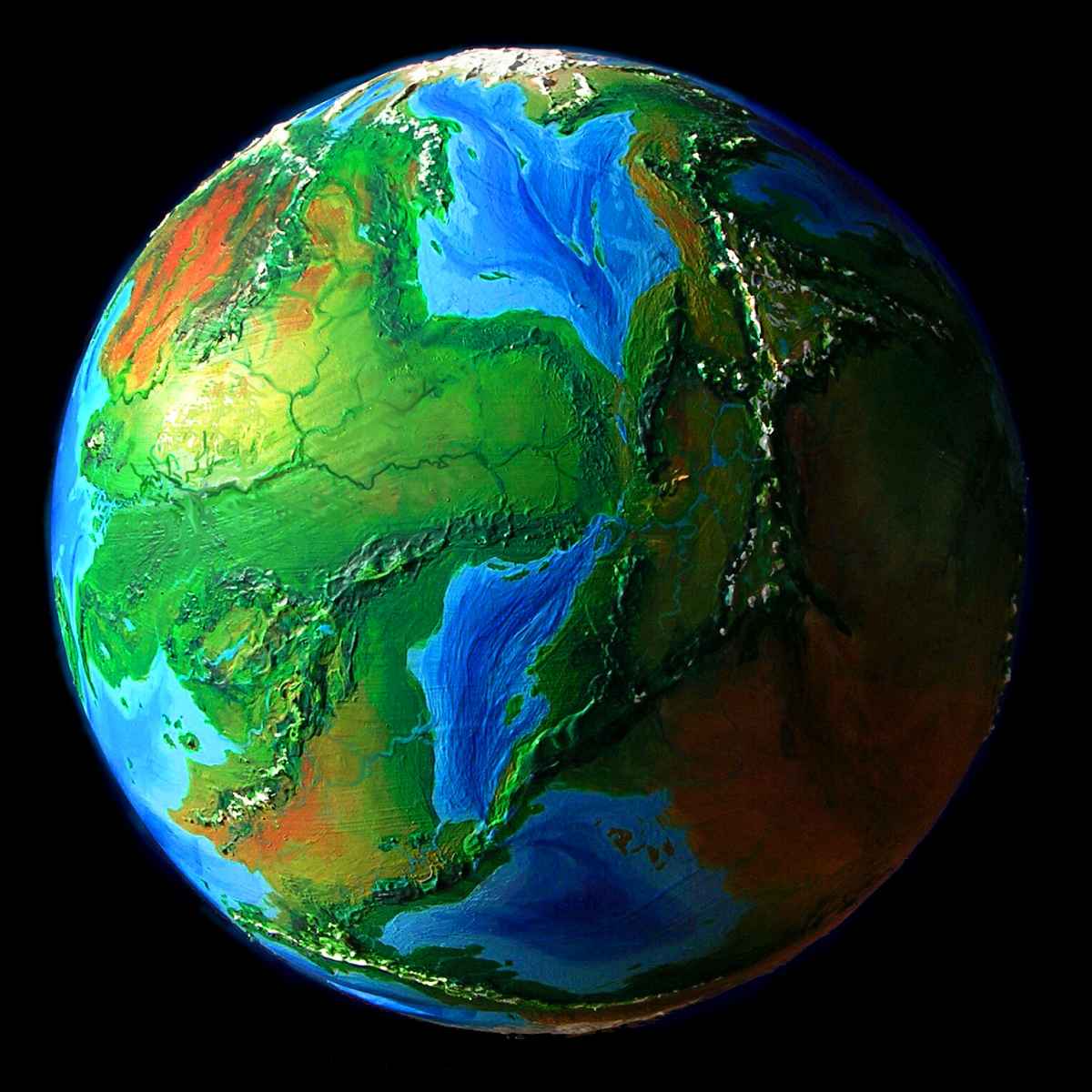
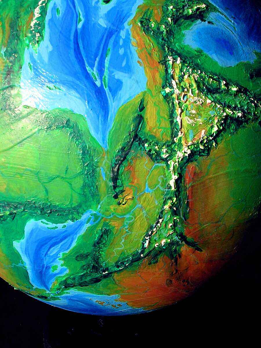
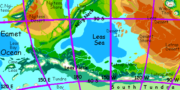
This orbital photo gives you a good overview of the southern three seas. That's Narek in the north, little Niirg in the middle, and broad Leas in the south, partly in shadow. The blue patches on the sunlit left are all lobes of the Eamet Ocean.
Let's start around 60 degrees north, and fly south along this chain of puddles.
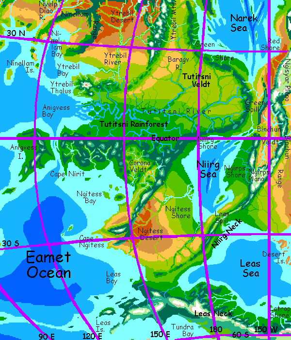
THE NAREK SEA
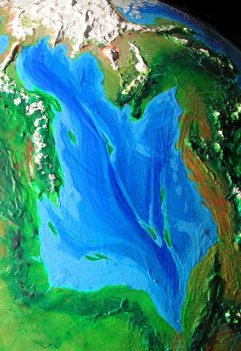
Narek Sea almost deserves the name. It's the third largest body of water on Serrana, 5.5 million sq km (2.2M sq mi--the area of over two Mediterraneans. Not, as I pointed out above, anywhere near the volume. Serranian seas are shallow puddles--and life there is glad they are.)
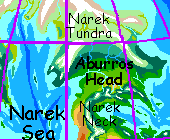
The sea's north end is near the Narek Cap, the larger of the two northern ice caps, rivaling Greenland, though lower--rarely over a mile thick. These days no large glaciers calve into the sea; there's a barren coastal strip. Inland lies Narek Tundra, a great sweeping valley, green in summer, rust in fall, still and white the rest of the year.
Ice-capped mountains border it to the south; paradoxically, their forbidding icy ridges block the polar winds, sheltering the land beyond: Aburros Head, nearly a million square miles of unbroken forest: dark conifers in the hills and hardwoods on the great plain.
Aburros Head is the nearest thing to a separate continent on Serrana. Many species here are endemic (unique to the region) for the only migration-corridor is from the south, up the rugged, rather dry isthmus between the Narek and Aburros Seas; locals call it Narek Neck. Only a narrow eastern coastal strip is fertile, for Serrana's weather patterns are in many ways quite Earthlike, with similar convection cells; and the Neck happens to lie in a high-pressure zone. To the south, the tropical sun heats the air, which rises, dropping rain as it cools. This high, cool, dry air descends around thirty degrees north and south--creating a zone of weak winds and few storms much like Earth's notorious Horse Latitudes, where sailing ships often were becalmed until they starved. Narek Neck is right in the middle of Serrana's equivalent. On the east shore, the dry air descends on the Aburros Sea and rehydrates; Coriolis forces turn the winds west onto the Neck. Rains fail some years, but farming and ranching are possible. But the central hills wring out what little rain they bring; beyond, on the west coast, the winds are weak and mostly from land. Narek Sea contributes almost no rain. This desert strip is called the Red Shore. Inland, only small tribes of pastoral and hunting raptors can survive.
But it's a rare wind that blows no good. The offshore wind also pushes surface waters out to sea, so colder deep water rich in nutrients wells up, feeding plankton blooms--and fish. The coast is dry, but every creek-mouth has a raptor fishing-village, and the catch is reliable; dried fish exported from Narek ends up in caravans all over Serrana. This pattern--a dry west coast around 30 north or south with good fishing--is seen on Earth too. California, Peru, the Sahara's Atlantic coast, southern Africa...
Slipping back north for a moment... most inhabitants of the great forests of Aburros Head are featherballs tending fruit and nut trees and raising mushrooms.
But very recently, the opener woods and tundras in the north have been settled by mammoths. They sailed in from Thron, across the Aburros Sea, taking passage on raptor-built ships.
 They had to: all the overland routes from existing mammoth colonies to the Neck skirt the tropics--fatally hot for mammoths. But even second-hand tales of Narek Tundra were too tempting. Too big for any hold or cabin, the Six Pioneers suffered through days on deck (as did the raptor crews: a mammoth can't duck enough to let the boom swing by, and it turns out they're prone to seasickness. One little accident can mean a truly odoriferous day of deck-swabbing). But they're well-established now: over one hundred and calving successfully. A hundred may sound small, but when they meet at the Midwinter Fair, small is NOT the word you'll use. Believe me, it takes a lot of land to sustain a hundred mammoths.

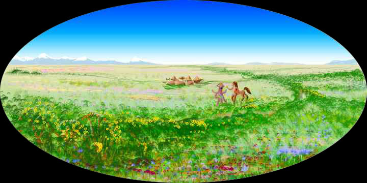
In contrast, the southwestern Narek shore is called the Green Shore, for good reason--it's one of the gardens of Serrana. Here the rains are reliable, the land is lush, and subarctic peoples thrive--raptors, taurlopes, land-squid, hexapi, and flying foxes. All can be found in every town, some of which actually lack a majority of any species--a rarity on Serrana.

Groves in the hills shelter a sixth species, not unique to the Shore but most common here: woodogs. These arboreal, colonial creatures, neither simple animals nor quite people, may in time become equal partners in Serranian culture. But for now, their groves are protected reserves and visits are supervised. But the Greenians seem proud of them; you see images of their distinctive, comical snouts everywhere; inns have names like The Nose-Claw or The Burrow-Tree.
But the Green Shore is only that--a narrow coastal strip. Inland, the rain-catching Tutitsni Hills rise to a crest 2 km high, and drop to a very different world beyond.
If you climb the hills, it's a bit of a shock--the woodog groves, the dark, piny heights (though Serrana's equivalents of conifers tend toward purples as well as dark blue-greens), and then the dropoff to a vast golden plain below: Tutitsni Basin, the largest savanna in the world.
But we won't raft down the river to the rainforest--that's on the Eamet Ocean tour, and we're exploring the Lesser Seas. Instead, let's follow the Tutitsni Hills east and south to the Green Spill.
THE SPILL
At the southern tip of the Narek Sea, a long valley, the Green Spill, leads 1200 km to the Niirg Sea. Though rivers wind along it today, it's not a river-valley, but the only undrowned stretch of the great rift that created the Narek and Niirg Seas. The Spill has repeatedly been a sea-strait in wetter, warmer eras (and no doubt will be again). Whenever the seas reconnect, the Niirg is up to a hundred meters lower (it evaporates faster in its hot dry basin) so the Narek pours in a salt cascade for months or years until the seas are level again.

NIIRG SEA
Niirg Sea today is a landlocked, mountain-rimmed, equatorial sea smaller than the Mediterranean; the smallest of the chain. The northern shores are tropical forest rising to low hills. Let's head down the more scenic east side. Here, as on the Tutitsni Veldt, the population is mainly taurlopes and hexapi. At the wide Binchun River Delta we detour inland for a look at Binchun Veldt, a mountain-rimmed prairie basin with a central marsh--ten times bigger than California's Central Valley, and equatorial, but remarkably similar just the same--low green coastal range, grassy, marshy north-south basin, snowy inland range. Yes, snow on the equator, at least now, during orbital winter. When Serrana swings close to the sun, the snow melts, feeding the great delta below. It's one of the best illustrations on Serrana of the way an eccentric orbit generates seasons both like and unlike Earth's axial-tilt seasons. If this were Earth's unchanging tropics, the snow would either be absent or permanent. But on Serrana, seasonal swings happen all the way to the equator, and the Binchun plain is greener for it.
The southern branches of the Binchun River arise in the near-Andean Ngirps Range (the initial "ng" is like "wringer" not "finger" or "ginger". If you can't manage it, say "neerps" and the locals will understand. You're just a tourist.) It's not Andean merely because of its height--the visible range isn't a wall, just an edge! The rim of Ngirps Plano, three miles high, a sky-island of alpine meadows nearly as large as the Andean altiplano, and only a small echo of Ngisyar Plano just to the north, nearly a million square km (400,000 sq mi) of alpine meadows hemmed by truly Andean peaks up to 6 km high. Here too, the orbital seasons make these grasslands greener than much of the Andean altiplano.
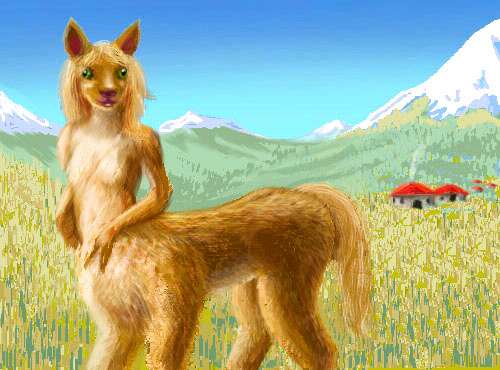
The people of these highlands are the stocky, cheerful Planians, cameloid centaurs with a quite Incan culture, if you could just crossbreed the llamas and their herders. Valley farms, flute music, village dances, wool weaving (their own wool, mostly) and thread-writing, even a fondness for hats and bright colors. Plus, of course, the ability to comfortably breathe very thin, cold air... Their centauroid bodies are roomy; the upright part of the torso is nearly all lung. They need it. Even at sea level, little Serrana's air pressure is only 2/3 of sea level on Earth. But up here, it's as low as 40-50%--comparable to 4-5 km up on Earth (2-3 mi). Unless you're Tibetan or Andean, you'll be miserable. Assuming you're conscious at all.
Let's continue down the Niirg Basin along the east shore, the Ngirps Shore, to its south end. Here, on Niirg Neck, between the Niirg and Leas Seas, the forest dries and opens to savanna. Niirg Neck is the most obvious of Serrana's rift valleys: a spreading zone here forms distinct twin ranges with a long valley of even newer rock between, presently dotted with fingerlakes and sink ponds. It looks like East Africa--or Diana Chasma, on Venus. As we follow the shore, these rift-mountains lower to hills, and finally break: the Leas Spill. This low point, in warmer wetter days, was a strait to the Leas Sea.
NGITESS AND LEAS NECK
But before we explore that final sea, let's first turn west. We skim across a green plain, wetter than Niirg Neck--more storms blow southwest off the Niirg Sea than southeast. This lush region is called the Ngitess Shore; it's a patchwork of groves (orchards tended by squid) and fields (tended by taurlopes and hexapi). But slowly the trees thin into mere stream-borders and the farmland frays into a golden grass plain--as always on Serrana, sooner or later, away from the sea. Ahead the gold-veined flat turns dusty red: the Ngitess Desert.
The winding streambeds deepen and steepen. Bluffs, rocks. A web of winding canyons dissects the desert, and each cradles a living stream--the branches of the Ngitess River. Not the Nile, not a single great river, but dozens of small ones, watering ranches run by scaly, dinosaurian (but marsupial!) raptors. Where's all the water come from, in this desert? Look ahead--those floating white shapes on the horizon: the Ngitess Range. This region west of the Niirg Sea is quasi-continental--nearly Australian in size and feel, it's cut off by mountains and narrow necks from the rest of Serrana.

After a thousand kilometers, the patchy groves become solid forest, and the shore turns west. Inland, to the southeast, is a vast plain densely forested with hardwoods; instead of Mediterranean villages, plank featherball lodges are hidden in the trees; orchards are fewer and smaller, for the tree-squid are gone. Winter storms off the Eamet bring snow most winters; the squid can't take it.
On the horizon to the right, gaunt snowy mountains start to rise--the Leas Range. A thousand km more, and the woods turn dark and piny, the mountains higher, the streams shallow and silver-blue--milky with silt. They all run to the left, down to the Leas Sea, that pale strip on the horizon... Though the mountains are taller, the lower reaches of these valleys are actually warmer than near the Eamet coast. Indeed this long strip, Leas Neck, is one of the most fertile temperate regions on Serrana--mixed villages strung along each river like beads, with a port town at the rivermouth, and over it all, the snowy Leas Range, providing snowmelt in summer and a sheltering wall again polar storms in winter.
Over those mountains, where we're not going, is Tundra Bay--another tongue of the Eamet. The bay's fully 2000 km long and 1500 wide. To the south is only cold steppes, tundra, and sea ice surrounding the South Polar Cap. Well, not quite true: offshore are the chill, windy Leas Islands, one of the few places on Serrana with not one intelligent species. Too cramped for mammoths, too cold for featherballs. You can't build lodges from those twisted little tail-high trees.
Brrr! Instead, let's stay on the warm side of the mountains, and explore the shores of the Leas Sea.
THE LEAS SEA
Leas is the size of two Mediterraneans, 5 million sq km (2M sq mi). Shallow, salty, silty, a remnant of a much larger sea. The Dry Shore on its northeast proves it--red plains run endlessly back from low seacliffs, but the desert's scalloped with terraces, winding sandy strips, hoodoos. Ancient sea-cliffs, beaches and sea-stacks! It was all seabottom; even 1000 km inland, petrified coastal forests litter the plain with stone columns, like fallen Greek cities.
We glide a long while east along Leas Neck--river after river, each with a proud local culture; inns and meetinghalls have profiles of the distinctive volcanic peaks at each head of each valley--civic competition, both artistic and agricultural, is a constant here, with fairs every season. Their logos echo Terran heraldry, but it says much about the Serranian mind that they're all topographical--the proud heads of mountains, not kings.
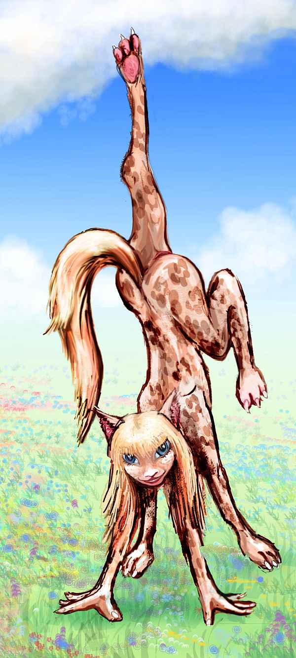
The majority of people here are a subspecies of taurlope, dappled like Appaloosas, with pale manes and tails; but you see a few stubby Planians and plenty of featherballs and their lankier cousins, raptors. The taurlopes, with their playfulness and sensuality, are the social glue binding this mixed society; Planians can seem shy or stuffy to raptors, and raptors bring up old fears of tooth and claw for both taurlopes and planians, while featherballs seem loud and officious to... well, everybody. But taurlopes apply bonobo tactics: play, sex and grooming all calm aggression and smooth ruffled feathers, fur, and crests.
To the right is a sketch of a taurlope girl handstanding. Is this play, yoga, humor, dance, a flirtation or a serious come-on? All the above--to different people(s) present--and all instinctively aimed at keeping the game fun for all. Typically multileveled taurlopism!
As we head east, the stretches between rivers slowly grow drier and grassier. Intensive farming retreats to the riverbottoms. We're nearing the end: the Latrop Shore. This region can get dust storms from the great Tsud Desert ahead, but the eastern hills take the brunt, and the winter rains, though light, are reliable (for the south). It's pleasantly Californian--until the dust blows. The inhabitants are a mixture of taurlopes and raptors, who mostly herd and ranch the hills rather than farm.
The open woods and pastures and brushy ridges slowly trail off to the north and east into the Latrop Desert--the first finger of the Tsud. Southeast, it cools and dries into a steppe. Eventually, though, even the steppe fades out. The land here's throttled by that old Martian squeeze--too cold or too dry. Or both!
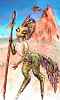
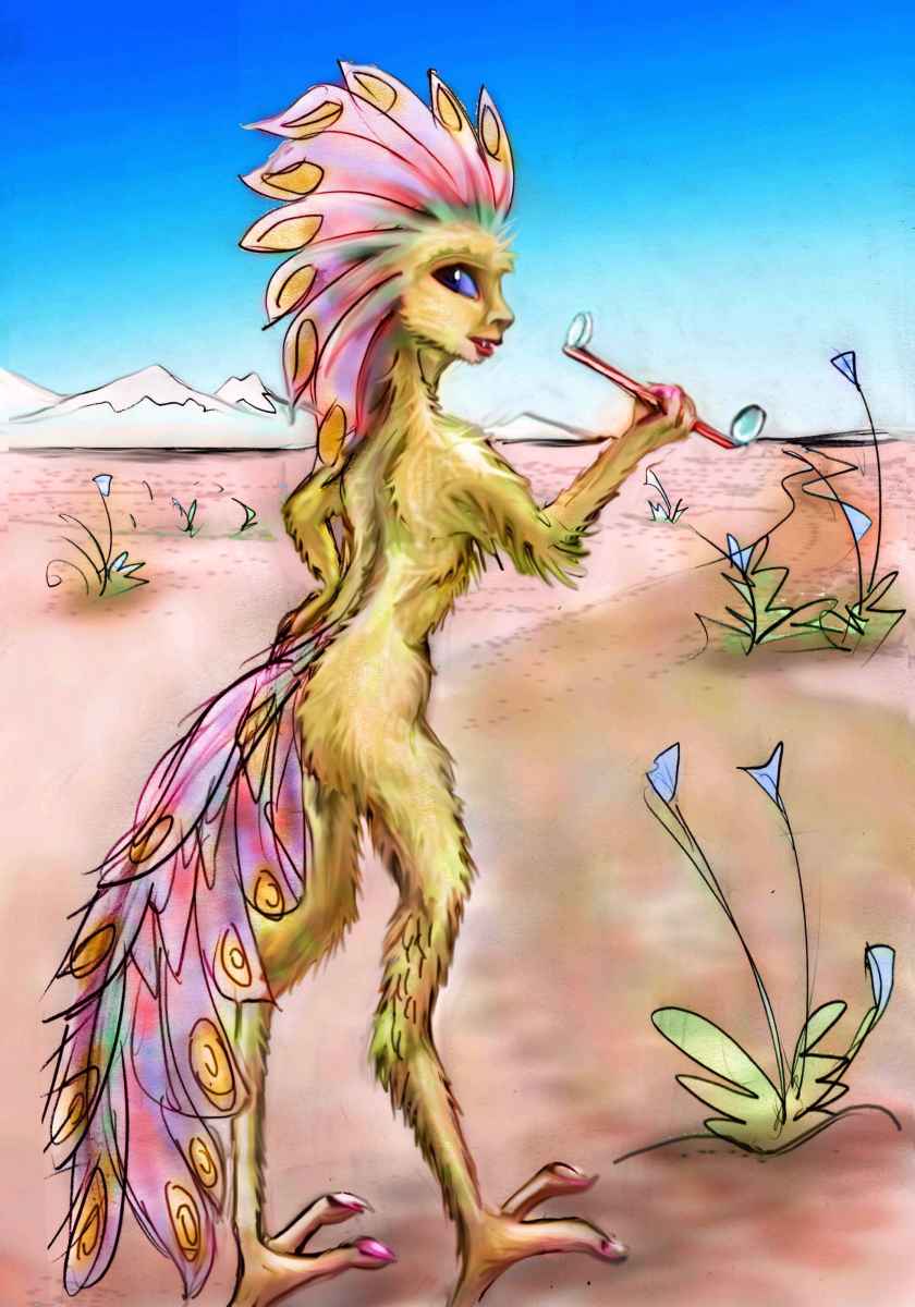
There are still nomadic bands of raptors here, herding and managing caravans. No, they don't raid anymore. Bad for trade. Here's an adolescent raptor, female by her feather pattern, holding a spyglass, on the Yelav Narg Steppe; those are the Reppok Mts on the horizon. Her feathers, while still short by featherball standards, are much shaggier than desert raptors. Clearly, her clan lives on the steppes year-round. It's a big land and a free life, but lonely, hard, and hungry at times. My Montanan and Mongolian readers don't need to be told this of course--both the wonderful and the awful. Continental climates select for certain types of people. Tough ones...
What'll it be next? Desert, or ice? The safest course is to turn back and tour the coasts of the Eamet Ocean, for it gets grim ahead--unless you're a mammoth, with a meter of shaggy barklike hair. They roam these steppes, browsing on lichen and telling stories under the stars...
Though even the tundra's not endless. Past the vast Tsud (a long caravan, it's true--as long as the Silk Road, or skirting the Sahara end to end) the land comes alive again on the far side of the world: Mosnoll and Eronit, Serrana's heartland.

Serrana's homepage - Peoples of Serrana - Culture - Evolution - Gazetteer - How I Built Serrana
World Dream Bank homepage - Art gallery - New stuff - Introductory sampler, best dreams, best art - On dreamwork - Books
Indexes: Subject - Author - Date - Names - Places - Art media/styles
Titles: A - B - C - D - E - F - G - H - IJ - KL - M - NO - PQ - R - Sa-Sk - Sl-Sz - T - UV - WXYZ
Email: wdreamb@yahoo.com - Catalog of art, books, CDs - Behind the Curtain: FAQs, bio, site map - Kindred sites