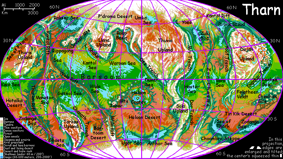
THARN:
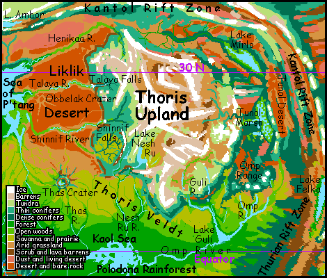
Thoris Region
by Chris Wayan, 2005-6
Map, Tharn's homepage, Peoples of Tharn, Regional tours, Geology and Evolution, gazetteer, terms explained. More worlds? Planetocopia!
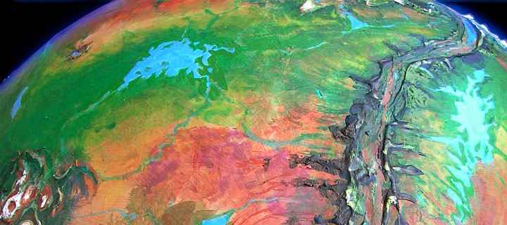
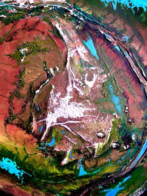
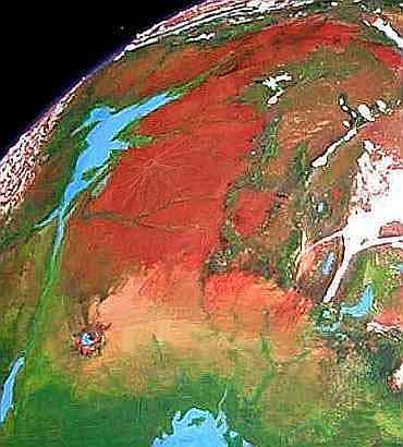
Thoris Upland barely deserves the name; it's the lowest of the large highlands. It's fair-sized, some 4 million sq km (1.5M sq mi, half as big as Australia), but much of it's only 2-4 km above bedlevel, with a merely Tibetan climate, instead of 4-6 km (13-20,000') high, like its big sisters. Thoris lacks their abrupt "continental shelves" and "coastal ranges", too; instead of a clear continental plate, it's a jumbled stack of irregular terraces capped by straight, intersecting snowy ridges called dorsae, with an arc of volcanoes at its feet. Thoris's strange ridges seem to be a grander version of the compression fan seen in nearby Tars Triangle. Kantol Rift curves much of the way round Thoris, squeezing it from every side. Unlike its sister highlands that float above the spreading crust, Thoris just crinkled, cracked and stacked.
Being lower isn't bad: though sparse, cold and thin-aired, it's still paradise next to the average upland. High snowy ranges wall off cool grassy plateaus like stone walls around gigantic pastures. A wide rim of evergreen forest clings to Thoris's gradual slopes and terraces. The local mops and camaroos live scattered in hamlets (or nomadic camps, in the case of mamooks), but the total is surprisingly large.
Still, most of the region's population isn't on the upland itself, but in the surrounding basins. Let's start in the south and circle the massif.
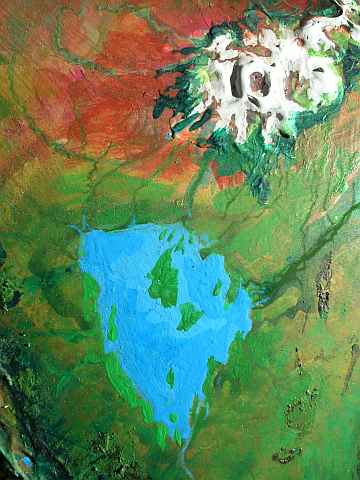
Due south of Thoris lies Lake Guli, a triangular freshwater body about 300 km across (190 mi). It's fed mainly by the Omp River, which runs west from the Omp Mountains, and the Guli, draining the southern edge of Thoris. An enlarged Omp River drains the lake west to the Kaol Sea. The lower Omp Valley, 1200 km long (750 mi) and half as wide, is a tongue of huge Polodona Wood, a tropical forest generating its own rain like a sea. Though it thins to groves and mixed savanna above Lake Guli, the whole basin is notably wetter than surrounding regions, and the Omp Valley supports a dense bo/veltaur/centah population typical of Tharn's equatorial strip. One strange new species joins this familiar mix, though: lobbras.
The lobbras disappear as we head up the Omp River to its source--even the foothills are enough to make them gasp. The Omps are a volcanic range, small in extent but fairly high, with three pairs of peaks 5-7 km high (16-23,000'), as big as Ararat or Denali or Kilimanjaro--steep cones like the giant volcanoes of Tars Triangle just across Thurian Rift. Both volcano fields probably arose in response to compression. Pressure makes pimples, if you're a planet...
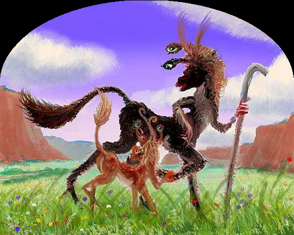
Like the Tars giants, the Omps are ringed in settlements; but these lack the flamboyance of the Big Four, possibly because the lowlands here are more fertile. In Tars, the Big Four are the place to live, and shelter at least a few of every local species; here in the Omps, lobbras are conspicuously absent; downriver is more cosmopolitan, and thus a magnet for the restless.
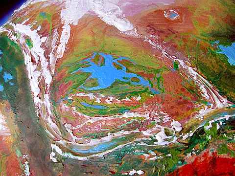
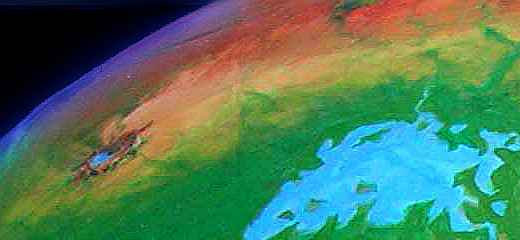
North of the Omp Range lies huge, brackish Tunol Marsh. Lake Tunol at its center is 640 km long but less than 100 wide (400 by 60 mi). Though, really, it's hard to say where marsh ends and lake begins, except to the east, where the Tunol Mts rise: a third chain of steep volcanic cones like the Omps. Tunol is largely thotter country--too boggy for anyone non-aquatic!
To the north lies Lake Mirlo, about the same size, but deeper, colder, less marshy and buggy.
 It differs culturally, too: on these forested shores live the easternmost elaffes on Tharn. Elaffes are a tall, giraffish people who prefer temperate woods. Cultural interchange between the mercurial thotters and calm, slow elaffes is hard to imagine, but it does happen here; certainly they trade incessantly.
Lake Mirlo is a region in flux, as the elaffes slowly cull and plant their longlived fruit-, nut- and leaf-trees, turning these woods into orchards.
Between Kantol Rift and the Tunol Range is a long, narrow basin: the Tunolian Desert. No thotters, no elaffes, no anyone, not even little plains wingbok, ubiquitous in the drylands of the far hemisphere. They've never made it over the ridges of Kantol Rift--struck flightless in that stratospheric air.
To the east, the desert slowly rises in broken ridges until it's high enough to catch sparse summer rains and winter snowfall, sustaining thin evergreen forests; camaroo and mop country. The central rift valley, though warmer, is desert and scrubland: the ridges on both sides cut off rain. As a Lake Mirlo thotter-ballad puts it in the chorus:
Unlovable, unloved,The east side of the ridge system looks the same writ large: a wider plain, the Tlani Desert, and a far greater volcano, Mt Gholit, the summit of the Orovar Range, 16 km high (50,000'). But Tlani is 2 km lower than Tunol, with denser air, so this desert has natives--after a fashion! Plains wingbok so stunted by altitude and drought that their brains are little larger than a chimp's. True, they're more efficient brains--these wingbok can talk. But they probably won't; isolated, neophobic, they'll flee an alien monster like you. A behavior you haven't seen even in the buggiest, backwardest village so far! Nor will you; Tharn's interspecies relations favor neophilia. Strangers bring news and gossip. Strangers are fun.
O lonely land unlived!
But not here. A measure of just how borderline these plains-wingbok are. People? Animals? Neither Terran term works.
Further south, Tlani turns gold, then green: a fertile prairie where veltaurs graze and garden, and centahs herd their "ostriches" and "roos." No wonder it's greener: we're nearing the Rippagong Sea---just the first and least of a whole chain of seas generating rain over the rich Barsoom Basin. Not all of Tharn is like Tlani Desert! This tour around Thoris Upland isn't representative of Tharn as a whole moon--it's a colder, drier, culturally backward region, on average. All Tharn ranges between Martian and Terran, but Thoris clearly tilts toward Mars. All the uplands do.
North of Lake Mirlo, boreal forest steadily thickens, covering the hills. Kantol Rift's ridges grow alpine, with glaciers on some north slopes. A scattering of camaroos, mops and elaffes live in these rather Nordic woods. Not rich country but quite habitable.
2000 km (1250 mi) up Kantol Rift lies weird Lake Amhor, in the floor of the Rift: a bubbling stew of minerals and bacteria that never freezes over. The bottom seethes with hot springs, tufa towers loom and lurch over the shores. Amhor changs color seasonally: bacteria blooms stain the water brick-red in summer, but die back in winter.
North of the Rift is the Siberian basin of the Ozara Sea. Worth visiting in high summer for the chong-ma, the great song-fest held by mamooks, it's a place to avoid the rest of the year, unless you have four tons of fat.
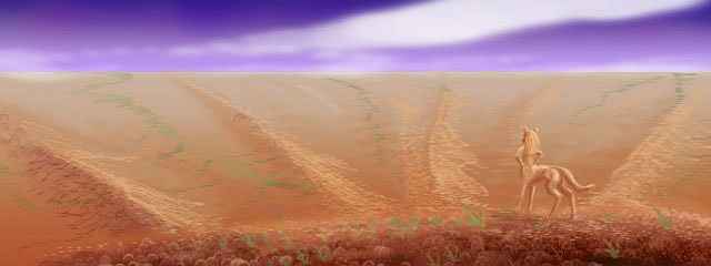
Thoris Upland descends in great terraces to the west--alpine, then boreal forest, then open scrub woods, and lastly the Liklik Desert. Liklik is huge--a red plain 2000 by 1200 km across (1250 by 750 mi), extending nearly to the shore of the Sea of P'tang. At this latitude, cool dry air blows west off Thoris's icy heights and across the desert to the sea; so most storms off P'tang blow further west, onto Ohhh Forest.
As a result, Liklik is the largest, harshest desert in the northern hemisphere--if, of course, you exclude the uplands themselves. Still, even Liklik has a few linear oases:
In the north, the Henikaa River flows 2000 km west to Henikaa Bay, the northeastern arm of the Sea of P'tang. The upper Henikaa is wooded, if thinly; the lower Henikaa winds across the Liklik Desert, one of only three year-round streams to do so; its canyon is farmed by flyotes and lobbras.
It's 400 red, dusty kilometers of featureless plain to the next landmark: Talaya Canyon. The Talaya rises from snowy dorsae (those long, straight compression ridges) in central-western Thoris, winds briefly through alpine meadows, drops to a "terrace" hundreds of km wide, dotted with "scrub oak" and "pine", where it collects the runoff from half western Thoris, then pours 200 meters (660') in a broad fall like Iguazu or Niagara.
Below the Falls, Talaya Canyon winds across the Liklik Desert. Just as in the Henikaa Valley, flyotes and lobbras farm Talaya's floor. Isolated, but a pleasant place to live.
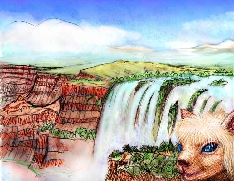
From up here, looking back, you can see the rays of lighter rock run out to the horizon.
It's another 600 km of steadily warmer plains before we reach the last stream to cross Liklik: the Shinnif River. The longest of the three, it flows 2200 km (1350 mi) from the Thoris Uplands; like Talaya, the Shinnif drops off the final terrace in a long, wide, spectacular fall. Down here in the canyon winding across the plain, though, it's sedate enough.
Past Shinnif, the red desert slowly pales to orange and gold, and grass becomes more than a sometime thing. This time you recognize that funny-shaped range of hills to the southwest as another impact crater. To be seen at this distance, it must be much bigger. It is. Thas Crater is fully 150 km rim to rim (over 90 mi). There's another difference: we've truly left the dry zone. Half the crater floor is marsh; the rest; a shallow lake.
The plain is now golden grass dotted with thorn-trees. Herds of lobbras, centahs and veltaurs abound. You could almost mistake it for Africa... until your oxygen mask slips loose and you nearly faint.
Ahead the trees clump into groves--the outliers of Polodona Wood, the richest rainforest in this hemisphere, ringing the shores of Kaol Sea.
You've come full circle round Thoris, like a Tharnian Magellan--except of course that you didn't sail around this continental mass. You had to walk. Tharn can't afford luxuries like oceans.
World Dream Bank homepage - Art gallery - New stuff - Introductory sampler, best dreams, best art - On dreamwork - Books
Indexes: Subject - Author - Date - Names - Places - Art media/styles
Titles: A - B - C - D - E - F - G - H - IJ - KL - M - NO - PQ - R - Sa-Sk - Sl-Sz - T - UV - WXYZ
Email: wdreamb@yahoo.com - Catalog of art, books, CDs - Behind the Curtain: FAQs, bio, site map - Kindred sites